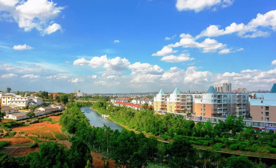
Rivers
rivers in yunnan
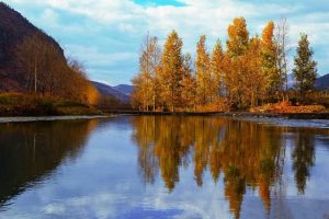
Chinese Name: 会泽以礼河
English Name: Yili River in Huize County, Qujing
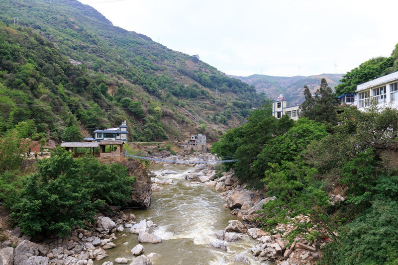
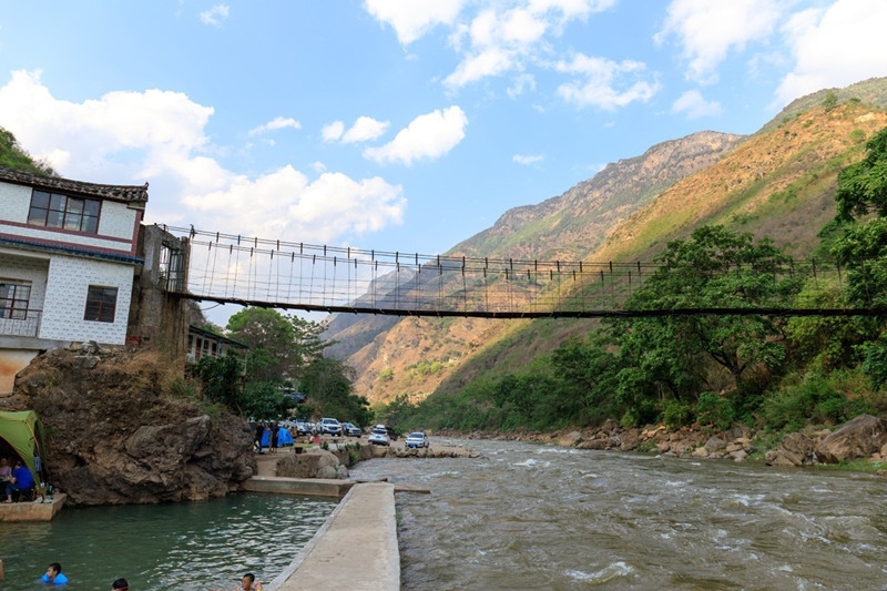
With the gift, it is Yi’s language, the meaning of the willow is inserted on the bank of the river, calls “the river of the willow”, rise in wild horse Sichuan of the south of county town of Huize, flow through waiting to mend, sea, gold clock, aunt Na, old five villages and towns and 122 kilomters of factory. Whole river, of flowing rhythm, the twists are colorful, exactly like a fairy maiden and throw a silver color made to take to human world, drifts slightly in the high mountain ridges carelessly.
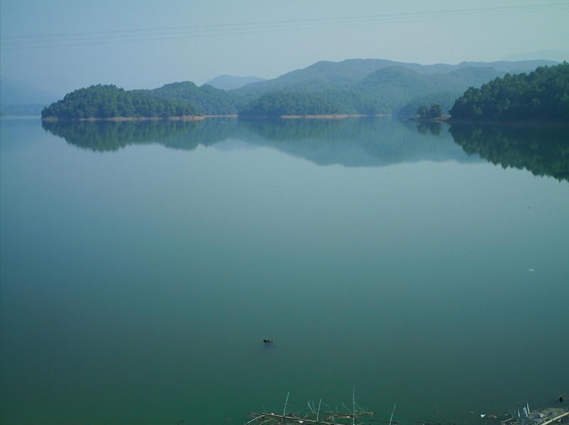
The reservoir of the Mao’s village lay in with the state of being middling of the gift river, it is one of the national key projects to intercept water and build the dam in the fifties, the capacity of the whole storehouse is 533 million cubic meters, the most famous one is the earth-filled dam of this reservoir, it is 80.5 meters high, it is very 463.5 meters long, it is first in Asia, the core-wall type wide dam of many kinds of soil of clay of second in world, surface of water of 40 kilometers,the lake-light is overflowing, the glistening light of waves is clear, like a jewel, glimmer with the gift riverside.
The tower of style of writing of Maan Mountain, lie in and flow through the south of the embankment of Huize with the gift river, from three kilometers of county towns. The fourth year of Guangxu (one year), know office Cai have Xie according to geomantic to geomantic omen theory, determine to pilot a ship into harbour into the city, and build scene artificially in Maan Mountain of water mouth place, build one pagoda of seven grades on the mountaintop, form office gold Wenchang palace of Zhong Mount around the city, China should chief pavilion, style of writing tower trigonometry of Maan Mountain of stockaded.
Village set against, the tendency of “gentle luck” of reflecting each other, has reach the so-called best realm of “sending first in department” of the geomantic omen skill. This tower was destroyed in and resumed in the Culture Revolution in 2002, the tower was 37 meters high now, can collect seven stories of steps, whenever climb the tower, have a panoramic view in beautiful scenery of the whole city. And if look far into the distance in the embankment, just as the jade pen towers, seem that here as the paper with the blue sky in the pagoda, try the beautiful mountains and rivers of Huize of the book best.
To if the sky blue scene is bright, pagoda and for example note on the earth, a great song of resounding across the skies is jumping to imitate.
Chinese Name:罗平多依河
English Name: Duoyi River in Luoping County, Qujing
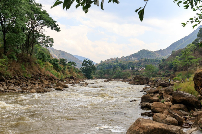
Duo Yi River is located in Luoping County, Yunnan Province, at the junction of Yunnan, Guizhou, and Guangxi provinces, connecting to the national scenic spot of Malong River Canyon in Xingyi City, Guizhou. Passing through the forests of the Ten Thousand Peaks, it leads to Duo Yi Village and enters the scenic area. From Duo Yi Village to the “Three Provinces’ Rooster Call” confluence of the three rivers, there are nearly 40 waterfalls along the 12-kilometer riverbed, flanked by ancient trees and bamboo, offering rich colors and clear layers. Duo Yi River merges with the Nanpan River near the triple junction of Yunnan, Guangxi, and Guizhou provinces.
Overview
At the “One Look, Ten Beaches,” countless layers of calcareous beach deposits form naturally, intricately arranged. The river water is crystal clear and azure year-round. Particularly notable are the ancient trees along both banks, their roots twisting intricately like a vast natural root carving art gallery. The river meanders through the landscape, with Bai villages dotting the banks, their stilted houses peeking through the trees and bamboo groves, creating a picturesque tropical scene. The phenomenon of three rivers merging, with the Qing River on one side and the murky waters on the other, creates a unique and stunning spectacle. On the western bank of the triple junction, Duo Yi River cascades down in seven tiers, totaling 15 meters in height and 80 meters in width, with consistently clear water.
The Xinzhai Waterfall group consists of three waterfalls: one measuring 3 meters high and 35 meters wide, another 2 meters high and 40 meters wide, and the third 2 meters high and 15 meters wide, spread over approximately 300 meters of river channel. Further downstream are other attractions like the Langwai Waterfall group, Leigongtan Waterfall group, and Bantai Waterfall group.
 Duoyi River in Luoping County, Qujing
The movie “Journey to the West: Conquering the Demons 2” was filmed here.
Related article:
Duo Yi River
Duo Yi River is situated on the border of Yunnan, where it merges with the three rivers, offering a natural, rustic, and pristine landscape. Due to its remote location, appreciating its beauty requires a full day of hiking.
Duo Yi River, located in Luoping County, Yunnan Province, at the junction of Yunnan, Guizhou, and Guangxi provinces, connects with the national scenic area of Malong River Canyon in Xingyi City, Guizhou. Passing through the forests of the Ten Thousand Peaks, it leads to Duo Yi Village and enters the scenic area. From Duo Yi Village to the confluence known as “Three Provinces’ Rooster Call,” the riverbed stretches 12 kilometers with nearly 40 waterfalls, flanked by ancient trees and bamboo, offering rich colors and clear layers. Duo Yi River merges into the Nanpan River near the triple junction of Yunnan, Guangxi, and Guizhou provinces.
 Duoyi River in Luoping County, Qujing
Highlights
Duo Yi River boasts beautiful landscapes, serene environments, rich cultural flavors, dense waterfall clusters, and diverse formations, captivating visitors at every turn. The area’s Bouyei ethnic culture adds a deeply intoxicating charm, especially during the third lunar month when Bouyei youths in traditional attire gather along the riverbanks for festivities like bamboo raft races, egg-wrapped competitions, water splashing games, and courtship singing, creating a scene reminiscent of a paradise. Visitors can also savor ethnic delicacies such as colorful rice, sour bamboo shoots with fish, palm cake, and “horse leg pole,” all tantalizingly delicious.
Scenic Views
Above Bantai, the riverbed widens and straightens, offering expansive vistas. Picturesque Bouyei villages line the riverbanks, surrounded by towering ancient trees, dense bamboo groves, and banana trees, with clear springs flowing by. Walking along the river, the fragrance of orchids fills the air, and bamboo covers the hills and streams. Distant mountains reflect in the water, while primitive water wheels slowly turn, and golden rice waves roll on both banks, presenting a tranquil and mesmerizing pastoral landscape that visitors will find difficult to leave.
 Duoyi River in Luoping County, Qujing
Bantai Waterfall Group
Located below Bantai Village, along the river are winding paths like Jinguitan, Yinhuatan, and Gorongtan. The Bantai Waterfall Group consists of six waterfalls, ranging from 1 to 3 meters in height and 30 to 50 meters in width, spread over approximately 100 meters of river channel. The curved stone dam shapes the water into cascades, resembling overflowing silver basins or pearls spewing emerald, showcasing serene and elegant scenery.
Mandarin Ducks Waterfall
Known in Bouyei as “Zhongzhang,” located about 500 meters below the Leigongtan Waterfall Group, consists of three waterfalls ranging from 0.6 to 8 meters in height and 20 to 40 meters in width. The largest waterfall, Zhongzhang Waterfall, is 8 meters high and 60 meters wide, divided into left, middle, and right sections by vegetation and huge rocks, with swift-flowing water in the central part. The splashing waterfall, with its thunderous roar and magnificent momentum, stirs the emotions of visitors.
 Duoyi River in Luoping County, Qujing
Dragon Bone Water Wheel
Located in the World Natural Waterwheel Expo Park within the Duo Yi River Scenic Area, the Dragon Bone Water Wheel, also known as the “turning cart,” was created by Bi Gang during the Eastern Han Dynasty (AD 168-189). For thousands of years, it has been used for irrigation and drainage, driven by the principle of chain wheel transmission powered by human or animal force. The Dragon Bone Water Wheel includes hand-cranked and foot-operated models, accommodating from two to seven individuals, each contributing to the irrigation and drainage needs of farmland.
Travel Guide
To reach Duo Yi River, there are limited morning bus services from Fengzha, or alternatively, visitors can travel via Rubuge Gorge, then take a bus from Rubuge Power Station through Xinzhai and Bajiaoqing to Duo Yi River, returning to Luoping County to avoid retracing steps. For groups, renting a car from Luoping County to travel by mini-van or bread van costs approximately ¥120-260.
 Duoyi River in Luoping County, Qujing
Culinary Recommendations
When visiting Luoping, enjoying the local Bouyei-made Five-color Flower Rice in the Duo Yi River and Rubuge scenic areas is a rare delight. Luoping, located in northeast Yunnan, enjoys convenient transportation due to its proximity to the mainland and extensive communication with the Central Plains, sharing culinary similarities with Sichuan cuisine. Opposite the Xinhua Bookstore on Zhenxing Road, there are many snack stalls in the pedestrian street at night, offering delicious flavors at reasonable prices.
Travel Transportation
From Kunming East Passenger Station to Luoping, there are 17 daily buses from 7:00 to 18:20, with a journey time of about 4 hours.
From Qujing High-speed Bus Station to Luoping, multiple services are available.
From Luoping Passenger Station to Duo Yi River Scenic Area (40 kilometers), rural passenger vehicles operate with rolling departures.
Alternatively, taking a tourist special line, chartering, or carpooling is also viable.
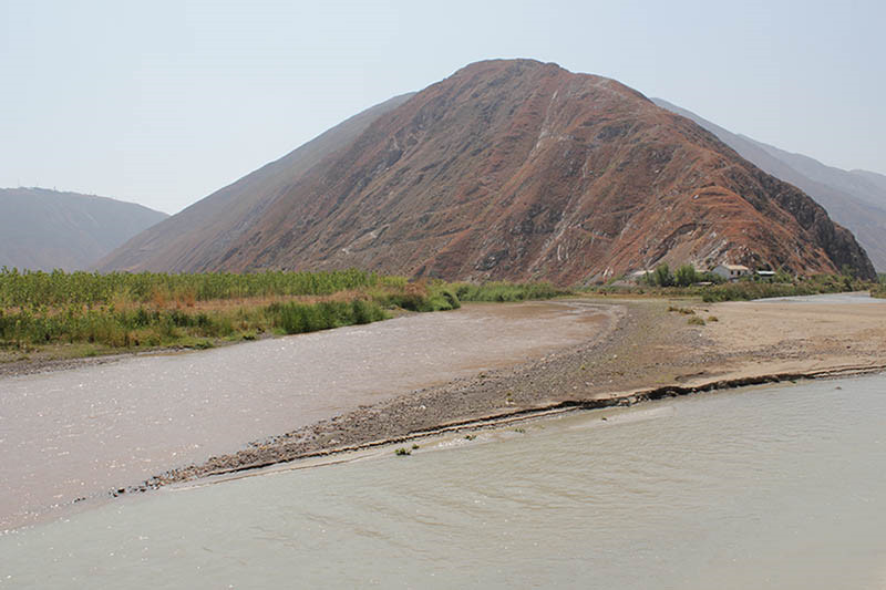
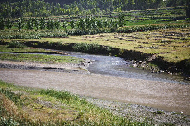
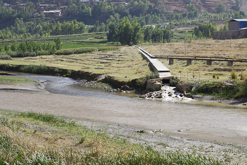
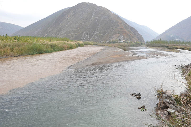
Xiaojiang River (牛奶河) refers to a river in the Xiaojian area of Dongchuan District, Kunming City, Yunnan Province. Due to local mining industries discharging tailings water directly into the river, the water in Xiaojiang River appears grayish-white, resembling milk. This phenomenon led to it being colloquially dubbed the “Milk River.”
On June 1, 2013, Kunming City reported the follow-up handling of the “Milk River” pollution incident. On November 29, 2014, local villager Liu Tianhua reported that the “Milk River” phenomenon had reoccurred in Xiaojian, Dongchuan District, Kunming City.
In April 2013, the water in a small river in Dongchuan Valley, Yunnan, turned milky white due to the illegal discharge of wastewater by several mining companies, leading to the nickname “Milk River.” This milky water flowed for over 70 kilometers, eventually merging with the Jinsha River (金沙江) at the junction of Menggu Township in Qiaojia County, Zhaotong City, and Yebao Ping Township in Huadong County, Sichuan Province, as well as Gele Village in the Dongchuan District.
At the confluence of the two rivers, one side of the Jinsha River presents a natural earthy yellow, while the Xiaojiang side is milky white, creating a distinct visual contrast. The two-colored water flows together downstream.
After the founding of New China in 1949, Dongchuan became an important mining area in Yunnan, with tailings water from dozens of mining companies along the riverside contaminating Xiaojiang. The Xiaojiang River ultimately merges into the Jinsha River at the junction of Qiaojia County, Huize County, and Dongchuan District.
Dongchuan is one of the five districts under the jurisdiction of Kunming City, Yunnan Province. The confluence of the Jinsha River and Xiaojiang River at Xiaokou, within Dongchuan, is at an altitude of only 695 meters, making it the lowest point in Kunming City. Due to the region being part of the world’s deep fracture zone, there is significant geological erosion, forming a typical high mountain canyon topography characterized by steep cuts. Additionally, differences in airflow, rainfall, soil, and vegetation contribute to a distinctive “one mountain divides four seasons, ten miles vary in weather” three-dimensional climate.
In Dongchuan District, Kunming City, a river that local villagers call the “Milk River” flows through the area. Tailings water from local mining activities is directly discharged into the river, causing it to turn white, resembling milk. The irrigation and drinking water for nearby villages have been severely affected.
On June 1, 2012, a journalist published a report titled “Life Irrigated by Dongchuan’s ‘Milk River’ is Withering” that caught the attention of many readers. Due to the illegal discharge of wastewater by some mining companies, the water in Xiaojiang River had temporarily turned milky white, sparking widespread concern.
Puduhe River (普渡河) is a major tributary of the Jinsha River (金沙江) on the right bank, located in the central part of Yunnan Province (云南省), People’s Republic of China. The river originates from Chalaqing (喳拉箐) on the northern foothills of Liangwang Mountain (梁王山) in Songming County (嵩明县) at an elevation of 2,600 meters. It flows through various districts and counties, including Guandu District (官渡区), Panlong District (盘龙区), Wuhua District (五华区), Xishan District (西山区), Chenggong District (呈贡区), Jinning County (晋宁县), Anning City (安宁市), Fumin County (富民县), and Luquan County (禄劝县). The river empties into the Jinsha River about 1 kilometer northeast of Heiquxiaopingzi (黑区小河坪子) in Luquan County.
The total length of Puduhe River is approximately 380 kilometers, with a drop of around 1,850 meters and an average slope of about 4.9‰. The watershed area covers approximately 11,090 square kilometers, with over 9,400 square kilometers within Kunming City (昆明市), accounting for about 85% of the Puduhe River watershed. It is conventionally divided into four sections: Panlong River (盘龙江), Dianchi Lake (滇池), Tanglangchuan (螳螂川), and the lower section of Puduhe River (普渡河下段).
Puduhe River flows through the central and northern parts of Yunnan Province. It originates from Haikou (海口) on the southwestern shore of Dianchi Lake, flowing north through Xishan District (西山区) in Kunming City and the counties of Anning, Fumin, and Luquan, before merging into the Jinsha River in the northeastern part of Luquan County. Its total length is 379.6 kilometers, with a watershed area of 11,089 square kilometers. The average annual flow rate is 101 cubic meters per second, and the annual runoff is approximately 2.3 billion cubic meters.
Puduhe River originates from Dianchi Lake (滇池) and flows through Xishan District (西山区) in Kunming City, Anning, and Fumin counties, generally flowing from south to north before finally emptying into the main Jinsha River at Xiaopingzi Village (小坪子村) in Luquan County. The river is approximately 379.6 kilometers long, with an average slope of 4.88‰ and a drainage area of 11,083 square kilometers.
The section from Dianchi Lake to the Yongding Bridge (永定大桥) in Fumin County is known as Tanglangchuan (螳螂川), while the segment below Yongning Bridge (永宁大桥) is referred to as Puduhe River. The Tanglangchuan section measures 200.3 kilometers and is the only outlet of Dianchi Lake, flowing through Anning Pingba before the riverbed deepens. The valley gradually opens up at Yongding Bridge. This section receives several tributaries, including Mingyi River (鸣矣河), Muban River (木板河), Daying River (大营河), Qingshui River (清水河, also known as Tuodan River or 拖担河), Longna River (龙纳河), and Sandan River (散旦河).
Panlong River (盘龙江) is the upstream section of Puduhe River. It originates from the confluence of Mu Yang River (牧羊河) and Dianwei River (甸尾河) at Chahezhui (岔河嘴) in Guandu District (官渡区). It flows through Guchangba Reservoir (谷昌坝水库), exiting Songhuaba Reservoir (松华坝水库) and passing through the urban area of Kunming, ultimately flowing into Dianchi Lake at Hongjia Village (洪家村). The river is 93.5 kilometers long, with a watershed area of 903 square kilometers and an average annual runoff of 165 million cubic meters. The elevation of the watershed ranges from 2,280 to 1,890 meters, with a gentle slope.
Dianchi Lake (滇池) is the largest lake in the upper reaches of the Yangtze River (长江), located between longitudes 102°36′ to 102°47′ and latitudes 24°40′ to 25°02′. It is situated in a watershed region between three major water systems: the Yangtze River, the Red River (红河), and the Pearl River (珠江). Dianchi Lake is a limestone fault lake formed under the influence of the Himalayan uplift in the Tertiary period. Surrounded by mountain ranges, it belongs to the eastern branch of the Yunling Mountain Range (云岭山脉). There are dozens of peaks surrounding the lake, with the western part of the lake adjacent to the foot of the Xishan Mountain (西山), while the other three sides consist of river alluvial and lake sediment plains. This creates a semi-circular distribution of plains and hills around the lake.
Tanglangchuan (螳螂川) begins at the outlet of Dianchi Lake and flows into Anning, passing through Shilong Dam Power Plant (石龙坝电厂) and reaching Tongxian Bridge (通仙桥). The section extends to Wengquan (温泉) and Qinglong Temple (青龙寺), ending at Yongding Bridge in Fumin County. It measures 97.6 kilometers in length, with elevations ranging from 1,884 to 1,700 meters and a drainage area of 5,178 square kilometers. Major tributaries include Mingyi River, Shuanghe River (双河), Maliao River (马料河), Sha River (沙河), Xianjie River (县街河), Luji River (禄脿河), Dianwei River (甸尾箐河), and Luze River (律则河). The notable tributary, Mingyi River, is 77 kilometers long, with a watershed area of 908 square kilometers and an average annual runoff of 187 million cubic meters, making it a significant irrigation river for Anning City.
The lower section of Puduhe River starts from Yongding Bridge and flows through areas including Mailong, Zhebei, Yiwut, Chahe, Tiesuo Bridge (铁索桥), Lao Chicken Street (老鸡街), Lezuoni (乐作尼), and Jidu, ultimately merging into the main Jinsha River about 1 kilometer northeast of Xiaopingzi Village in Luquan County. This section measures 156.2 kilometers in total. Major tributaries include Dahe River (大合河), Longzhaba River (龙闸坝河), Zhangjiu River (掌鸠河), Muban River, Xima River (洗马河), Zhongping River (中屏河), Wumeng River (乌蒙河), Shugu River (舒姑河), and Jidu River (基多河). The larger tributary, Zhangjiu River, originates from Fanglaogu (放老姑) in Sanyingpan Town (撒营盘镇) of Luquan County, measures 129 kilometers in length, and has a watershed area of 1,933 square kilometers (of which 1,421 square kilometers is within Kunming). It runs vertically through Luquan County from north to south with a drop of 1,010 meters, serving as a major irrigation river for the county, with significant hydropower potential.
The section from Yongding Bridge in Fumin County to the mouth of the Jinsha River is considered the lower segment of Puduhe River, measuring 156.2 kilometers. Its main tributaries include Daying River, Longzhaba River, Zhangjiu River, Muban River, and Xima River. The upper and middle sections are located within the flat area of Kunming, while the lower sections are characterized by mountainous canyons, with a usable drop of 484 meters and hydropower potential of approximately 720,000 kilowatts, suitable for dam-based development.
The tributaries of Puduhe River mainly include three rivers: Zhangjiu River (掌鸠河) on the left bank, and Mangzhai River (蟒寨河) and Xima River on the right bank. Most tributaries originate from the plateau and plain areas, with small watershed areas, short lengths, and concentrated drops at the mouths where they join the main river. The average annual flow rate of Puduhe River is about 95 cubic meters per second, leading to a total annual runoff of 2.95 billion cubic meters. The major tributaries include Daying River, Luji River, Muban River, Qingshui River, and Zhangjiu River.
Puduhe River is a significant waterway in Yunnan, playing a crucial role in irrigation and hydropower generation. It flows through various scenic areas and contributes to the ecological balance in the region. The river’s tributaries also enhance the local water supply and support agricultural development.
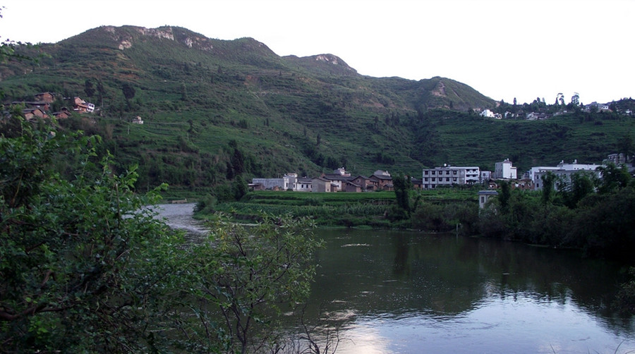
Bajiang River (巴江), also known as Banqiao River (板桥河), is a first-level tributary of the Nanpan River (南盘江) on the left bank of the Pearl River (珠江) system.
The river originates from the Shanshen Temple Peak (山神庙峰) in Shilin County (石林县), flowing from north to south through the county seat of Shilin and merging into the Nanpan River at Lufeng Village (禄丰村) in Yiliang County (宜良县). The total length of Bajiang River within Shilin County is 57 kilometers, with a drainage area of 810 square kilometers.
Bajiang River serves as a multifunctional waterway, providing irrigation, flood control, power generation, and urban ecological environment regulation for Shilin County. Along the banks, four townships and two towns host a population of approximately 120,000.
Bajiang River is revered as the mother river of the people of Shilin, nurturing countless generations with its vast and generous waters. However, rapid economic and social development has led to significant environmental challenges:
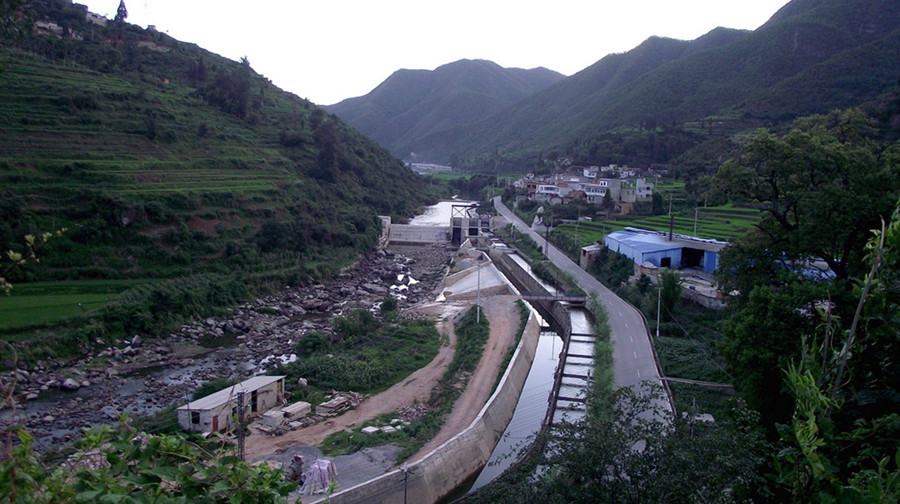
In June 2003, the county committee and government decided to invest 212 million yuan in four phases to initiate the largest environmental remediation and protection project in Shilin’s history. The goals are to:
By the end of 2004, the first two phases of the project, which included 2,200 meters of river length and 115,300 square meters of green space, had been completed with a total investment exceeding 68 million yuan. Construction of a sewage treatment plant is set to begin.
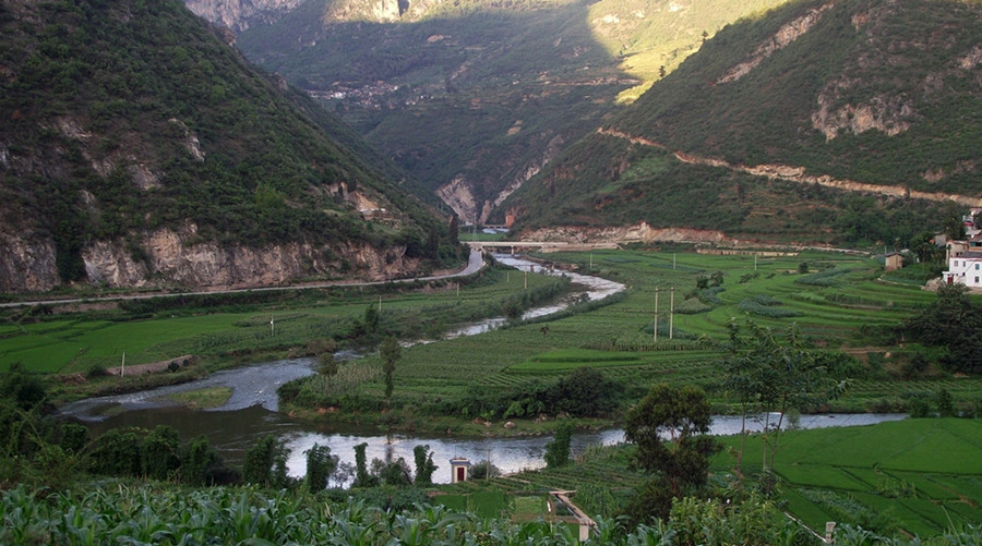
In the early morning and evening, the 3,300-meter-long Bajiang linear park exudes tranquility and beauty, featuring:
The scenery resembles an unembellished ink wash landscape painting, attracting an increasing number of domestic and international tourists.
Bajiang River is not only a vital water source but also a tourist link, enriching the cultural and recreational landscape of Shilin County:
After the comprehensive management of Bajiang, Shilin County has introduced a new highlight for tourism and leisure: the Bajiang River Linear Park. The town of Shilin has transformed, allowing the river to flow through the city, creating a harmonious environment where the river and urban life intertwine.
In the early morning and evening, the serene riverbanks are adorned with scenes of fishing, net casting, swimming, and laundry, resembling an exquisite ink wash painting. Visitors can stroll along winding paths by the river, enjoying lush green lawns, clear waters, blooming flowers, shady trees, and refreshing breezes, allowing for relaxation and a reconnection with nature.
The rejuvenated banks of Bajiang have become a popular choice for residents to relax and take walks after meals. As evening falls, the sounds of frogs fill the air, and crowds are often seen enjoying the gentle, colorful lights along the river. The improved water quality and ecological environment have led to an increase in fish and shrimp, with the sight of fish leaping from the shimmering waters adding to the enjoyment. The successful designation of Shilin as a national-level garden city is closely tied to these positive developments.
Puduhe River Nature Reserve (普渡河自然保护区) is located in Luquan County (禄劝县), covering an area of 11 hectares. Established in 1984, the reserve aims to protect the rare and endangered ancient plant Cycas panzhihuaensis (攀枝花苏铁).
Cycas (苏铁) is an ancient group of plants and one of the most primitive groups among seed plants. There is only one family with 110 species globally, primarily distributed in tropical and subtropical regions. In China, there is one genus with ten species. Puduhe Provincial Nature Reserve is one of the narrow and concentrated distribution areas of Cycas panzhihuaensis, which possesses significant scientific research and conservation value.
Kunming (昆明) is suitable for tourism year-round, with the best visiting period from March to October, as it showcases beautiful scenery and numerous festivals of ethnic minorities. It is also the season for abundant fruits and flowers. In early spring (March), one can still see the snow-capped mountains.
Kunming, known as the “Spring City,” has a temperate plateau humid monsoon climate, characterized by long sunshine hours and a mild climate throughout the year. Summers are not extremely hot, and winters are not harsh. This makes Kunming a favorable destination for tourism across all seasons. The annual average temperature in the urban area of Kunming is around 15°C, with the hottest months averaging between 19°C and 22°C, while the coldest months range from 6°C to 8°C.
The Puduhe Scenic Area (普渡河风景区) is located within Luquan County, covering an area of 11 hectares. The reserve aims to protect the rare and endangered ancient plant Cycas panzhihuaensis (攀枝花苏铁) and was established as a provincial nature reserve in 1984.
Puduhe River (普渡河) is a major tributary on the right bank of the Jinsha River (金沙江) located in central Yunnan Province. The river originates from Liangwang Mountain (梁王山) in Songming County (嵩明县) at an elevation of 2,600 meters. It flows through various districts and counties, including Guandu District (官渡区), Panlong District (盘龙区), Wuhua District (五华区), Xishan District (西山区), Chenggong District (呈贡县), Jinning County (晋宁县), Anning City (安宁市), Fumin County (富民县), and Luquan County, before merging with the Jinsha River one kilometer northeast of Heihe Xiaopengzi (黑区小河坪子). The total length of Puduhe River is about 380 kilometers, with a drop of approximately 1,850 meters and an average slope of about 4.9‰. The watershed area is approximately 11,090 square kilometers, with over 9,400 square kilometers within Kunming, accounting for about 85% of the Puduhe River watershed. Conventionally, Puduhe River is divided into four sections from upstream to downstream: Panlong River (盘龙江), Dianchi Lake (滇池), Tengchong River (螳螂川), and the lower section of Puduhe River.
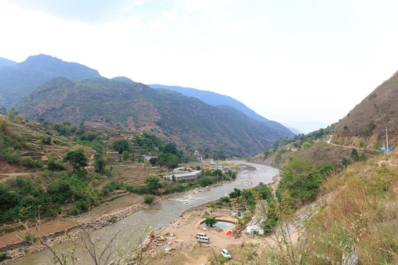
The Puduhe Grand Canyon (普渡河大峡谷) is situated within Luquan County. However, the truly magnificent section is from Sanjingkou (三江口) to where it converges with the Jinsha River. The following description pertains to the large canyon area near Kazu Village (卡租村) in the Zehai Township (则黑乡). Opposite Kazu Village lies the renowned Jiaozi Snow Mountain (轿子雪山). Here, visitors can enjoy stunning views of the vast and deep Puduhe Grand Canyon, as well as the towering and majestic Jiaozi Snow Mountain, the undulating Mazong Ridge (马鬃岭), and the cliff-hanging road from Wumeng Township (乌蒙乡) to Xueshan Township (雪山乡). Kazu Village is approximately 140 kilometers from Luquan County and 13 kilometers from Zehai Township. The entire route is paved with asphalt and cement, taking about three and a half hours one way. The road from Zehai to Kazu Village passes through a vast forest area, providing a perfect spot for a short break.
After leaving the second-class road Ludao Highway (禄大公路) from Luquan to Sayinpan Town (撒营盘镇), travelers enter the narrow Sazhe Section (撒则段) road. The famous Banbi Rock (板壁岩) along this section is situated on steep slopes or cliffs, requiring cautious driving.
A distant view from the Dega Village Committee (德嘎村委会) overlooks the ridge leading from Malutang Township (马鹿塘乡) to Pufu Village Committee (普福村委会).
The small town of Zehai under blue skies and white clouds offers picturesque views, as does the distant Zehai Reservoir (则黑水库).
The cement road leading from the east side of Zehai Township to Kazu Village is very narrow. Especially when leaving the town, there might be traffic congestion in the village area. Travelers will also pass through the renowned ten-thousand-acre forest. Following the winding mountain road, visitors arrive at Fameke Village (法木克村) by the banks of the Puduhe River. Across from Fameke Village is the famous cliff-hanging road in Xueshan Township, where the grand Puduhe Grand Canyon appears even more spectacular, leading up to the renowned Jiaozi Snow Mountain.
Kazu Village (卡租村).
Jiayan Hydropower Station (甲岩水电站) dam.
Some villagers from Kazu Village occasionally like to come here to gaze across the grand canyon at the snow mountain town and Jiaozi Snow Mountain or simply to daydream.
A flock of sheep returns home led by a shepherd.
The road from Kazu Village ends here.
The sunset casts its glow on Shugu (书姑) and the majestic Mazong Ridge (马鬃岭).
In the evening light, the imposing Mazong Ridge appears even more magnificent.
The longer the road traveled, the less ostentatious one becomes. The longer the journey, the more experiences one accumulates, which allows one to feel their own insignificance. What is called maturity is a process of self-restraint. When you restrain your brilliance and hide your exuberance, you drift further away from extravagance and arrogance.
From the Jiaozi Snow Mountain direct line to the snow mountain township road section, this is the famous cliff-hanging road in Luquan Snow Mountain Township (禄劝雪山乡). On the left, the snow-capped mountains rise steeply, while on the right lies the Puduhe River valley. The road is situated 1,820 meters above the valley. From a distance, the road looks like a fine line wrapped around the cliff, precariously hanging on the sheer wall, threatening to fall at any moment, with a sheer cliff beside it. Here, photography isn’t just about taking pictures; it feels like aerial photography. If a car were to fall off the road, it would be like an air disaster. Driving through here feels like riding on clouds, leaving a lasting impression, almost like dancing on the edge of a cliff.
The road winds and spirals, flanked by steep cliffs and loose stones. A slight deviation towards the edge brings a feeling of floating in the clouds. A glance down can leave one dizzy and terrified if they have a fear of heights; this is truly a road for the brave.
After about three and a half hours of driving, we arrive at the junction of the Wumeng Township (乌蒙乡) and Xueshan Township (雪山乡) road. Here is a viewpoint that offers the best views of the grand canyon. The most dangerous places often reveal the most beautiful views, as the infinite scenery unfolds at perilous peaks. Layers of rocky strata and a steep cliff showcase the wonders of nature. Above are the towering cliffs known as Wangtiang Cliff (望天崖), and below lies the magnificent Lao Gu Rock (老姑岩).
Descending the steps to the viewpoint, one can see steep cliffs lining both sides of the canyon, with snow-capped mountains stretching endlessly. Despite the challenging mountain canyon terrain, several villages are scattered throughout this remote area. The turquoise waters at the canyon’s bottom reflect the beauty of Puduhe River, which flows into the Jinsha River, eventually heading toward the distant Pacific Ocean.
Half an hour later, we turn onto Shugu Village’s (书姑村) Caozi Road (草子路) towards the Jiayan Hydropower Station (甲岩水电站). It is only ten minutes away. The dam here is built with towering concrete, appearing solid and robust. On the banks of the river, we can see the dam constructed at the head of the Puduhe River.
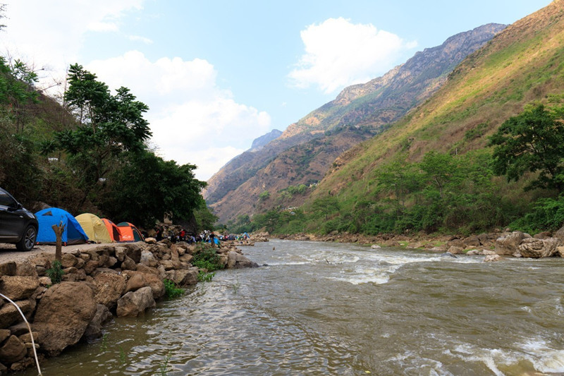
After strolling along the river for about an hour, we can start preparing for dinner and camping. Camping under the stars, with the gentle sound of flowing water accompanying us, we can enjoy the breathtaking beauty of nature.
In the evening, we can gather wood to start a fire. The flickering flames dance and reflect off the river, creating an enchanting atmosphere.
In addition to the nature reserve, nearby attractions include:
Daguan River is located on the western side of Kunming’s main urban area. It begins on the southern side of Daguan Road (大观路) in the east and extends to Jinhuapu (近华浦) in the west, flowing from the northeast to the southwest into the Caohai (草海), a part of Lake Dianchi (滇池). The river is 2,800 meters long, 20 meters wide, and has an average depth of 2 meters. Historically, during the Yuan and Ming Dynasties, it was a natural watercourse that flowed into the Caohai.
In the Ming Dynasty, the Caohai was known as the “West Lake” (西湖) or alternatively as Caohai Lake (草海子) and Green Grass Lake (青草湖). The Yunnan Tongzhi (《云南通志》) from the Wanli period of the Ming Dynasty records: “The West Lake is located west of the prefecture, surrounded by water reeds, with a circumference of four li. It is the upper stream of Dianchi Lake, where people often sail boats. The locals call it Caohai Lake.” It also mentions a place called “Water Cloud Village” (水云乡), where the Marquis of Xiping, Mu Ying (沐英), built a villa called “West Garden” (西园) during the Hongwu era of the Ming Dynasty.
Sailing from the Xiaoxi Gate (小西门) of Kunming to Jinhuapu, across the Caohai, to enjoy the “Moonlight on Dianchi” (滇池夜月) has been a popular activity for centuries.
In 1638, during the Ming Dynasty, the famous geographer and explorer Xu Xiake (徐霞客) recorded his journey in the Travel Notes of Mount Taihua (《游太华山记》). He wrote, “Two li southwest of the provincial capital, we boarded a boat. Both sides of the river are flat fields, and after ten li, the fields end, and reeds fill the marshland. We sail through the deep green waters without realizing that this is the vast flow of Dianchi Lake. This is the Caohai. The water passage through the reeds is narrow, and in the distance, the Western Hills (西山) rise up against the sky, where the Arhat Temple (罗汉寺) is located.”
At that time, the river was not yet called Daguan River (大观河), and the Daguan Tower (大观楼) had not been built. Xu Xiake’s route from Kunming to the Caohai followed what is now the Daguan River.
In the early Qing Dynasty, Wu Sangui (吴三桂), the Prince of Pingxi, dredged the river to transport grain from places such as Jincheng (晋城), Kunyang (昆阳), and Chenggong (呈贡) into the city. This river was then known as the “Grain Transport River” (运粮河).
According to Shu Zao’s (舒藻) Record of the Construction of Daguan Tower (《创建大观楼碑记》): “During the Qing Dynasty, Wu Sangui, the Prince of Pingxi, dredged a river from Jinhuapu towards Huicheng (会城), a distance of about ten li, called the Grain Transport River. He also built a granary port called Zhuangtang (篆塘) outside the Xiaoxi Gate, where grain ships from Dianchi Lake would transport rice to the warehouses, making it very convenient.”
Zhuangtang became a key grain port, where merchants and travelers would converge. The Granary Wharf (粮港码头) in Zhuangtang was vital for both grain and fish trade, as it also served as a hub for fishermen from the Caohai.
In 1690, under the administration of the Yunnan Provincial Governor Wang Jiwen (王继文) and Minister Shi Wencheng (石文晟), Daguan Tower was constructed at Jinhuapu. With its completion, the Grain Transport River began to be referred to as Daguan River. This river became both a route for grain transportation and a scenic waterway, offering boat rides to the Daguan Tower for panoramic views of the lake and surrounding mountains.
In the Republic of China era, a new arched bridge was built over the Zhuangtang River (篆塘河), known as the “New Bridge” (新桥), or Zhuangtang Bridge (篆塘桥). As the water level of Dianchi Lake gradually dropped, the old Zhuangtang port was filled in and developed into residential areas. However, in 1917, a new Zhuangtang Port was opened on the western side of the old one, and this new port, now Zhuangtang Park (篆塘公园), remained a key part of Kunming’s river infrastructure.
In 1957, as the water levels of Dianchi continued to fall, a new Zhuangtang Port was built further west. This port covered an area of 31,300 square meters, with space for 40-ton ships to dock. It became an essential part of Kunming’s transport network, serving as a modern shipping hub.
Over the years, Daguan River and Zhuangtang underwent several restoration and dredging efforts. In 1973, a large-scale restoration project cleaned the river and Zhuangtang, and the Zhuangtang Wharf was repurposed. In 1987, Zhuangtang Park opened to the public, providing a green urban space with tea houses, bridges, and gardens, making it a peaceful retreat amidst the bustling city.
Zhuangtang Park, located at the intersection of Daguan Road (大观路) and Xichang Road (西昌路), is a small green oasis in the city. The park features a variety of scenic elements, including a pond with a winding bridge and platforms for viewing the water. The park is designed in a blend of Chinese and Western styles, with small pavilions, flower beds, and tea rooms hidden among the greenery.
The park underwent a significant renovation in 2002, expanding the green space and adding new plants, such as bougainvillea, osmanthus, and camphor trees. The landscaping of the park now covers 70% of the area, with flowerbeds, lawns, and carefully curated trees, including gingko, cypress, and magnolia.
In 2009, Zhuangtang Park was transformed into Zhuangtang Legal and Cultural Park, themed around the concepts of “rule of law, integrity, peace, and harmony.” The park now includes more than 40 informational boards on topics such as law, corruption prevention, and public safety, making it not only a scenic destination but also an educational hub for the local community.
The Daguan River and Zhuangtang are deeply intertwined with the history of Kunming. They tell the story of Dianchi Lake’s development, the rise and fall of Caohai fisheries, and the transformation of Kunming into a modern city. The Daguan River, once a vital artery for grain and fish, is now a scenic and cultural treasure. Efforts to preserve its history and culture continue to shape the identity of Kunming as a historic and cultural city.
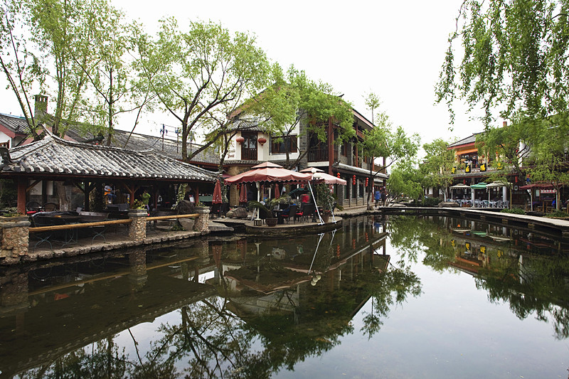
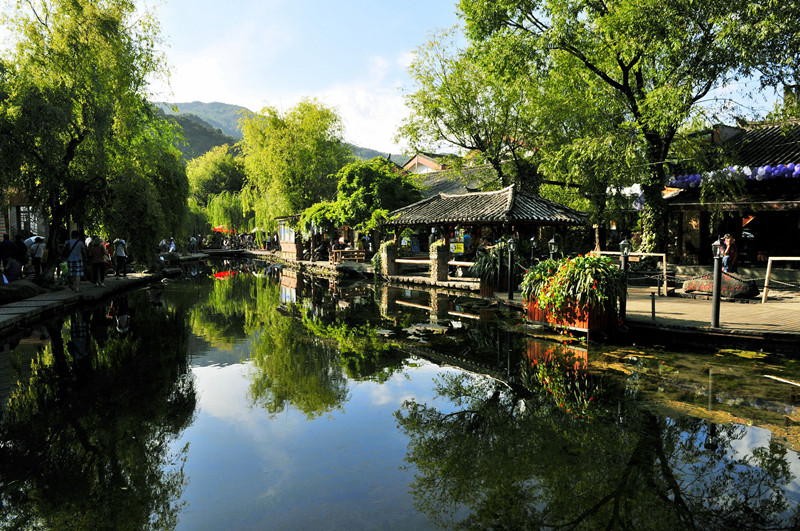
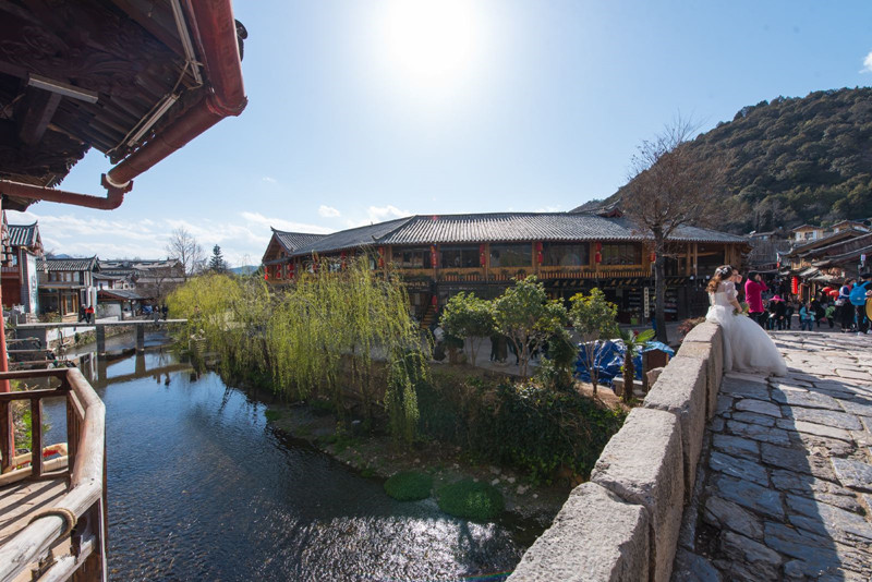
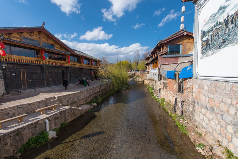
Qinglonghe River, located in Shuhe Old Town (束河古镇) within the ancient district of Lijiang (丽江), is a tributary of the Yangong River (漾弓江) and serves as its upstream source. The river begins at Wénmíng Village (文明村) in Shuhe Street and extends to Changshui Road (长水路), covering a length of 17.56 kilometers.
Chinese Name: 青龙河
Geographical Location: Yunnan Province (云南省), Lijiang City (丽江)
Opening Hours: Open all day
Admission Fee: Free admission
Famous Attractions:
The residential complex in Shuhe is located about 4 kilometers northwest of Lijiang Ancient Town (丽江古城). This area features a small market and a unique architectural cluster of traditional homes, characterized by a layout similar to that of the Sifang Street (四方街) in Lijiang Ancient Town.
The Qinglonghe River runs through the center of the residential area, and the Qinglong Bridge, built during the Ming Dynasty (明代) (1368-1644), spans the river. This bridge is recognized as the largest stone arch bridge within Lijiang (丽江).
To reach Qinglonghe River in Shuhe Old Town, you can take a taxi or a local bus from Lijiang City (丽江). The journey takes approximately 20 minutes. If you are staying in Lijiang Ancient Town (丽江古城), you can also walk or ride a bike to Shuhe, which is about a 30-minute ride, allowing you to enjoy the beautiful scenery along the way.
Xier River, originally known as “Xierhe” (嶲洱河), was named after the ancient Xier people who lived along its banks. It serves as the waterway that connects Erhai Lake (洱海) to the Lancang River (澜沧江).
As night falls, the banks of Xier River shimmer with colorful landscape lighting, illuminating iconic structures like Meideng Bridge (美登大桥), the Xier River Control Gate (西洱河节制闸), and Taian Bridge (泰安桥). This beautification project aims to enhance the aesthetics of the riverbanks, highlighting architectural outlines and elevating the urban ambiance.
The beautification project has a total investment of over 4.8 million yuan and will enhance the green spaces along the banks of Xier River from Meideng Bridge to Taian Bridge, as well as improve lighting on the riverbanks and structures. Various unique lighting options, including floodlights, water lights, ground lights, solar lights, and LED lights, will create a peaceful yet vibrant nighttime atmosphere. The project is currently in the final stages and is expected to be completed by the end of October.
The planning scope extends approximately 4 kilometers from Erhai Park (洱海公园) to the Tian Sheng Bridge (天生桥) along the riverbanks and related areas.
The project aims to analyze and segment the tourism market in Dali (大理) and develop a strategy that includes:
Xier River is the discharge channel for Erhai Lake, one of Yunnan’s three major plateau lakes, with a constant water level of 1973 m, covering an area of 250 km² and a total volume of 3.16 billion cubic meters. The river flows through regions such as Xiaguan (下关) and Yangbi (漾濞), eventually merging into the Yangbi River (漾濞江), a tributary of the Lancang River. The river traverses steep mountainous valleys, providing excellent conditions for the construction of hydroelectric power stations.
The cascade hydroelectric system comprises four stations, utilizing a total drop of 605 m with an overall installed capacity of 255 MW and an average annual power generation of 903 million kWh. The first station began construction in October 1958, while the last was completed in December 1980.
From Dali Railway Station (大理市火车站):
Nanlei River (南垒河, Nánlěi Hé), known in Dai language as “Chasing Husband River,” originates in the northern part of Laba Township, Lancang Lahu Autonomous County (澜沧拉祜族自治县, Láncāng Lāhù Zìzhìxiàn), Yunnan Province, China, at an elevation of 2043 meters. The river is referred to as Muyin River in its source section. It flows south through Menglian Dai and Lahu Autonomous County (孟连傣族拉祜族佤族自治县, Mènglián Dǎizú Lāhùzú Wǎzú Zìzhìxiàn), changing its name to Nanlei River as it enters the county. The river is fed by the Nataranong River on its right bank and flows through scenic areas before entering Myanmar.
The total length of the river within China is 88.9 kilometers, with a drainage area of 1928.7 square kilometers and a drop of 1133 meters. The average annual runoff is approximately 1.579 billion cubic meters. The Nanlei River is regarded as the mother river of Menglian, nurturing generations of Dai people living along its banks. The river’s banks showcase typical karst topography with numerous caves, and the slopes are adorned with precious tree species such as the dragon blood tree.
In May, the Nanlei River shines under the bright sun, with a deep blue sky dotted with fluffy white clouds, reminiscent of blooming phoenix flowers. The gentle breeze ripples the emerald waters, creating layers of shimmering waves that sparkle like pearls scattered by Dai women.
As you navigate the river on a bamboo raft, you can enjoy the stunning scenery on both sides. The Jinshan (金山, Jīnshān) and Yingshan (银山, Yínshān) hills along the river host unique flora and fauna, creating a vibrant atmosphere filled with the sounds of frogs and birds, while butterflies dance among the flowers.
The riverbanks are lively with people leisurely strolling through the bamboo groves, sharing romantic moments along the fragrant banks of Nanlei River. Here, you can immerse yourself in the beauty of nature, capturing cherished memories in a poetic narrative of love and longing.
The Nanlei River embodies the spirit of the Dai people, reflecting their deep connection to nature and the land. It symbolizes life, love, and the tranquility that the river brings to the surrounding communities.
Nanlei River, the mother river of Menglian, represents the beauty and essence of this enchanting region. May it forever flow with joy and simplicity, leading to the vast, shadowless ocean.
To reach Nanlei River in Lancang County, you can take a bus or drive from Puer City (普洱市, Pǔ’ěr Shì) to Menglian County (孟连县, Mènglián Xiàn). The journey takes about 2-3 hours by car. Once in Menglian, local transportation options, such as taxis or guided tours, are available to take you to the river.
Dulu River (嘟噜河, Dūlū Hé) is located in Jingdong County (景东彝族自治县, Jǐngdōng Yízú Zìzhìxiàn), Yunnan Province, China. The river flows through stunning landscapes, characterized by lush greenery and a rich cultural heritage of the local Yi people (彝族, Yízú). Known for its clear waters and vibrant ecosystems, Dulu River serves as an essential water source for the surrounding communities.
The Dulu River is flanked by picturesque hills and valleys, providing a serene environment for outdoor activities. The river’s banks are often adorned with colorful wildflowers, making it an ideal spot for nature photography and peaceful walks.
Visitors can enjoy various activities along the Dulu River, including:
Dulu River holds cultural significance for the Yi people, who have lived in harmony with the river for generations. The river is often featured in local folklore and traditions, symbolizing life and abundance.
To reach Dulu River in Jingdong County, you can take a bus from Puer City (普洱市, Pǔ’ěr Shì) or Jingdong County seat. The journey typically takes about 2-3 hours by car. Local transportation options, such as taxis, are available to reach specific river access points.
Leiguang Temple (雷光佛迹寺, Daxianrenjiao Temple) is located in Yongping Town, Jinggu County (景谷县, Jinggu Xian), Puer City (普洱市, Puer Shi). Often referred to by locals as “Daxianrenjiao Temple,” it was established in the 50th year of the Qianlong reign (乾隆, Qianlong) of the Qing Dynasty (清朝, Qing Chao). This temple is a significant site for Theravada Buddhism, housing four large footprints believed to have been left by the Buddha during his ascent to heaven.
As I approached the entrance of Leiguang Temple, a stone archway came into view. Although modest in size, it exudes a sense of antiquity. There are no walls around the archway, and two open gates enhance its spacious feel. A large character “佛” (Buddha) is carved prominently on the central stone tablet, symbolizing entry into the sacred realm of Buddhism, suggesting a passage into the “empty gate.”
Climbing the steps, I turned to see a couplet inscribed in Chinese on the back of the stone archway:
The inscription reflects the artistic skill of ancient literati. The central inscription records the person responsible for the monument and the date: “In the 50th year of Qianlong, under the stewardship of Hu Chao, it was established in the month of Mengchun.”
The archway is divided into two parts. On the left, inscriptions recount the process of the Buddha leaving his footprints here, while the other details the construction of the temple.
Upon respectfully removing my shoes and entering the main hall, I was greeted by the serene visage of the Buddha seated on a lotus platform, embodying compassion and a broad heart for saving and helping all beings. At the foot of the giant Buddha, a massive stone bears four overlapping footprints, each representing different saints who ascended to heaven after extensive periods of meditation.
Legend has it that Siddhartha Gautama, upon his birth, was able to walk and left a lotus flower with each step. His ascension occurred around 470 BCE, during which he left a peacock and a golden rooster at the footprints’ sides, waiting for the fifth Buddha’s arrival.
Below the giant footprints lies a small well that never runs dry, regardless of the season. This well is considered holy water, believed to cure ailments. Visitors often take a bottle of this water home as a blessing.
Our host warmly explained various artifacts and paintings within the temple, enriching our understanding of Leiguang Temple’s history. The site has deep cultural significance, as it has been a place of spiritual pilgrimage for centuries.
The Jinggu River Reservoir (景谷河水库, Jinggu He Shuiku) is situated upstream on the Jinggu River in Jinggu County. Construction began in September 1983 and was completed in May 1990. The reservoir has a total capacity of 56.7 million cubic meters and serves multiple purposes: irrigation, flood control, power generation, industrial water supply, and urban drinking water supply.
Historically, water has been a lifeblood for civilizations, influencing the development of societies near great rivers such as the Yellow River (黄河, Huang He) and the Nile River (尼罗河, Ni Luo He). In Jinggu County, water resources are abundant, with 94 rivers and a total water resource volume of 6.72 billion cubic meters, averaging 23,500 cubic meters per person.
Despite these resources, the region has faced challenges such as droughts and floods due to complex topography and heavy rains concentrated in July and August. Historical mismanagement and deforestation have led to soil erosion, affecting water supply stability for many communities.
Leiguang Temple and Jinggu River Reservoir are vital cultural and natural landmarks in Jinggu County, embodying both spiritual significance and resource management challenges.
To reach Leiguang Temple, you can fly into Puer Airport (普洱机场, Puer Jichang) and take a taxi or local bus to Jinggu County. The temple is about 30 km from the county center. For the Jinggu River Reservoir, follow the main road from Jinggu County for approximately 20 km.


rivers in yunnan

Chinese Name: 会泽以礼河 English Name: Yili River in Huize County, Qujing With the gift, it is Yi’s language, the meaning of the willow is inserted on the bank of the river,...

Chinese Name:罗平多依河 English Name: Duoyi River in Luoping County, Qujing Duo Yi River is located in Luoping County, Yunnan Province, at the junction of Yunnan, Guizhou, and Guangxi provinces,...

Xiaojiang River (牛奶河) refers to a river in the Xiaojian area of Dongchuan District, Kunming City, Yunnan Province. Due to local mining industries discharging tailings water directly into the...

Puduhe River (普渡河) is a major tributary of the Jinsha River (金沙江) on the right bank, located in the central part of Yunnan Province (云南省), People’s Republic of China....

Bajiang River (巴江), also known as Banqiao River (板桥河), is a first-level tributary of the Nanpan River (南盘江) on the left bank of the Pearl River (珠江) system. Origin...

Overview Puduhe River Nature Reserve (普渡河自然保护区) is located in Luquan County (禄劝县), covering an area of 11 hectares. Established in 1984, the reserve aims to protect the rare and...

Overview of Daguan River Daguan River is located on the western side of Kunming’s main urban area. It begins on the southern side of Daguan Road (大观路) in the...

Introduction Qinglonghe River, located in Shuhe Old Town (束河古镇) within the ancient district of Lijiang (丽江), is a tributary of the Yangong River (漾弓江) and serves as its upstream...

Xier River, originally known as “Xierhe” (嶲洱河), was named after the ancient Xier people who lived along its banks. It serves as the waterway that connects Erhai Lake (洱海)...

Overview Nanlei River (南垒河, Nánlěi Hé), known in Dai language as “Chasing Husband River,” originates in the northern part of Laba Township, Lancang Lahu Autonomous County (澜沧拉祜族自治县, Láncāng Lāhù...
Overview Dulu River (嘟噜河, Dūlū Hé) is located in Jingdong County (景东彝族自治县, Jǐngdōng Yízú Zìzhìxiàn), Yunnan Province, China. The river flows through stunning landscapes, characterized by lush greenery and...

Overview of Leiguang Temple Leiguang Temple (雷光佛迹寺, Daxianrenjiao Temple) is located in Yongping Town, Jinggu County (景谷县, Jinggu Xian), Puer City (普洱市, Puer Shi). Often referred to by locals...
Don't assume you're restricted to the main hubs of Beijing and Shanghai, our tours can start from any city.
For your safety, please register with the Embassy.
Exchange some local currency for your trip
Start planning your tailor-made holiday to China by contacting one of our specialists. Once enquired, you’ll get a response within 0.5~23.5 hours.

