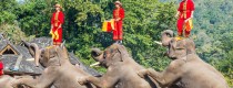
 7 Days GolfingTour
 8 Days Group Tour
 8 Days Yunnan Tour
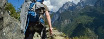
 7 Days Shangri La Hiking
 11 Days Yunnan Tour
 6 Days Yuanyang Terraces
 11 Days Yunnan Tour
 8 Days South Yunnan
 7 Days Tea Tour
 8 Days Muslim Tour
 12 Days Self-Driving
 4 Days Haba Climbing
 Tiger Leaping Gorge
 Stone Forest
 Yunnan-Tibet
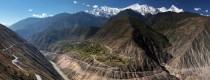
 Hani Rice Terraces
 Kunming
 Lijiang
 Shangri-la
 Dali
Dali
 XishuangBanna
 Honghe
 Kunming
 Lijiang
 Shangri-la
 Yuanyang Rice Terraces
 Nujiang
 XishuangBanna
 Spring City Golf
 Snow Mountain Golf
 Stone Mountain Golf


Chuxiong Geography
Geographic Environment
Location and Boundaries
楚雄彝族自治州 (Chuxiong Yi Autonomous Prefecture) is located in the central part of Yunnan Province, China, spanning between 100°43′ to 102°30′ east longitude and 24°13′ to 26°30′ north latitude. It is situated in the western part of the Yungui Plateau, which forms the main part of the central Yunnan Plateau. To the east, it borders Kunming City; to the west, it borders Dali Bai Autonomous Prefecture; to the south, it connects with Pu’er City and Yuxi City; to the north, it adjoins Panzhihua City and Liangshan Yi Autonomous Prefecture in Sichuan Province. Across the Jinsha River to the northwest lies Lijiang City. The prefecture covers an area of 28,438.41 square kilometers.
Topography and Landforms
Terrain and Landforms
Chuxiong Yi Autonomous Prefecture features a terrain that slopes generally from northwest to southeast. From a north-south perspective, it is characterized by higher elevation in the central part, lower elevation in the north and south, and slightly higher elevation in the north compared to the south. From an east-west perspective, the eastern part is slightly higher, while the central part is gently sloping. The highest point is the main peak of Baicaoling in Dayao County, reaching 3,657 meters above sea level. The lowest point is Sanjiangkou, where Shuangbai County meets Xinping County of Yuxi City, at an elevation of 556 meters. The prefecture exhibits a complex terrain with developed folds and faults, predominantly mountainous with mountains accounting for over 90% of the total area, while basins and riverbank plains occupy less than 10%.
Climate Conditions
Climate
Chuxiong Yi Autonomous Prefecture enjoys a pleasant climate characterized as a subtropical highland monsoon climate. Due to its varied topography and altitude differences, it experiences distinct vertical climate changes and regional microclimates. The overall climate features short winters and summers, long springs and autumns, large diurnal temperature variations, and relatively small annual temperature differences. Winters are mild without severe cold, and summers are free from extreme heat. The region experiences distinct dry and wet seasons, with precipitation concentrated in the rainy season. Sunshine hours are abundant, and the frost period is short. In 2021, the average annual precipitation was 738 millimeters, the average annual temperature was 17.6°C, and the annual sunshine hours were 2,681.
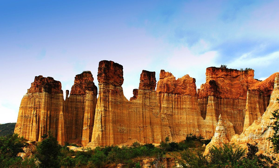 Langbapu Earth Forest in Yuanmou County, Chuxiong
Hydrology
Water Resources
Chuxiong Yi Autonomous Prefecture spans the Jinsha River and Yuanjiang River basins. The watershed to the north belongs to the Jinsha River system, covering a length of 151.9 kilometers within the prefecture and a basin area of 17,091.48 square kilometers, accounting for 60.1% of the prefecture’s land area. The main rivers of the Jinsha River system within the prefecture include the Yupojiang, Wanma River, Qinglong River, Longchuan River, and Mengguo River. The Yuanjiang River, known as the upper main stream of the Red River, stretches for 164.8 kilometers within the prefecture, with a basin area of 11,346.93 square kilometers, covering Shuangbai County and parts of Nanhua, Chuxiong, and Lufeng. The main rivers of the Yuanjiang River system within the prefecture include the Qinglong River, Malong River, and Lishu River.
Natural Resources
Soil Resources
Chuxiong Yi Autonomous Prefecture has a total land area of 43.887 million mu, including 2.3836 million mu of arable land and 1.2395 million mu of paddy fields. There are 19 soil types, including 14 types of arable soils and 5 types of natural soils. Purple soil is the most widespread, followed by red soil. Purple soil has a thin upper layer with poor water retention and erosion resistance but is rich in phosphorus and potassium, suitable for growing various economic crops, particularly tobacco. Red soil layers are generally thicker with good structure, acidic in nature, suitable for growing tea, potatoes, and beans. Additionally, paddy soil is the primary arable soil, covering 1.28 million mu, mainly distributed in the plains.
Mineral Resources
Chuxiong Yi Autonomous Prefecture is rich in mineral resources, including coal, copper, iron, lead, zinc, titanium, platinum, gold, rare earths, saltpeter, salt, and graphite. Notably, it is known for its reserves of iron ore (261 million tons) and coal (1.061 billion tons).
Plant Resources
The prefecture is home to over 6,000 species of higher plants, including more than 4,500 species of seed plants. It is notable for hosting 36 nationally protected wild plant species such as Cycas fairylakea, Cycas chenii, Cycas debaoensis, Dracaena cambodiana, Dracaena cochinchinensis, and Magnolia duclouxii.
Animal Resources
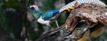
Chuxiong Yi Autonomous Prefecture boasts over 680 species of vertebrate animals, including 110 species of mammals, 390 species of birds, 66 species of reptiles, 34 species of amphibians, and 85 species of fish. It is home to 126 nationally protected terrestrial wild animals, including the black-crested gibbon, clouded leopard, green peafowl, black-necked crane, python, macaque, black bear, giant lizard, and leopard cat.


