 7 Days GolfingTour
 8 Days Group Tour
 8 Days Yunnan Tour
 7 Days Shangri La Hiking
 11 Days Yunnan Tour
 6 Days Yuanyang Terraces
 11 Days Yunnan Tour
 8 Days South Yunnan
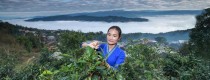
 7 Days Tea Tour
 8 Days Muslim Tour
 12 Days Self-Driving
 4 Days Haba Climbing
 Tiger Leaping Gorge
 Stone Forest
 Yunnan-Tibet
 Hani Rice Terraces
 Kunming
 Lijiang
 Shangri-la
 Dali
Dali
 XishuangBanna
 Honghe
 Kunming
 Lijiang
 Shangri-la
 Yuanyang Rice Terraces
 Nujiang
 XishuangBanna
 Spring City Golf
 Snow Mountain Golf
 Stone Mountain Golf


Top 6 River Bends in Yunnan Province
Yunnan Province, known for its diverse landscapes and rich history, is home to some of China’s most stunning river bends. These natural wonders include the Mati River Bend (马蹄河弯), offering serene views surrounded by rice fields, and the Taiji Diagram Bend (太极图河弯), shaped like the Taoist symbol, which changes colors with the seasons. The First Bend of the Yangtze River (长江第一湾) in Shigu (石鼓) marks a dramatic curve at the river’s northeastern journey, while the Great Bend of Jinsha River (Moon Bay) (金沙江大拐弯/月亮湾) showcases a breathtaking hairpin turn. The First Bend of the Nujiang River (怒江第一湾) creates a semicircular curve amidst mountains, and the Honghe River Bend (红河弯) offers picturesque views along its route through Dali (大理). Each of these river bends is not only a geological marvel but also a symbol of the region’s cultural and historical significance, making them must-visit destinations for nature lovers and photographers.
Mati River Bend
The Mati River Bend near Kunming offers a panoramic view from Laoya Mountain near Jianshan Village, Yiliang County. This horseshoe-shaped bay along the Mati River is a rare trekking destination surrounded by fields where locals cultivate rice and wheat, creating a stunning natural landscape.
Taiji Diagram Bend
Located just 1 km north of Yulong County seat in Dali, the Taiji Diagram Bend is formed by the Bijiang River as it curves near the county seat, resembling the Taiji diagram of Taoism. This natural wonder is renowned for its S-shape and changes appearance with the seasons—green in spring and yellow in autumn—drawing photographers from afar.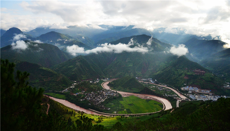
The First Bend of the Yangtze River in Shigu
Situated in Shigu Town, Yulong County, Lijiang City, this bend marks the beginning of the Yangtze River’s journey through Yunnan, known here as the Jinsha River. Originating from the Qinghai-Tibet Plateau, the river abruptly turns northeast at Shigu Town, forming a distinctive V-shaped bend. This site holds historical significance and features a drum-shaped stone tablet commemorating its strategic importance.
The Great Bend of Jinsha River (Moon Bay)
Located 15 km north of Benzilan Township in Deqin County, the Great Bend of the Jinsha River, also known as Moon Bay, showcases a dramatic hairpin turn as the river flows southward through mountain barriers. This natural wonder offers breathtaking views and is a testament to the river’s powerful erosive force.
The First Bend of the Nujiang River
Originating from Tibet, the Nujiang River forms its first bend near Bingzhongluo Village, changing its course dramatically due to natural barriers like the Wangqing Cliff and Danla Mountain. Known locally as “Huo Jia” or the First Bend of the Nujiang River, this semicircular bend creates spectacular scenery with its gentle flow and lush surroundings.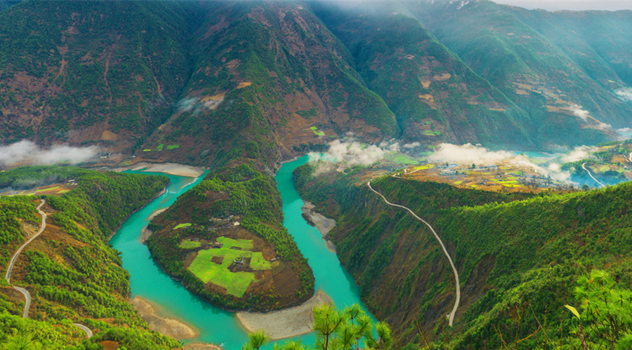
Honghe River Bend
Emerging from Weishan County in Dali, the Honghe River flows southward through Ailao Mountain, creating a picturesque bend in Xinping County. This river is a vital international waterway connecting Yunnan with Vietnam, celebrated for its natural beauty and cultural significance.
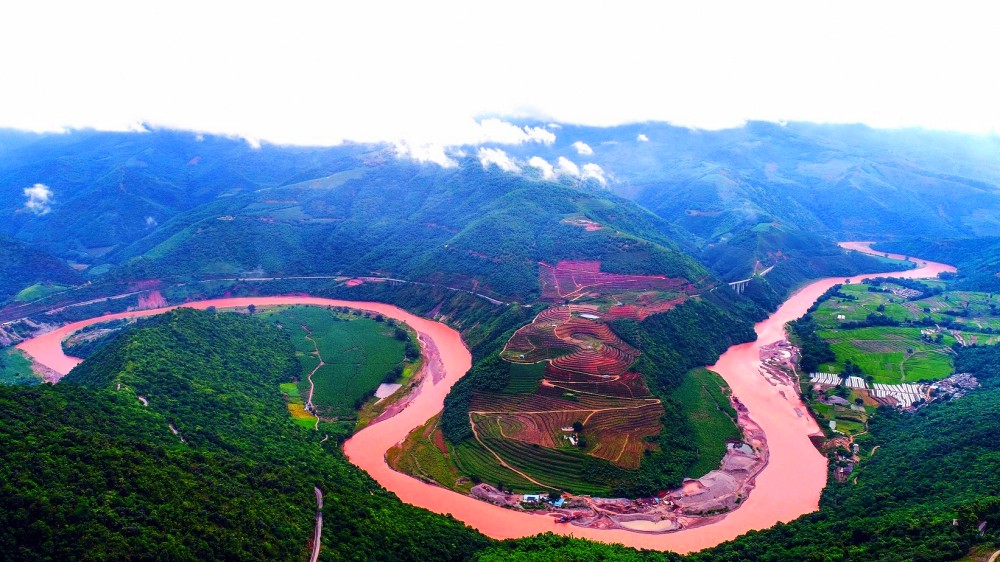 The First Bend of Red River (Honghe) in Xinping County, Yuxi
These river bends in Yunnan Province offer not only stunning natural landscapes but also insights into the geological and historical significance of the region. Each bend has its unique charm, attracting visitors and photographers alike from around the world.


