7 Days GolfingTour
 8 Days Group Tour
 8 Days Yunnan Tour
 7 Days Shangri La Hiking
 11 Days Yunnan Tour
 6 Days Yuanyang Terraces
 11 Days Yunnan Tour
 8 Days South Yunnan
 7 Days Tea Tour
 8 Days Muslim Tour
 12 Days Self-Driving
 4 Days Haba Climbing
 Tiger Leaping Gorge
 Stone Forest
 Yunnan-Tibet
 Hani Rice Terraces
 Kunming
 Lijiang
 Shangri-la
 Dali
Dali
 XishuangBanna
 Honghe
 Kunming
 Lijiang
 Shangri-la
 Yuanyang Rice Terraces
 Nujiang
 XishuangBanna
 Spring City Golf
 Snow Mountain Golf
 Stone Mountain Golf
Gengma County Overview
Basic Information
Chinese Name: 耿马县
Key Words: Frontier County
Gengma County Population: 296,300(in 2010)
Gengma County Area: 3837 Square Kilometers
Gengma County Average Temperature: 18.8℃
Gengma County Altitude: 450 meters-3233 meters
Geographical Location
Gengma Dai and Wa Autonomous County(耿马傣族佤族自治区) is in the southwest of Lincang prefecture, Yunnan province, between 98°48′-99°54′ east longitude and 23°21′-24°01′ north latitude. It is adjacent to Linxiang district and Shuangjiang county in the east, Cangyuan county in the south, Zhenkang county and Yongde county in the north across from the Nanting river, and is connected with Myanmar in the west with 47 kilometers of boundary line. By 2013, Gengma county covers total area of 3837 square kilometers, mountainous area takes up 92.4%, basin area accounts for 7.6%. The highest point, located in the snow mountain at the east border of Gengma County, is 3233 meters above sea level; the lowest point, at the confluence of Nanting River and Qingshuihe River, is 450 meters above sea level. The county seat, Gengma Town, is 1125 meters above sea level. Terrain of Gengma county is high in northeast and low in southwest.
Climate
More than 90% of the land in Gengma Dai and Wa Autonomous County is distributed in tropical and subtropical. The climate is subtropical monsoon climate of South Asia, which is good for plants to grow. Ethnic festivals in Gengma county focus on April to October. Enjoy a temperate climate, tourists can travel in Gengma county any seasons.
Top Attractions
1. Mengding Basin(孟定坝)
2. Gangdong Park (甘东公园)
3. Jingge White Pagoda(景戈白塔)
4. Mengding Dongjing Temple (孟定洞景佛寺
5. Gengma General Buddhist Temple (耿马总佛寺)
6. Langcang River Natural Reserve(澜沧江流域自然保护区)
7. Shifodong Cave Site of Neolithic Period(石佛洞新石器文化遗址)
8. Gengma Nanding River Scenic Spot(耿马南汀河省级风景名胜区)
Transportation
Transportation in Gengma County is convenient, tourists can get to or leave by airplane and long-distance bus. The problem is no direct flight gets to Gengma county because there is no airport yet. Therefore, Tourists should take long-distance bus to Gengma county after flying to Lincang airport or Cangyuan Washan airport, or take long-distance bus to Gengma county directly.
Administrative Divisions
Gengma Dai and Wa Autonomous County(耿马傣族佤族自治县) administers 4 towns, 5 townships and 3 farms. They are Gengma Town(耿马镇), Mengyong Town(勐永镇), Mengsa Town(勐撒镇), Mengding(孟定镇), Daxing Township(大兴乡), Sipaishan Township(四排山乡), Hepai Township(贺派乡), Mengjian Township(勐简乡), Manghong Lahu and Bulang Ethnic Town(芒洪拉祜族布朗族乡), Overseas Chinese Farm(耿马华侨农场), Mengsa Farm(勐撒农场) and Mengding Farm(孟定农场) respectively.
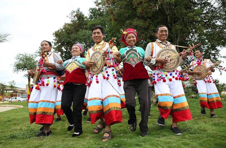
Ethnic Culture
23 ethnic minority groups live in Gengma county, including Dai, Wa, Lahu, Bulang, Jingpo, Deang, Lisu, Yi, Hui. Among them, Dai and Wa are main ethnic groups. There are traditional minority festivals like Qingmiao festival of Wa, Water-splashing festival of Dai and Item Brain Vertical Song(目瑙纵歌) of Jingpo; Traditional handcrafts like handmade paper, embroidered shoes and pottery of Dai; Ethnic dance like red deer dance, butterfly dance and peacock dance.
Education
Almost every town and township has their own middle school, primary school and kindergarten. Infrastructure and environment of Gengma education are in progress.
History
Gengma Si(耿马司), the short name of Gengma Anfusi(耿马安抚司) and Gengma Xuanfusi(耿马宣抚司), is a Tusi in the west Yunnan, China, in history. The early four generations did not belong to the Yuan dynasty. It was later conferred by the Ming dynasty, Qing dynasty and the republic of China, the jurisdiction is present Gengma Dai and Wa Autonomous County of Yunnan province. Tusi is Dai ethnic group, the surname of Han(罕). Gengma Governs bureau was repealed after 1950, changed to Gengma Minorities Administrative committee. Later on, it was changed to Gengma county in 1952, Gengma Dai and Kawa Autonomous County in 1955. After several changes, it became Gengma Dai and Wa Autonomous County in 1963.