 7 Days GolfingTour
 8 Days Group Tour
 8 Days Yunnan Tour
 7 Days Shangri La Hiking
 11 Days Yunnan Tour
 6 Days Yuanyang Terraces
 11 Days Yunnan Tour
 8 Days South Yunnan
 7 Days Tea Tour
 8 Days Muslim Tour
 12 Days Self-Driving
 4 Days Haba Climbing
 Tiger Leaping Gorge
 Stone Forest
 Yunnan-Tibet
 Hani Rice Terraces
 Kunming
 Lijiang
 Shangri-la
 Dali
Dali
 XishuangBanna
 Honghe
 Kunming
 Lijiang
 Shangri-la
 Yuanyang Rice Terraces
 Nujiang
 XishuangBanna
 Spring City Golf
 Snow Mountain Golf
 Stone Mountain Golf


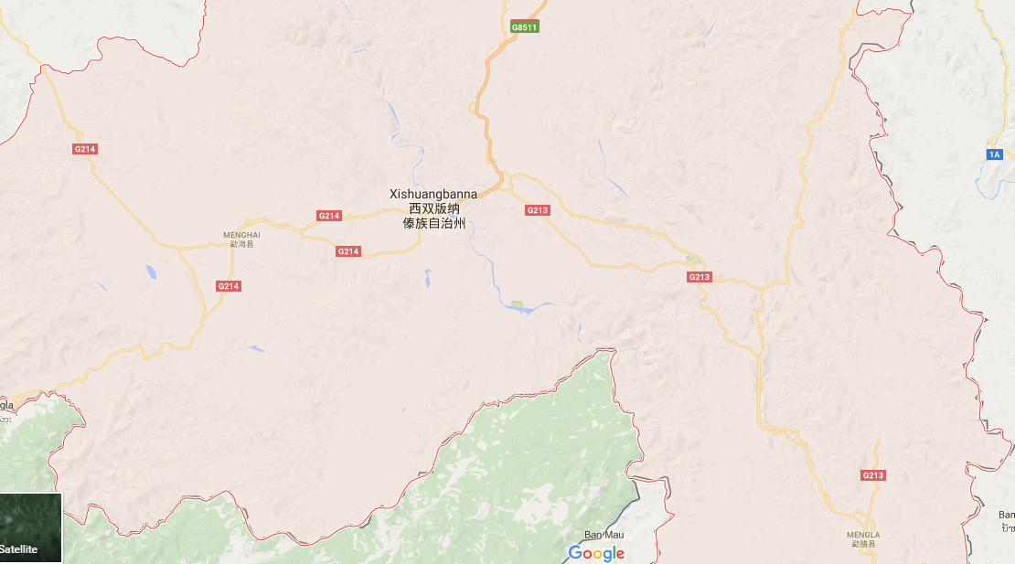
XishuangBanna Maps
Xishuangbanna maps include Xishuangbanna Prefecture Map, Xishuangbanna Attraction Map, Xishuangbanna Tour Map, Xishuangbanna Transportation Map, Xishuangbanna Location Map, etc., through which you will get the overall information about Xishuangbanna for your Yunnan Travel. You will get to know how to explore and what to see in Xishuangbanna which covers 19,184.45 square kilometers of territory, with tourist and scenic resorts making up 1,202.13 square kilometers, and nature reserves occupying a total of 2,064.6 square kilometers.
Xishuangbanna Tourist Attractions Maps
- Tourist Attractions Map of Mohan Border in Xishuangbanna
- Tourist Attractions Map of Menglun Town in Xishuangbanna
- Tourist Attractions Map of Mengla County in Xishuangbanna
- Tourist Attractions Map of Menghai County in Xishuangbanna
- Tourist Attractions Map of Jinghong City in Xishuangbanna
Xishuangbanna Location Maps
- Region Map of Menglun Town in Xishuangbanna
- Region Map of Mengla County in Xishuangbanna
- Region Map of Menghai County in Xishuangbanna
- Region Map of Jinghong City in Xishuangbanna
- Region Map of Xishuangbanna Prefecture
- Location Map of Menglun Town in Xishuangbanna
- Location Map of Menghai County in Yunnan
- Location Map of Mengla County in Yunnan
- Location Map of Mohan Border in Mengla County, Xishuangbanna
Xishuangbanna Transportation Maps
How to Get to Simao District (Puer) from Jinghong City
Simao District (思茅区), located in Puer (普洱) City, is approximately 127 kilometers away from Jinghong City (景洪市) in Xishuangbanna Dai Autonomous Prefecture (西双版纳傣族自治州). The journey typically takes around 2...
Maps
View Details

Location Map of Menglun Town in XishuangBanna
Location Map of Menglun Town in XishuangBanna...
Maps
View Details
Location Map of Mengla County in Yunnan
Location Map of Mengla County in Yunnan...
Maps
View Details
Location Map of Menghai County in Yunnan
Location Map of Menghai County in Yunnan...
Maps
View Details


