7 Days GolfingTour
 8 Days Group Tour
 8 Days Yunnan Tour
 7 Days Shangri La Hiking
 11 Days Yunnan Tour
 6 Days Yuanyang Terraces
 11 Days Yunnan Tour
 8 Days South Yunnan
 7 Days Tea Tour
 8 Days Muslim Tour
 12 Days Self-Driving
 4 Days Haba Climbing
 Tiger Leaping Gorge
 Stone Forest
 Yunnan-Tibet
 Hani Rice Terraces
 Kunming
 Lijiang
 Shangri-la
 Dali
Dali
 XishuangBanna
 Honghe
 Kunming
 Lijiang
 Shangri-la
 Yuanyang Rice Terraces
 Nujiang
 XishuangBanna
 Spring City Golf
 Snow Mountain Golf
 Stone Mountain Golf
Yunnan Geography
Yunnan is the most southwestern province in China, with the Tropic of Cancer running through its southern part. The province has an area of 394,100 square kilometres (152,200 sq mi), 4.1% of the nation’s total. The northern part of the province forms part of the Yunnan–Guizhou Plateau. The province borders Guangxi and Guizhou in the east, Sichuan in the north, and the Tibet Autonomous Region in the northwest. It shares a border of 4,060 kilometres (2,520 mi) with Burma in the west, Laos in the south and Vietnam in the southeast. For practical purposes, all of Yunnan province falls within the Zomia (region) of Asia.
Geology
Yunnan is at the far eastern edge of the Himalayan uplift, and was pushed up in the Pleistocene, primarily in the Middle Pleistocene, although the uplift continues into the present. The eastern part of the province is a limestone plateau with karsttopography and unnavigable rivers flowing through deep mountain gorges. The main surface formations of the plateau are the Lower Permian Maokou Formation, characterized by thick limestone deposits, the Lower Permian Qixia Formation, characterised by dolomitic limestones and dolostones, the Upper Permian basalts of the Ermeishan Formation (formerly Omeishan plateau basalts), and the red sandstones, mudstones, siltstones, and conglomerates of the Mesozoic–Paleogene, including the Lufeng Formation and the Lunan Group (Lumeiyi, Xiaotun, and Caijiacong formations). In this area is the noted Stone Forest or Shilin, eroded vertical pinnacles of limestone (Maokou Formation). In the eastern part the rivers generally run eastwards. The western half is characterized by mountain ranges and rivers running north and south.
Topography
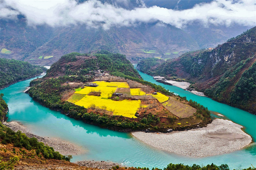
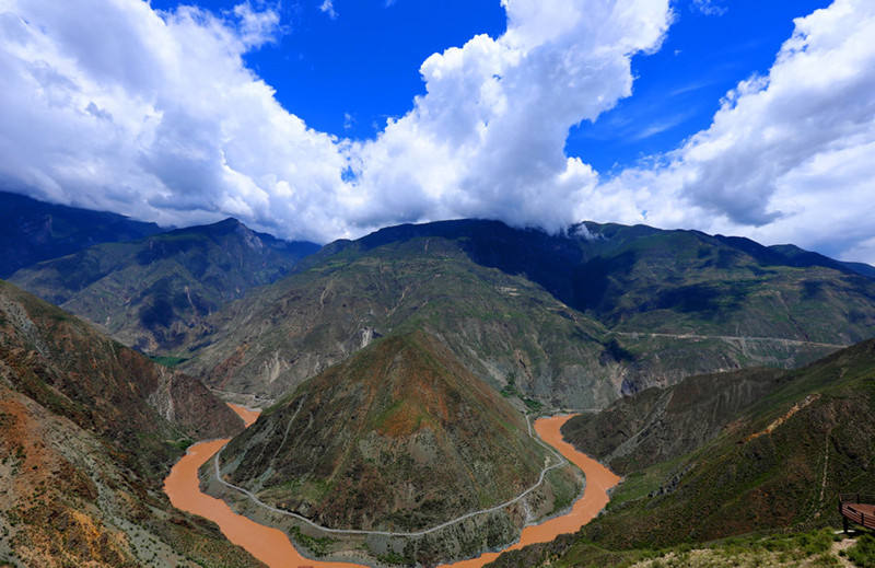
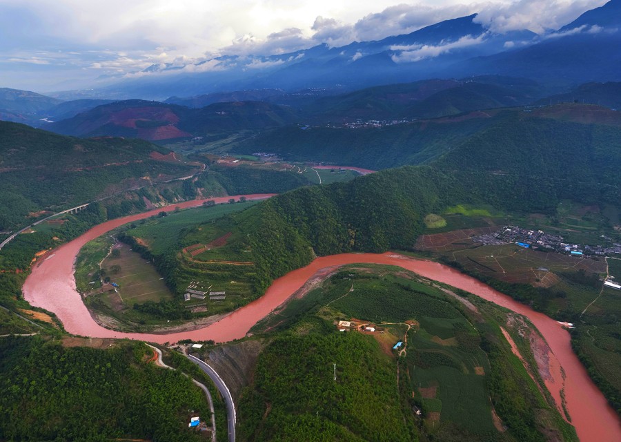
The terrain is largely mountainous, especially in the north and west. A series of high mountain chains spreads across the province. There is a distinct canyon region to the west and a plateau region to the east. Yunnan’s major rivers flow through the deep valleys between the mountains.
The average elevation is 1,980 metres (6,500 ft). The mountains are highest in the north where they reach more than 5,000 m (16,000 ft); in the south they rise no higher than 3,000 m (9,800 ft). The highest point in the north is the Kawagebo Peak in Deqin County on the Diqing Plateau, which is about 6,740 m (22,110 ft); and the lowest is in the Red River Valley in Hekou County, near the Vietnamese border, with an elevation of 76.4 m (251 ft).
The eastern half of the province is a limestone plateau with karst scenery and unnavigable rivers flowing through deep mountain gorges; the western half is characterised by mountain ranges and rivers running north and south. These include the Nujiang (Thai: Salween) and the Lancangjiang (Thai: Mekong). The rugged, vertical terrain produces a wide range of flora and fauna, and the province has been called a natural zoological and botanical garden.
Borders
Bordering Chinese provincial-level divisions are Tibet, Sichuan, Guizhou and Guangxi. Starting from the east and working clockwise, bordering countries are Vietnam (Hà Giang, Lào Cai, Lai Châu and Điện Biên provinces), Laos (Phongsaly, Oudomxayand Luang Namtha provinces), Myanmar (states of Shan and Kachin). The main border crossings are:
- Hekou–Lào Cai, by road and rail, is the only Sino-Vietnamese land border crossing open to non-Chinese/non-Vietnamese.
- Sino-Laotian at Boten
- Ruili–Muse is the only Sino-Burmese border crossing open to non-Chinese/non-Burmese.
Lakes
There are several major lakes in Yunnan. The province has nine lakes with areas of over 30 square kilometres (12 sq mi). They include:
- Dianchi Lake, near Kunming
- Fuxian Lake, in Yuxi, the second deepest lake in China
- Xingyun Lake, directly south of Fuxian Lake and connected with it by a short river
- Qilu Lake, south of Fuxian and Xingyun Lakes, separated from them by mountains, in Tonghai County
- Erhai Lake, near Dali City
- Lugu Lake, in Ninglang near the border with Sichuan
- Yangzong Lake, in Yiliang County
- Yilong Lake
Rivers
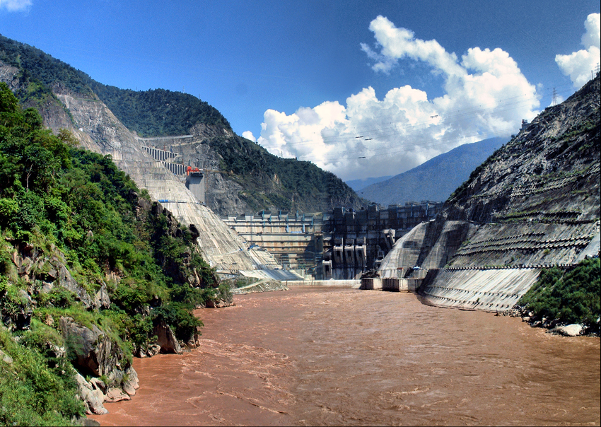
Yunnan is the source of two rivers, the Xi River (there known as the Nanpan and Hongshui) and the Yuan River. The Hongshui is a principal source stream of the Xi River. Rising as the Nanpan in eastern Yunnan province, it flows south and east to form part of the boundary between Guizhou province and Guangxi autonomous region. Flowing for 345 km (214 mi), it unites with the Yu River at Guiping to form what eventually becomes the Xi River.
The province is drained by six major river systems:
- the Yangtze River, here known as the Jinsha Jiang (River of Golden Sands), drains the province’s north.
- the Pearl River, with its source near Qujing, collects the waters from the east.
- the Mekong (Lancang), which flows from Tibet into the South China Sea forming the boundaries between Laos and Burma, between Laos and Thailand and through Laos, Cambodia and Vietnam
- the Red River (Yuan or Honghe) has its source in the mountains south of Dali and enters the South China Sea through Hanoi, Vietnam
- the Salween (Nujiang), which flows into the Gulf of Martaban and the Andaman Sea through Burma
- the Irrawaddy, which arises from the confluence of two rivers in Kachin State in Burma, has a few small tributaries in Yunnan’s far west, such as the Dulongjiang and Taping River, and rivers in the prefecture of Dehong.