 7 Days GolfingTour
 8 Days Group Tour
 8 Days Yunnan Tour
 7 Days Shangri La Hiking
 11 Days Yunnan Tour
 6 Days Yuanyang Terraces
 11 Days Yunnan Tour
 8 Days South Yunnan
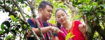
 7 Days Tea Tour
 8 Days Muslim Tour
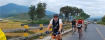
 12 Days Self-Driving
 4 Days Haba Climbing
 Tiger Leaping Gorge
 Stone Forest
 Yunnan-Tibet
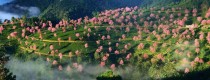
 Hani Rice Terraces
 Kunming
 Lijiang
 Shangri-la
 Dali
Dali
 XishuangBanna
 Honghe
 Kunming
 Lijiang
 Shangri-la
 Yuanyang Rice Terraces
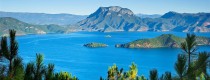
 Nujiang
 XishuangBanna
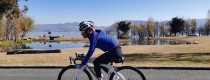
 Spring City Golf
 Snow Mountain Golf
 Stone Mountain Golf


 What Our Customers Say?
 alt="Market Days in Menglian and Townships, Puer"
/>
alt="Market Days in Menglian and Townships, Puer"
/>
XishuangBanna Geography
Xishuangbanna is located between 21°10′ to 22°40′ N latitude and 99°55′ to 101°50′ E longitude, at the northern edge of the tropics south of the Tropic of Cancer. It covers an area of 19,124.5 square kilometers, bordered by Pu’er City to the northeast and northwest, Laos to the southeast, and Myanmar to the southwest, with a total border length of 966.3 kilometers. The highest point in the region is Huazhu Liangzi in Mengsong Township, Menghai County, at an elevation of 2,429 meters, while the lowest point is the confluence of the Lancang River and Nanla River, at an elevation of 477 meters.
Geological Structure
Tectonic Framework
Xishuangbanna spans two fold systems: the Tanggula-Changdu-Lanping-Simao and the Gongshan-Tengchong fold systems, divided by the Lancang River fault. The former comprises the Banpo anticline and Dehua syncline, while the latter occupies the southeastern end of the Lincang-Menghai fold system. The Banpo anticline features Mesozoic turbidite, intermediate-acidic, and intermediate-basic volcanic constructions, predominantly associated with molasse formations, with sporadic exposures of red constructions and unconformably overlain by Cenozoic molasse formations. The Dehua syncline exhibits widespread Mesozoic red constructions, locally interspersed with molasse, carbonate, and coal-bearing clastic constructions. At the southeastern end of the Lincang-Menghai fold system, the Precambrian Lancang Group and Damenglong metamorphic rocks are exposed, with extensive Menghai granitic basement rocks from the Hercynian-Indosinian period occupying large areas.
Topography and Landforms
Xishuangbanna is situated in the southern extension of the Hengduan Mountains, at the terminal ends of the Nujiang, Lancang, and Jinsha River fold systems. Mountains and hills account for approximately 95% of the area, with intermountain basins (valleys) and river valleys comprising about 5%. The region is characterized by higher elevation surroundings, lower central areas, higher elevations to the northwest, and lower elevations to the southeast. Divided by the Lancang River, it is categorized into three geomorphic regions: central, western, and eastern. The eastern region features the Wuliang Mountains, traversing the northeastern part of Jinghong City and Mengla County, with elevations ranging from 1,000 to 1,500 meters. The western region consists of residual ranges of the Nujiang Mountains, distributed throughout Menghai County. Apart from a few pearl-like basin strings and low mountains, the area is predominantly dissected by ridges, with elevations between 1,500 and 2,000 meters. The central region is characterized by numerous open low gorges eroded by the downstream Lancang River and its tributaries, concentrated in the western and southern parts of Jinghong City and southern Mengla County, with relatively gentle terrain and elevations between 500 and 1,000 meters. Xishuangbanna is predominantly composed of highly dissected mountainous terrain. The highest point in the region is Huazhu Liangzi in the northeast of Menghai, at an elevation of 2,429.5 meters, and the lowest point is in the Lancang River valley southwest of Liangjiaojiao, Mengla County, at an elevation of 470 meters.
River System
Hydrological Network
Rivers within Xishuangbanna belong to the Lancang River system. There are 2,761 rivers of various sizes, with a total network length of 12,177 kilometers and a network density of 0.633 square kilometers. The region is abundant in water resources, totaling 145 billion cubic meters. The Lancang River originates from Zhaqu Peak in the Tanggula Mountains of Qinghai Province, flowing through Changdu where it becomes the Lancang River. It spans 2,354 kilometers with a basin area of 165,000 square kilometers, of which 2,198 kilometers are within China, making it China’s longest north-south river. The Lancang River runs 174 kilometers through the city section of Jinghong, with a basin area of 7,093 square kilometers and an annual runoff of 57.89 billion cubic meters. Peak flow occurs in September, with a maximum historical flow rate of 12,800 cubic meters per second and a minimum flow rate of 359 cubic meters per second in April, averaging 1,845 cubic meters per second annually. Upon leaving China at the confluence with the Nanla River in Mengla County, the Lancang River becomes the Mekong River, flowing through Southeast Asia via Myanmar, Laos, Thailand, Cambodia, and Vietnam before emptying into the South China Sea.
Climate Characteristics
Xishuangbanna is located on the northern edge of the tropics, with the Ailao and Wuliang Mountains acting as barriers to the southward cold air flow. To the south, the region is flanked by the Indian Ocean and the Bay of Bengal, influenced in summer by the southwest monsoon from the Indian Ocean and southeast airflow from the Pacific. This results in a climate characterized by high temperatures, abundant rainfall, distinct dry and wet seasons, and indistinct seasons throughout the year. Consequently, Xishuangbanna enjoys a warm and humid climate year-round, with only dry and wet seasons. The dry season lasts from November to April, and the wet season from May to October.
In 2021, annual rainfall across various counties and cities ranged from 1,024.4 to 1,365.3 millimeters. Compared to the long-term average, Jinghong and Mengla experienced lower rainfall, while Menghai had normal levels. Total sunshine hours ranged from 1,878.5 to 2,241.0 hours, with normal levels in Jinghong and Mengla, but higher levels in Menghai. The average annual temperature across counties and cities ranged from 18.9 to 23.5°C. Compared to the long-term average, Jinghong had higher temperatures, while Menghai and Mengla experienced normal levels. The main meteorological disasters throughout the year were wind and hail disasters, as well as heavy rain and flooding.

