7 Days GolfingTour
 8 Days Group Tour
 8 Days Yunnan Tour
 7 Days Shangri La Hiking
 11 Days Yunnan Tour
 6 Days Yuanyang Terraces
 11 Days Yunnan Tour
 8 Days South Yunnan
 7 Days Tea Tour
 8 Days Muslim Tour
 12 Days Self-Driving
 4 Days Haba Climbing
 Tiger Leaping Gorge
 Stone Forest
 Yunnan-Tibet
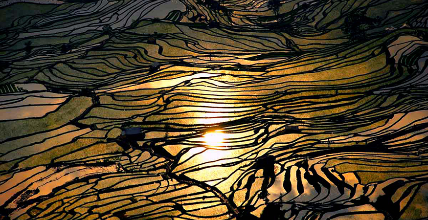
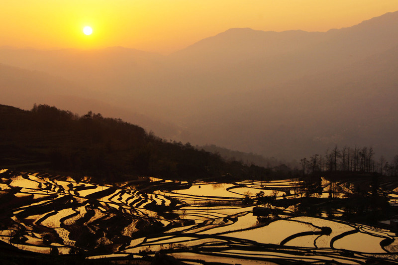
 Hani Rice Terraces
 Kunming
 Lijiang
 Shangri-la
 Dali
Dali
 XishuangBanna
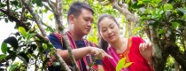
 Honghe
 Kunming
 Lijiang
 Shangri-la
 Yuanyang Rice Terraces
 Nujiang
 XishuangBanna
 Spring City Golf
 Snow Mountain Golf
 Stone Mountain Golf
Honghe Geography
Honghe Hani and Yi Autonomous Prefecture is situated in the southern part of Yunnan Province. It borders Kunming City to the north, Wenshan City to the east, and Yuxi City to the west. To the south, it shares a border with the Socialist Republic of Vietnam. The prefecture lies between 101°47′ and 104°16′ E longitude and 22°26′ and 24°45′ N latitude. It spans a maximum east-west distance of 254.2 kilometers and a maximum north-south distance of 221 kilometers, covering a total area of 32,931 square kilometers.
Topography and Landforms
Honghe Hani and Yi Autonomous Prefecture features terrain that is higher in the northwest and lower in the southeast. The prefecture is divided by the Hong River into northern and southern regions. The eastern part belongs to the Eastern Yunnan Plateau, while the western part comprises the Ailao Mountains of the Hengduan Mountains vertical valleys. The Ailao Mountains stretch southward along the southern bank of the Hong River into Vietnam, forming the main mountain range in the prefecture. Mountainous areas account for 88.5% of the total area. The highest point is Xilong Mountain in Jinping County at 3,074.3 meters, and the lowest point is the confluence of the Hong and Nanxi Rivers at 76.4 meters (the lowest point in Yunnan Province).

Climate
Honghe Hani and Yi Autonomous Prefecture lies in the low-latitude plateau monsoon region of southern Yunnan, with the Tropic of Cancer passing through its middle. It has a tropical and subtropical vertical climate. The terrain is high in the north and low in the south, with prevailing southeast trade winds and southwest monsoons in summer, and southerly winds in winter and spring. The region exhibits complex horizontal heat distribution and significant vertical differences, with central high areas and lower elevations in the north and south, and higher elevations in the west compared to the east. Dry and hot river valleys are higher than humid and hot river valleys. The prefecture enjoys abundant light and heat resources, though these are unevenly distributed across seasons. The southern region beyond the Tropic of Cancer has longer periods of usable sunlight with good light quality. Spring and autumn temperatures are unstable, summer heat is insufficient, winters are not severely cold, and summers are not extremely hot, with large daily temperature variations and small annual variations. The spring season is clear and dry with higher temperatures, while autumn cools rapidly. The region has distinct wet and dry seasons, with uneven annual precipitation. The average annual rainfall is 1,396.4 millimeters, with 75.9% of the annual rainfall occurring from May to October, and 49% of the annual rainfall during the flood season. Dry season rainfall accounts for less than 20% of the annual total.
Hydrology
The water systems in Honghe Hani and Yi Autonomous Prefecture belong to the Hong River and Pearl River systems. The southern part belongs to the Hong River system, and the northern part belongs to the Pearl River system. Major rivers include Lixian River, Tengjiao River, Nanxi River, Qu River, and Dianxi River. The prefecture has 180 rivers with a drainage area of over 100 square kilometers, including the main streams of the Nanpan and Hong Rivers. Of these, 65 rivers are part of the Pearl River system, and 115 are part of the Hong River system. There are 13 rivers with a drainage area of over 1,000 square kilometers, six in the Pearl River system (Nanpan, Qu, Lu, Shadian, Dianxi, and Nandong Rivers) and seven in the Hong River system (Hong, Xiaodi, Nanxi, Lixian, Sinanjiang (Niukong River), Xiaohei, and Tengjiao (Mengla River) Rivers). The prefecture’s lakes are all freshwater, located in the Nanpan River basin, including Yilong, Chishui, Sanjiaohai, Datunhai, and Changqiaohai Lakes.
Natural Resources
Water Resources
Honghe Hani and Yi Autonomous Prefecture has an average annual surface water resource volume of 20.07 billion cubic meters and an underground water resource volume of 6.627 billion cubic meters, with a repeat calculation volume of 6.627 billion cubic meters. The total volume of surface and underground water resources is 20.07 billion cubic meters, with an average annual runoff depth of 624 millimeters and an average annual runoff coefficient of 0.463. By the end of 2018, the prefecture had constructed 490 reservoirs with a total capacity of 1.129 billion cubic meters and an effective capacity of 825 million cubic meters, with a per capita water storage of 237.9 cubic meters. Among these, there are 27 medium-sized reservoirs with a total capacity of 804 million cubic meters, 90 small (Type I) reservoirs with a total capacity of 229 million cubic meters, and 373 small (Type II) reservoirs with a total capacity of 96 million cubic meters.
Mineral Resources
Honghe Hani and Yi Autonomous Prefecture has widespread but relatively concentrated mineral resources. The northern region is concentrated with energy and building material minerals such as coal and marble. The central region is rich in non-ferrous and ferrous metal minerals like tin, copper, lead, zinc, silver, and manganese. The southern region is abundant in precious metals, non-ferrous metals, and building materials such as gold, copper, nickel, gypsum, and marble. The prefecture’s tin reserves and production are the highest in the world.
Biological Resources
Honghe Hani and Yi Autonomous Prefecture is rich in wild plant and animal resources, with vast subtropical primeval forests. The prefecture is home to 31 species of wild plants and 45 species of wild animals under national first-class protection.