7 Days GolfingTour
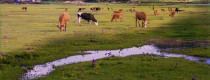
 8 Days Group Tour
 8 Days Yunnan Tour
 7 Days Shangri La Hiking
 11 Days Yunnan Tour
 6 Days Yuanyang Terraces
 11 Days Yunnan Tour
 8 Days South Yunnan
 7 Days Tea Tour
 8 Days Muslim Tour
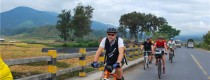
 12 Days Self-Driving
 4 Days Haba Climbing
 Tiger Leaping Gorge
 Stone Forest
 Yunnan-Tibet
 Hani Rice Terraces
 Kunming
 Lijiang
 Shangri-la
 Dali
Dali
 XishuangBanna
 Honghe
 Kunming
 Lijiang
 Shangri-la
 Yuanyang Rice Terraces
 Nujiang
 XishuangBanna
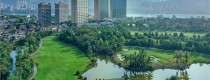
 Spring City Golf
 Snow Mountain Golf
 Stone Mountain Golf
Dali Geography
Position and Region
Dali Bai Autonomous Prefecture is located in the central-western part of Yunnan Province, lying between 98°52′~101°03′ E longitude and 24°41′~26°42′ N latitude. It borders Chuxiong Yi Autonomous Prefecture to the east, Pu’er City and Lincang City to the south, Baoshan City and Nujiang Lisu Autonomous Prefecture to the west, and Lijiang City to the north. The maximum east-west width is over 320 kilometers, and the maximum north-south length is over 270 kilometers. The distance from Kunming is 331 kilometers, covering a total area of 29,459 square kilometers.
Topography and Landforms
Topographical Features
Dali Bai Autonomous Prefecture is situated at the conjunction of the Yunnan-Guizhou Plateau and the Hengduan Mountains, with the terrain higher in the northwest and lower in the southeast. The region features complex and diverse landforms. West of the Cangshan Mountain range lies the high mountain and canyon area, while east of Cangshan and west of Xiangyun features mid-mountain steep slopes. The major mountain ranges include the Yunling Mountains and the Nushan Mountains. The Cangshan Mountain, located in the central part of the prefecture, is lofty and towering. The highest peak is Xuebanshan at the junction of Jianchuan and Lijiang’s Lanping, with an altitude of 4,295 meters. The lowest point is Hongqiba in Yunlong County along the Nujiang River, with an altitude of 730 meters.
Geological Structure
The prefecture is divided into two major parts by the significant fault line along the Laojunshan-Cangshan-Ailaoshan line. The eastern part belongs to the Yangtze Paraplatform, while the western part belongs to the Tibetan-Yunnan Geosynclinal Fold Zone (also known as the Three Rivers Zone). The Yangtze Paraplatform area is bounded by the Erhai-Honghe deep fault to the west, extending into the Chuxiong region. The Tibetan-Yunnan Geosynclinal Fold Zone covers the vast western and southern areas of the prefecture, bordered by the Erhai-Honghe deep fault to the east and extending to the Nujiang and Lancang River valleys in the west, running north-south through the prefecture.
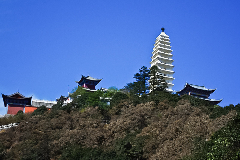 Lengyan Pagoda of Jizu Mountain in Binchuan County, Dali
Climate
Climatic Characteristics
Dali Bai Autonomous Prefecture features a low-latitude plateau monsoon climate with distinct vertical climatic zones, evident seasonal wet and dry periods, mild summers, and no severe winters. The annual temperature variation is small, but the daily temperature variation is significant. The highest elevation is 4,295.8 meters, and the lowest is 730 meters, with temperature decreasing by 0.6~0.7°C for every 100-meter increase in altitude. The temperature varies markedly with altitude, featuring cold, temperate, and hot (including subtropical) climates, leading to the saying “one mountain has four seasons, and ten miles have different weather,” offering unique scenery.
Temperature
The annual average temperature ranges from 1219°C across the prefecture. The hottest month (June) has average temperatures of 1925°C, with no periods where the average temperature reaches ≥30°C, and days above 35°C are rare or nonexistent. The coldest month (January) has average temperatures of 5.013°C, with no periods where the average temperature is ≤0°C. The annual temperature variation is 1214°C. Daily temperatures are cooler in the mornings and evenings and warmer at noon, especially in winter and spring, with daily temperature variations of 13~20°C.
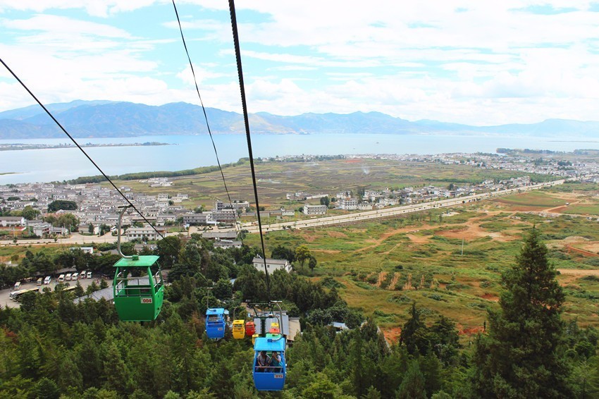 Tianlongdong Cableway of Cangshan Mountain in Dali City
Precipitation
Precipitation distribution is highly uneven both seasonally and regionally. The wet season (rainy season) lasts from May to October, accounting for 8395% of the annual rainfall. The dry season (dry season) spans from November to April, with only 517% of the annual precipitation. The average annual precipitation is 836 mm, with Dali City receiving the most at 1,055 mm, and Binchuan the least at 564 mm. Most areas receive less than 900 mm of annual precipitation. The frost-free period ranges from 225 to 345 days, which is relatively long.
Hydrology
Water Systems
The main rivers in Dali Bai Autonomous Prefecture belong to the Jinsha River, Lancang River, Nujiang River, and Honghe River (Yuanjiang River) systems, with over 160 rivers crisscrossing the prefecture. There are eight lakes within the prefecture: Erhai Lake, Tianchi, Cibi Lake, Xihu Lake, Donghu Lake, Jianhu Lake, Haixi Lake, and Qinghai Lake.
Soil
Soil Types
Dali Bai Autonomous Prefecture has soil types classified into 8 orders, 13 suborders, 23 groups, 76 subgroups, and 236 soil species. Purple soils cover 31.75% of the total land area, while red soils account for 27.7%.
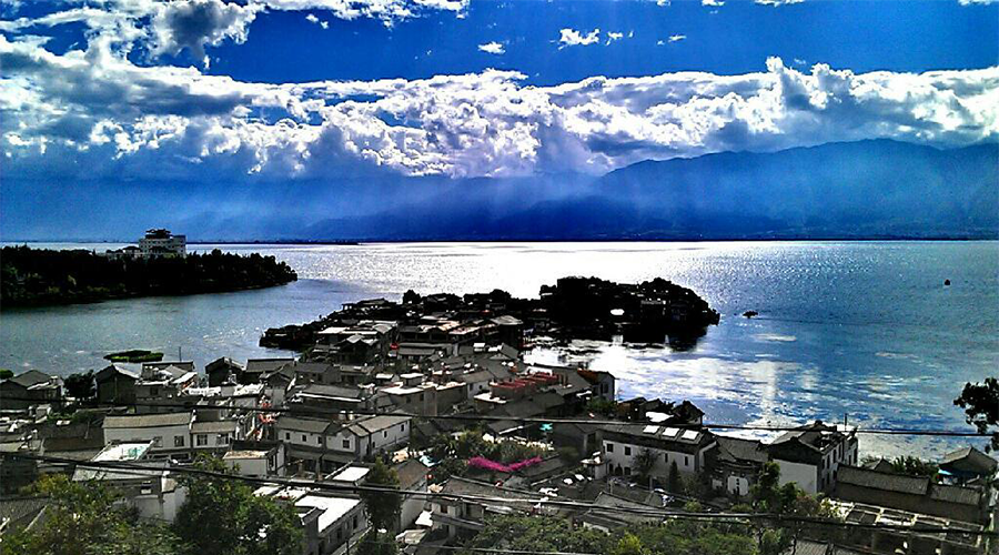
 Erhai Lake in Dali
Natural Resources
Land Resources
As of July 2023, Dali Bai Autonomous Prefecture covers an area of 29,459 square kilometers, with 368,884 hectares of arable land and 28,299 hectares of orchard land, serving as a production base for citrus, apples, peaches, plums, pears, tea, and mulberries. The land use is approximately 60% forest, 20% pasture, 13% arable land, and 7% other uses.
Biological Resources
The primary vegetation types include semi-humid evergreen broad-leaved forests, temperate mountain hard-leaved evergreen oak forests, temperate coniferous forests, temperate shrubs, dry-hot valley shrubs, and plateau lake aquatic vegetation. The prefecture is rich in forest resources, being a key forest area in Yunnan Province. Major tree species include Yunnan pine, Huashan pine, hemlock, fir, Masson pine, Simao pine, cypress, camphor, toon, and oak. Rare species include ginkgo, Munipero cypress, Podocarpus, Chinese yew, and Davidia involucrata.
Forests and Reserves
Approved by the Ministry of Forestry, the prefecture has established five national forest parks: Weibao Mountain in Weishan County, Qinghua Cave in Xiangyun County, Dongshan in Midu County, Lingbao Mountain in Nanjian County, and Baotai Mountain in Yongping County. There is one national nature reserve (Cangshan-Erhai), three provincial nature reserves (Tianchi in Yunlong County, Jizu Mountain in Binchuan County, and Jinguang Temple in Yongping County), and 14 prefecture-level nature reserves. Cangshan Mountain alone has identified around 3,000 species of higher plants, making it a major medicinal herb production area in Yunnan Province, with 600 types of medicinal herbs managed nationally.
Water Resources
The average annual precipitation in the prefecture is 29.872 billion cubic meters, with an average annual surface runoff of 10.58 billion cubic meters and groundwater reserves of 3.23 billion cubic meters, totaling 13.81 billion cubic meters of water resources, averaging 4,500 cubic meters per person. The prefecture’s rivers are rich in hydropower resources, with an estimated potential of 9.3 million kilowatts, of which 8.07 million kilowatts are exploitable. Currently, 304,700 kilowatts have been developed, accounting for 3.8% of the total.
 Erhai Lake in Dali
Mineral Resources
The prefecture has favorable geological conditions for mineral formation and a variety of mineral resources. Metallic minerals include manganese, iron, tin, antimony, lead, zinc, copper, nickel, cobalt, tungsten, silver, gold, platinum, palladium, molybdenum, aluminum, and mercury, with over 200 ore deposits and mineral points. Developed and utilized resources include Beiya lead mine, Heqing manganese mine, Weishan, Yangbi antimony mines, Heqing, Binchuan gold sands, among others. Non-metallic minerals include coal, rock salt, marble, limestone, dolomite, fluorite, quartz sand, arsenic, barite, asbestos, graphite, gypsum, talc, bentonite, diatomite, and clay minerals. Developed resources include coal, salt, limestone, and marble, with marble reserves reaching 100 million cubic meters, classified as a super-large deposit. Geothermal resources are mainly distributed along the Nanjian-Midu-Xiaguan-Eryuan line.