 7 Days GolfingTour
 8 Days Group Tour
 8 Days Yunnan Tour
 7 Days Shangri La Hiking
 11 Days Yunnan Tour
 6 Days Yuanyang Terraces
 11 Days Yunnan Tour
 8 Days South Yunnan
 7 Days Tea Tour
 8 Days Muslim Tour
 12 Days Self-Driving
 4 Days Haba Climbing
 Tiger Leaping Gorge
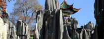
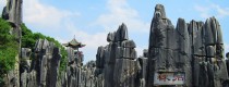
 Stone Forest
 Yunnan-Tibet
 Hani Rice Terraces
 Kunming
 Lijiang
 Shangri-la
 Dali
Dali
 XishuangBanna
 Honghe
 Kunming
 Lijiang
 Shangri-la
 Yuanyang Rice Terraces
 Nujiang
 XishuangBanna
 Spring City Golf
 Snow Mountain Golf
 Stone Mountain Golf


 What Our Customers Say?
 alt="Market Days in Menglian and Townships, Puer"
/>
alt="Market Days in Menglian and Townships, Puer"
/>
Lincang Geography
Location and Administrative Division
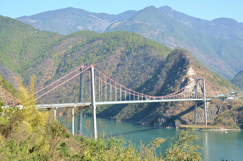
Lincang City is located in the southwest part of Yunnan Province, China, between 98°40′ to 100°32′ east longitude and 23°05′ to 25°03′ north latitude. The Tropic of Cancer crosses the southern part of its jurisdiction. The Lancang River and Nu River flow through the eastern and western sides of the city, respectively. It borders Pu’er City to the east, Dali Prefecture to the north, Baoshan City to the west, and Myanmar to the southwest, with a border length of 290.79 kilometers. The city covers an area of 24,000 square kilometers, and its municipal seat is 598 kilometers away from the provincial capital Kunming.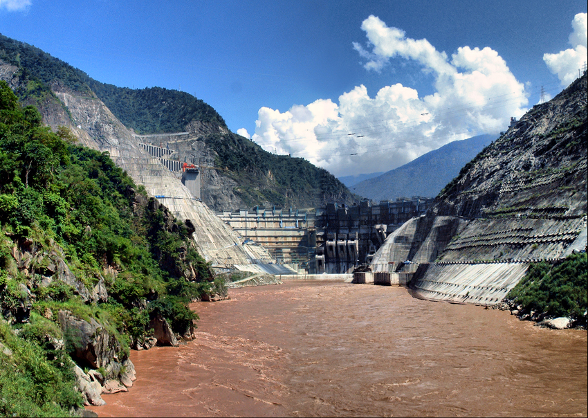
Terrain and Topography
Lincang City is located in the southern extension of the Hengduan Mountains and the southern part of the Nu Mountains, belonging to the western Yunnan longitudinal valley region. The area is characterized by rugged mountains and peaks. The highest point is the Yulong Snow Mountain at an altitude of 3,429 meters, and the lowest point is the Mengding Qingshui River at 450 meters above sea level, with a relative elevation difference of 2,979 meters. The terrain is higher in the middle and gradually slopes down from northeast to southwest.
 Mengku Ancient Tea Valley in Shuangjiang County, Lincang
Soil
The soils in Lincang City exhibit a zonal vertical distribution with 10 soil types, 19 subtypes, 72 genera, and 348 species. Soil types vary from low to high altitudes, including brick red soil, red soil, yellow soil, yellow brown soil, and subalpine meadow soil. Each type is distributed according to altitude ranges, with specific percentages allocated to different elevations.
Climate
Lincang City has a subtropical highland monsoon climate influenced by warm and humid air currents from the Indian Ocean and the southwest monsoon. It experiences distinct dry and rainy seasons with abundant rainfall and long sunshine hours. The city can be divided into six climate zones ranging from tropical to temperate. The annual average temperature is 17.3°C, with a frost-free period lasting between 317 to 357 days annually. Average annual rainfall ranges from 920 to 1750 millimeters, and annual sunshine hours range from 1894.1 to 2261.6 hours.
Hydrology
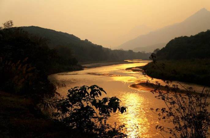
The city’s rivers belong to two major water systems, the Nu River and the Lancang River. There are seven rivers with drainage areas exceeding 1000 square kilometers, including the Luoza River, Xiahei River, Nanting River, Nanpeng River, Yongkang River, Mengmeng River, and Nangun River. Lincang City has a total of 361 rivers with drainage areas larger than 20 square kilometers, classified into various sizes based on their drainage areas.
Natural Resources
Mineral Resources
Situated in the “Three Parallel Rivers” metallogenic belt, Lincang City is rich in mineral resources with 42 identified types, accounting for 25% of the 171 mineral types discovered nationwide. It is renowned for germanium ores, contributing a quarter of China’s total production and recognized as a key base for the industrialization of high-tech germanium materials.
Solar Energy Resources
Lincang City receives an annual average of 1878 to 2247 hours of sunshine, with a total solar radiation of 5239 to 5702 megajoules per square meter per year, placing it among the medium-level regions of China’s solar energy resources.
Wind Energy Resources
The city has an annual average wind speed ranging from 0.7 to 2.2 meters per second, varying by season. The effective utilization hours can reach up to 8000 hours annually, and the city has the potential to develop wind power exceeding 1700 kilowatts per square kilometer.
Hydropower Resources
Due to abundant precipitation and significant elevation differences, Lincang City boasts rich hydropower resources. It hosts major hydropower stations along the Lancang River, including Manwan, Dachaoshan, and Xiaowan, with a combined capacity of over one million kilowatts. Theoretical estimates suggest a hydropower potential of 2.983 million kilowatts, with an exploitable capacity of 1.5123 million kilowatts, making it a crucial national hydroelectric energy base.
Water Resources
Lincang City has an average annual water resource volume of 23.227 billion cubic meters, with over 1000 rivers of varying sizes. Water quality from county-level and above centralized drinking water sources meets national Grade I and II protection zone standards. The per capita water resource availability is nearly 10,000 cubic meters, twice the average of Yunnan Province.
Biological Resources
The vegetation in Lincang City exhibits a vertical zonation pattern, with diverse plant species including Yunnan pine, Simao pine, oak, zhu muhe, qiu mu, and Huashan pine. The city is home to two national nature reserves, two forest parks, one national park, and five provincial scenic spots. It hosts a wide variety of flora and fauna, including 121 mammal species, 413 bird species, 55 reptile species, 35 amphibian species, and 85 fish species. Notably, it harbors 97 species of protected wildlife, including 19 species under national first-class protection, 73 under national second-class protection, and 5 under provincial protection.

Nature Reserves
National Level
- Nangun River Nature Reserve
- Yulong Snow Mountain Nature Reserve
Provincial Level
- Lincang Lancang River Nature Reserve
- Zhenkang Nanpeng River Nature Reserve
County Level
- Yongde Dedanghoushan Nature Reserve
Nature Conservation Areas
- Gengma Sifangjing Tieli Wood Nature Conservation Area

