-
- Home
- Yunnan Tours
Most Popular Yunnan ToursEssential Yunnan TripsFind Yunnan Tours by MonthFind Yunnan Tours by Duration
- Group Tours
Popular Yunnan Group ToursAll Yunnan Group Tours
- 1 Day Kunming Stone Forest Group Tour
- 1 Day Jade Dragon Snow Mountain Group Tour
- 2 Days Tiger Leaping Gorge Hiking Group Tour
- 4 Days Haba Snow Mountain Climbing Group Tour
- 6 Days Yuanyang Hani Rice Terraces Group Tour
- 8 Days Kunming-Dali-Lijiang-Shangri-la Group Tour
- 8 Days Yunnan Chinese-Speaking Group Tour
- 15 Days Yunnan-Tibet Small Group Tour
- Themes Tours
- City Tours
- Travel Guide
- Attractions
- Customize
 7 Days GolfingTour
 8 Days Group Tour
 8 Days Yunnan Tour
 7 Days Shangri La Hiking
 11 Days Yunnan Tour
 6 Days Yuanyang Terraces
 11 Days Yunnan Tour
 8 Days South Yunnan
 7 Days Tea Tour
 8 Days Muslim Tour
 12 Days Self-Driving
 4 Days Haba Climbing
 Tiger Leaping Gorge
 Stone Forest
 Yunnan-Tibet
 Hani Rice Terraces
 Kunming
 Lijiang
 Shangri-la
 Dali
Dali
 XishuangBanna
 Honghe
 Kunming
 Lijiang
 Shangri-la
 Yuanyang Rice Terraces
 Nujiang
 XishuangBanna
 Spring City Golf
 Snow Mountain Golf
 Stone Mountain Golf
You Might Like
- 7 Days Yunnan RV Caravan Self-Driving and Tea Tour (Kunming-Lincang-Xilinshan-Fengqing-Kunming)

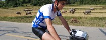
- 22 Days China-Laos Cycling Tour from Kunming to Luang Prabang and Vientane
- 4 Days Kunming and Dali Tour by High Speed Train
- 12 Days Grand Shangri-La Adventure Circle Driving Tour from Lugu Lake to Daocheng Yading
- 12 Days Yunnan Three Parallel Rivers Overland Tour with Biluo and Meili Snow Mountains from Lijiang to Tengchong
- 2 Days Dali Wuliang Mountain Cherry Blossoms Valley Tour
- 10 Days South Yunnan Ethnic Minority and Tropical Rain-forest Photography Tour with China Border Culture
- 20 Days West Yunnan and Three Parallel Rivers Overland Tour


Latest Articles


Contact Info

