Diqing Tibetan Autonomous Prefecture (迪庆藏族自治州) occupies a strategic position in northwestern Yunnan, where Yunnan, Sichuan, and Tibet meet on the southeastern edge of the Qinghai–Tibet Plateau. It also lies within the spectacular Three Parallel Rivers region, where the Jinsha, Lancang, and Nu rivers flow through some of the world's most dramatic mountain landscapes.
The name Diqing (迪庆) comes from Tibetan and is commonly understood as meaning a land of good fortune and auspiciousness. The region's history is closely connected with its geography. Rather than being an isolated highland, Diqing has long been a cultural and transportation corridor linking the Tibetan Plateau with Yunnan and Sichuan.
The history of Diqing is therefore also a history of migration, ethnic interaction, political competition, religious development, and trade. Tibetan, Naxi, Lisu, Pumi, Han, Hui, and other communities developed different economic and cultural traditions within the region's valleys, grasslands, forests, and high mountains.
Modern Diqing consists of Shangri-La City (香格里拉市), Deqin County (德钦县), and Weixi Lisu Autonomous County (维西傈僳族自治县). Each area preserves a different part of the region's historical landscape.
Prehistoric Diqing: Early Human Settlement and Tribal Societies
Archaeological discoveries indicate that human activity in the Diqing region can be traced back to prehistoric times.
During the later Paleolithic period, early human communities were already active in parts of the region. Human settlement expanded during the Neolithic period as communities developed more stable ways of living in mountain valleys and highland environments.
Archaeological discoveries around Nixi (尼西) and Deqin (德钦) include stone burial structures, pottery, bronze objects, and other artifacts associated with ancient communities. These remains demonstrate that the highland valleys of present-day Diqing were already part of broader cultural networks thousands of years ago.
The archaeological record also shows that Diqing was never culturally isolated. Objects and technologies found in the region indicate connections with communities in the upper Jinsha River basin, the eastern Tibetan Plateau, and areas farther north and east.
During the pre-Qin period, the region was inhabited by various ancient tribal groups associated with the broader Qiang cultural world. Communities practiced combinations of pastoralism, hunting, gathering, and agriculture depending on altitude and local geography.
Political organization was based largely on tribal and local community structures rather than centralized administration. The region lay within the broader area known historically as the southwestern tribal frontier, beyond the direct administrative reach of the early Chinese states.
Han, Wei, Jin, Southern and Northern Dynasties, and Sui Periods
Early Administrative Connections with Central China
The expansion of the Han dynasty into southwestern China brought the first clearer administrative records concerning parts of the region.
During the reign of Emperor Wu of Han, the Han government expanded its influence into southwestern tribal territories. Areas around present-day Weixi were connected with administrative units associated with the Yuexi Commandery, although direct administrative control over the high mountain areas of present-day Shangri-La and Deqin remained limited.
Local tribal communities continued to exercise considerable autonomy.
During the Eastern Han period, relations between the central government and southwestern highland communities developed further. Some tribal groups entered tributary relationships with the Han court, increasing cultural and economic exchange.
A Region of Independent Tribal Communities
During the Three Kingdoms period, parts of the region were associated with the administrative sphere of the Shu Han state, while the higher valleys and mountain areas continued to be dominated by local communities.
The political fragmentation of China during the Jin and Northern and Southern Dynasties reduced direct administrative influence over remote highland areas.
This was also a period of significant population movement. Different communities migrated through the Hengduan Mountains, and Tibetan-related populations gradually expanded southward from the plateau.
These movements contributed to the complex ethnic landscape that later became characteristic of Diqing.
Tang and Song Periods: The Rise of Tibetan Influence and the Tea Horse Road
The Establishment of Shenzhou
During the Tang dynasty, the central government began establishing stronger administrative connections with parts of Diqing.
In 621, during the early Tang period, a unit known as Shenzhou (神州) was established in part of the region and came under the loose administrative framework of the Yaozhou Protectorate.
The system reflected the Tang government's broader strategy of governing frontier areas through indirect administration rather than direct control.
The Expansion of the Tibetan Empire
The seventh and eighth centuries brought a major transformation.
The Tibetan Empire expanded eastward and southward from the Tibetan Plateau. Large parts of present-day Shangri-La, Deqin, and Weixi came under Tibetan political and military influence.
Around the late seventh century, Tibetan authorities established the Shenchuan Protectorate (神川都督府) in the region. The Jinsha River became a strategic frontier zone between different political powers.
One of the most famous historical features associated with this period was the Shenchuan Iron Bridge (神川铁桥), traditionally associated with the crossing of the Jinsha River. The bridge and surrounding transportation routes served strategic and commercial purposes and helped connect the Tibetan Plateau with Yunnan.
The expansion of the Tibetan Empire had profound demographic consequences. Military settlements, migration, and political expansion contributed to the establishment of Tibetan communities across the highlands.
Tibetan Buddhism also gradually became an important cultural force, although the religious landscape developed over a much longer period and incorporated multiple local traditions.
Nanzhao and Dali
As Tibetan power declined, the kingdom of Nanzhao became a major regional power in southwestern China.
Nanzhao and the Tibetan Empire competed repeatedly for strategic territories around the Jinsha River and the broader Shenchuan region.
After the decline of Tibetan political power in the area, much of Diqing came within the sphere of the Dali Kingdom.
Historical names associated with different parts of the region included Dandang (旦当) for the central Shangri-La area and Luopojian (罗裒间) for an area associated with present-day Weixi.
Dali continued the tradition of indirect frontier administration through local leaders.
The Early Tea Horse Trade
During this period, the trade routes connecting Yunnan with Tibet became increasingly important.
Tea, horses, salt, medicinal materials, textiles, and other highland and agricultural products moved through mountain corridors. These routes gradually developed into what later became known as the Tea Horse Road.
The significance of the Tea Horse Road went far beyond commerce. It became a channel for migration, religious exchange, language contact, technology, food traditions, and cultural interaction.
The Yuan Dynasty: Mongol Expansion and the Formation of a New Political Structure
Kublai Khan's Expedition to Dali
In 1253, Kublai Khan led the Mongol campaign against the Dali Kingdom.
Mongol forces entered the region through the mountains and crossed the Jinsha River. The famous tradition of crossing the river using leather boats is associated with this military campaign.
The conquest brought Diqing more firmly into the political sphere of the Yuan dynasty.
Yunnan and Tibetan Administrative Systems
The Yuan government developed a complex administrative structure for the frontier.
Areas east of the Jinsha River were incorporated into the administrative system associated with Lijiang Route under Yunnan Province, while highland Tibetan territories to the west were connected with institutions responsible for Tibetan regions.
This created an important historical pattern in which Diqing functioned between Yunnan administrative structures and Tibetan political and religious networks.
The Yuan government also expanded relay stations and transportation infrastructure. These improvements strengthened the mountain routes used by merchants, officials, military personnel, and religious travelers.
Tibetan Buddhist institutions expanded during this period, and the foundations of later religious and political structures gradually developed.
In Weixi, early county-level administrative arrangements also emerged, marking an important stage in the formalization of local government.
The Ming Dynasty and the Era of the Mu Chieftains
Lijiang Mu Family Influence
During the Ming dynasty, Diqing became closely connected with the powerful Mu Chieftains of Lijiang (丽江木氏土司).
The Mu family exercised influence over large areas of northwestern Yunnan for more than two centuries through a system of local chieftains and hereditary officials.
In Diqing, different local leaders administered communities in areas corresponding to present-day Shangri-La, Weixi, and Deqin.
The Mu administration invested in forts, relay stations, roads, and trade routes, strengthening connections between Lijiang and the Tibetan regions farther north.
The Tea Horse Road Reaches Its Peak
The Ming period was an important era for the development of the Tea Horse Road.
Caravans carrying tea from Yunnan traveled northward toward Tibetan communities, while horses, medicinal products, animal products, salt, and other goods moved south.
Dukezong Ancient Town (独克宗古城) gradually developed into one of the most important commercial centers along the Yunnan–Tibet trade route.
Merchants from different ethnic communities gathered in the town. Tibetan, Naxi, Han, and other traders participated in the regional economy, while caravan networks linked Diqing with Lijiang, Sichuan, Tibet, and other parts of Yunnan.
Naxi Migration and Cultural Exchange
The Mu administration was closely associated with Naxi political and cultural networks.
Naxi communities migrated into parts of Diqing, creating long-term cultural interaction between Naxi and Tibetan communities.
Religious institutions also expanded. Tibetan Buddhist monasteries became increasingly important centers of religious learning, political influence, education, and local community life.
The historical name Zhongdian (中甸) became increasingly established for the central basin. The name is associated with a Naxi expression referring to the basin or settlement area where a local chief lived, while the Tibetan name Gyalthang/Jiantang (建塘) remained important in local usage.
The Qing Dynasty: Mongol Influence, Tibetan Buddhism, and Incorporation into Yunnan
The Khoshut Mongols and the Tibetan Political Sphere
During the early Qing period, the Khoshut Mongols expanded their influence in the Tibetan world.
Around 1667, Khoshut forces occupied Zhongdian. Dukezong became an important administrative and commercial center, while Tibetan Buddhist institutions gained further political and religious influence.
Local governance developed through an interaction between local chieftains, monasteries, religious leaders, and secular elites.
This was an important period in the development of the distinctive political and religious landscape of Diqing.
Qing Administrative Reforms
A major transformation occurred during the reign of the Yongzheng Emperor.
Between 1724 and 1726, the Qing government reorganized the boundary between Sichuan and Yunnan and formally incorporated Zhongdian, Weixi, and Deqin into Yunnan's administrative system.
This change was significant because it established the long-term association of Diqing with Yunnan.
The Qing government adopted a mixed system of appointed officials and hereditary local chieftains. Central officials represented the imperial administration, while local hereditary leaders retained certain traditional powers.
The Growth of Dukezong
In the eighteenth century, Zhongdian's administrative status was strengthened. Zhongdian became a hall-level administrative unit under Lijiang Prefecture, while Weixi and the area around present-day Deqin received their own administrative arrangements.
At the same time, Dukezong Ancient Town flourished as a major Tea Horse Road trading center.
Caravan merchants from different communities lived and traded in the town. Tibetan, Naxi, Han, Hui, and other groups participated in the commercial economy.
The arrival and settlement of Hui Muslim merchant communities added another cultural layer to the region.
Religion, Society, and Local Power
During the late Qing period, religious institutions and hereditary elites possessed considerable economic and political influence.
Monasteries controlled land, labor, and economic resources, while local chieftains and secular elites exercised authority over communities.
Social divisions were pronounced, and many ordinary people lived under highly unequal systems of landholding and labor obligations.
This social structure would eventually undergo fundamental transformation during the twentieth century.
The Republican Period: Political Instability and the Continuation of Traditional Authority
Administrative Changes
In 1913, Zhongdian Hall was reorganized as Zhongdian County (中甸县).
Weixi continued to retain elements of hereditary local authority, while Deqin developed as an administrative area centered on Adun Zi (阿墩子).
Throughout the Republican period, administrative control changed several times. Diqing was successively associated with different regional administrative organizations, reflecting the political instability of China's frontier regions.
The Tea Horse Road Remains Essential
Despite political uncertainty, the Tea Horse Road continued to function.
There was no modern railway or extensive highway network, so long-distance transportation depended heavily on horse caravans.
Caravan routes connected Diqing with Lijiang, Dali, Sichuan, Tibet, and other trading centers.
Merchants transported tea, salt, medicines, textiles, livestock products, and everyday necessities through the mountain passes.
The caravan economy also encouraged cultural exchange. Languages, religious ideas, food traditions, clothing styles, and artistic forms moved along the same routes as commercial goods.
The Red Army and Diqing's Revolutionary History
An important chapter in modern Diqing history took place during the Long March.
In April 1936, the Second and Sixth Red Army Corps traveled through Zhongdian while moving northward.
The Red Army implemented policies emphasizing respect for ethnic traditions and religious beliefs. During their stay in Zhongdian, He Long (贺龙) presented a silk banner carrying the phrase "Prosperity for the Tibetan People" to the local Tibetan Buddhist community associated with Songzanlin.
Local communities helped provide food and supplies to the troops.
This episode is remembered as part of Diqing's modern revolutionary history and is also associated with the region's historical experience of interaction between different ethnic communities.
The Founding of Modern Diqing
The Establishment of Local Government
In July 1949, an armed uprising took place in Weixi, followed by the establishment of the Weixi County People's Government.
In May 1950, Zhongdian and Deqin were peacefully incorporated into the new administrative system of the People's Republic of China.
The political and social transformation that followed brought an end to the old systems of hereditary local authority and feudal social organization.
Initially, the three counties were administered through the Lijiang Prefecture.
In 1952, Deqin Tibetan Autonomous Region was established at county level, later becoming Deqin County in 1955.
Establishment of Diqing Tibetan Autonomous Prefecture
On September 13, 1957, the Diqing Tibetan Autonomous Prefecture was formally established.
The new autonomous prefecture included Zhongdian County, Deqin County, and Weixi County.
The name Diqing was taken from Tibetan and is associated with the meaning "land of good fortune".
The establishment of the autonomous prefecture marked a major institutional change in the region's history, with ethnic regional autonomy becoming the basis of local administration.
From 1973 onward, Diqing became directly administered by Yunnan Province.
From Zhongdian to Shangri-La
The International Discovery of Shangri-La
One of the most important developments in modern Diqing history came from the growing association between the region and the legendary name Shangri-La.
The name became famous internationally through James Hilton's 1933 novel Lost Horizon. The fictional Shangri-La was imagined as a secluded Himalayan valley representing harmony, longevity, and an idealized mountain civilization.
For much of the twentieth century, travelers, writers, explorers, and researchers debated the possible real-world inspiration for the fictional place.
In 1997, Yunnan officially promoted Diqing as the location of the legendary Shangri-La.
This decision transformed the international tourism profile of the region and connected its existing Tibetan cultural landscape with one of the world's most recognizable literary travel concepts.
Zhongdian Becomes Shangri-La County
In 2001, the central government approved the renaming of Zhongdian County as Shangri-La County.
In 2014, Shangri-La County was reorganized as Shangri-La City.
The name Shangri-La is also connected with local Tibetan cultural language and is commonly associated with the idea of "the sun and moon in one's heart."
The name has since become central to the international tourism identity of Diqing.
The Historical Development of the Three Major Areas
Shangri-La: From Tribal Basin to International Tourism Center
The central Shangri-La basin has historically been a meeting point between Tibetan, Naxi, Han, and other communities.
Its history includes Tibetan political influence, Naxi migration, the Mu chieftain system, Tea Horse Road commerce, Tibetan Buddhist development, and modern tourism.
Today, historic places such as Dukezong Ancient Town, Ganden Sumtseling Monastery (噶丹·松赞林寺), and the surrounding Tibetan villages provide visible links to different historical periods.
Deqin: Sacred Mountains and the Tibetan Frontier
Deqin developed around a landscape dominated by the high mountains of the eastern Himalaya and Hengduan Mountains.
Its history is strongly connected with Kawagarbo, Meili Snow Mountain, Tibetan religious traditions, Tea Horse Road routes, and Kham Tibetan culture.
The region's monasteries, sacred-mountain pilgrimage traditions, traditional music and dance, and caravan routes demonstrate how geography and religion shaped local society.
Weixi: Lisu Culture and the Western Diqing Valleys
Weixi occupies a complex landscape of deep river valleys and mountain ranges.
Its history reflects interactions among Lisu, Tibetan, Naxi, Pumi, Han, and other communities.
Today, traditional settlements such as Tongle Lisu Ancient Village, historical administrative sites, and cultural traditions such as Achimu Gua provide important opportunities to understand the social history of western Diqing.
The Tea Horse Road and Diqing's Multicultural Identity
Few historical forces have shaped Diqing as profoundly as the Tea Horse Road.
For centuries, caravan routes crossed the mountains between Yunnan and Tibet. Tea produced in Yunnan was transported northward, while horses, medicinal materials, animal products, salt, and other goods moved south.
Caravans required inns, markets, warehouses, animal handlers, guides, blacksmiths, traders, and food suppliers. As a result, commercial settlements developed along the routes.
Dukezong Ancient Town became one of the most important commercial nodes.
The Tea Horse Road also became a corridor for people and ideas. Tibetan, Naxi, Lisu, Han, Hui, Pumi, and other communities interacted through trade and migration.
This long history helps explain why Diqing today has such a layered cultural landscape.
Tibetan Buddhism and the Historical Landscape
Religion is another major component of Diqing's history.
Tibetan Buddhist monasteries developed into centers of religion, education, art, cultural transmission, community organization, and political authority.
Among the best-known historical religious sites are Ganden Sumtseling Monastery, Dongzhulin Monastery (东竹林寺), and other monasteries distributed throughout the prefecture.
Monasteries preserve religious paintings, sculptures, manuscripts, music, ritual traditions, masked dances, and architectural styles that have developed over centuries.
For cultural travelers, visiting these sites provides a way to understand the historical relationship between Tibetan Buddhism and the political, economic, and social development of Diqing.
Diqing as a Multi-Ethnic Cultural Corridor
The history of Diqing cannot be understood through a single ethnic or political narrative.
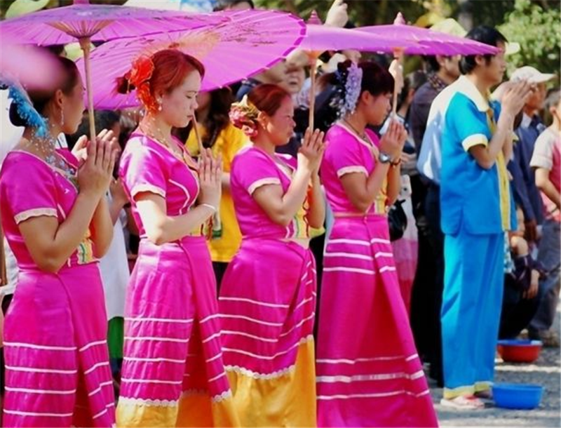
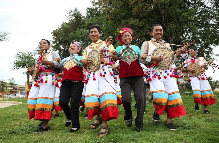
Tibetan communities became particularly influential in the highland areas, while Lisu communities developed distinctive cultures in mountain valleys. Naxi communities expanded into the region through historical political and migration networks. Pumi communities maintained their own traditions, while Han and Hui communities became involved in agriculture, administration, and caravan commerce.
These communities did not live in completely separate cultural worlds. Trade, marriage, migration, religious exchange, agriculture, pastoralism, and local markets created long-term interaction.
The result is a multi-layered cultural landscape in which languages, food traditions, architecture, clothing, music, religious practices, and festivals reflect centuries of exchange.
Important Historical Sites for Cultural and Study Tours
Visitors interested in Diqing history and cultural study tours can use several important sites to understand different historical periods.
| Historical Site |
Area |
Historical Significance |
| Dukezong Ancient Town (独克宗古城) |
Shangri-La |
Historic Tea Horse Road trading center and Tibetan cultural settlement |
| Ganden Sumtseling Monastery (噶丹·松赞林寺) |
Shangri-La |
Major Tibetan Buddhist institution and regional religious center |
| Shenchuan Iron Bridge Site (神川铁桥遗址) |
Diqing region |
Associated with ancient strategic and transportation links across the Jinsha River |
| Yezhi Wang Tusi Government Office (叶枝王氏土司衙署) |
Weixi |
Evidence of hereditary local administration and chieftain history |
| Tongle Lisu Ancient Village (同乐傈僳族古村) |
Weixi |
Traditional Lisu architecture, community organization, and cultural heritage |
| Dongzhulin Monastery (东竹林寺) |
Deqin |
Important Tibetan Buddhist monastery and religious heritage site |
| Meili Snow Mountain (梅里雪山) |
Deqin |
Sacred mountain landscape central to Tibetan religious traditions |
| Deqin historical settlements |
Deqin |
Evidence of Kham Tibetan culture and Tea Horse Road connections |
These sites can be combined into history study tours, ethnic culture programs, Tea Horse Road research trips, Buddhist culture tours, photography expeditions, and international educational travel.
Major Historical Characteristics of Diqing
A Strategic Mountain Corridor
Diqing has historically been a corridor rather than an isolated mountain region.
Its position between Yunnan, Sichuan, and Tibet made it strategically important to successive political powers. Control over its valleys and passes meant influence over transportation routes between the plateau and southwestern China.
A Major Tea Horse Road Center
The Tea Horse Road transformed Diqing into a major commercial crossroads.
Trade encouraged the development of towns such as Dukezong and brought different ethnic communities into sustained contact.
A Region Where Religion and Local Government Intersected
For centuries, monasteries, hereditary chieftains, local officials, and secular elites shared different forms of political and economic authority.
This interaction shaped the social structure of Tibetan communities and left a lasting imprint on the region's architecture, festivals, institutions, and cultural traditions.
A Long History of Multi-Ethnic Interaction
Diqing's present-day ethnic diversity developed through centuries of migration, trade, political expansion, religious exchange, and adaptation to different ecological zones.
Tibetan, Lisu, Naxi, Pumi, Han, Hui, and other cultural traditions have all contributed to the region's identity.
A Living Historical Landscape
Diqing's history is not preserved only in archaeological sites or museums. It remains visible in monasteries, ancient towns, caravan routes, traditional villages, festivals, religious practices, music, architecture, food, handicrafts, and sacred landscapes.
This makes the prefecture particularly suitable for travelers who want to experience history through direct observation and cultural participation.
Diqing History for International Cultural and Study Travel
For international visitors, the historical value of Diqing lies in the ability to connect several themes within one destination.
A Tea Horse Road study program can explore Dukezong Ancient Town, historic caravan routes, market culture, and the relationship between Yunnan tea and Tibetan society.
A Tibetan cultural study tour can focus on monasteries, sacred-mountain traditions, Tibetan architecture, festivals, traditional music, and religious art.
A multi-ethnic cultural program can combine Shangri-La Tibetan communities, Naxi Dongba heritage around Baishuitai, Lisu villages in Weixi, Pumi cultural traditions, and the historical role of Han and Hui merchant communities.
A historical geography program can use the Three Parallel Rivers landscape, Jinsha River crossings, mountain passes, valleys, and ancient transportation corridors to examine how geography influenced migration, trade, political power, and cultural development.
Exploring Diqing History with Yaso Trip
The history of Diqing Tibetan Autonomous Prefecture stretches from prehistoric settlements and ancient tribal societies through Tibetan expansion, the Nanzhao and Dali kingdoms, the Yuan and Ming dynasties, the Mu chieftain era, Qing administrative reforms, the Tea Horse Road trading age, the Republican period, and the establishment of the modern autonomous prefecture.
Its historical importance comes from the interaction of mountain geography, ethnic migration, political change, religious traditions, and long-distance trade.
Today, travelers can follow this history through Shangri-La's ancient town and monasteries, Deqin's sacred mountains and Tibetan heritage, and Weixi's Lisu villages and historical sites.
For Yaso Trip, these historical resources provide a strong foundation for developing cultural travel, heritage exploration, international study tours, photography programs, Tea Horse Road research, ethnic culture experiences, and educational journeys through Diqing.
Rather than presenting history as a sequence of dates alone, a visit to Diqing allows travelers to see how past societies continue to influence the landscape, communities, religious traditions, architecture, festivals, and everyday life of northwestern Yunnan.


 View All Yunnan Tours


 View All Yunnan Theme Tours by Interest


 Home