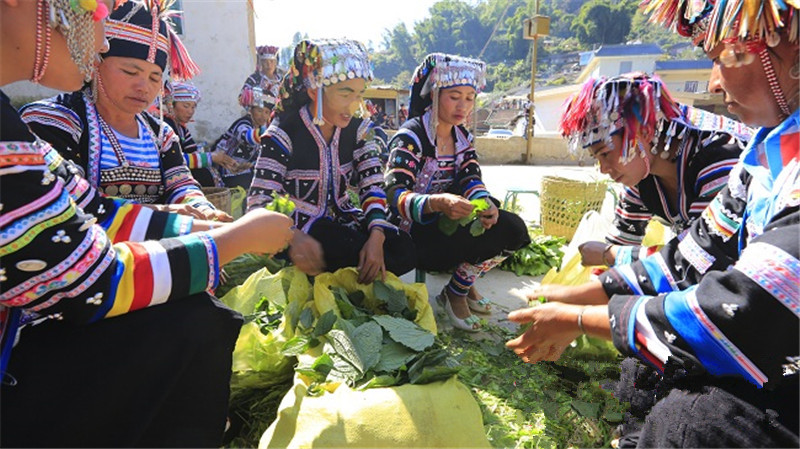
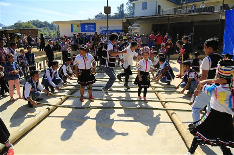
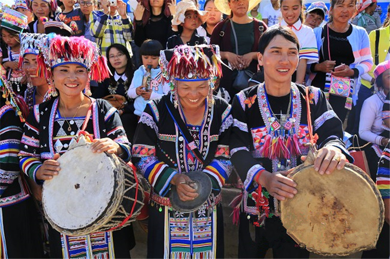
Fazhanhe Hani Ethnic Township (发展河哈尼族乡) is located in the southeastern part of Lancang Lahu Autonomous County (澜沧拉祜族自治县), Puer City (普洱市), Yunnan Province (云南省). It borders Menghai County (勐海县) of Xishuangbanna Dai Autonomous Prefecture (西双版纳傣族自治州) to the southeast, Huimin Hani Ethnic Township (惠民哈尼族乡) to the southwest, Jiujing Hani Ethnic Township (酒井哈尼族乡) to the west, and Nuozadu Town (糯扎渡镇) to the northeast. The township covers an area of 118.82 square kilometers and has a population of 16,624 according to the end of 2019.
Historically, the township was originally called Yingpan District (营盘区). In 1988, when the district was converted into a township, it was renamed Fazhanhe Hani Ethnic Township due to its location in Fazhanhe Village (发展河村) and a large population of the Hani ethnic group (哈尼族).
As of 2020, the township governs 4 administrative villages with Fazhanhe Village as the seat of the township government.
Historical Development
-
Pre-Qing Dynasty: Fazhanhe was part of the Dayakou Local Military Administration (大雅口土都司), later governed by a sub-ruler from the Tudu (土都司).
-
Republic of China Era: Initially under the jurisdiction of District 3 and Xinya Township (新雅乡).
-
Post-1949: After the liberation, it became part of Ningjiang County (宁江县), still belonging to District 3.
-
1953: After Ningjiang County was dissolved, it rejoined Lancang County (澜沧县).
-
1988: Converted to Fazhanhe Hani Ethnic Township after it had a significant Hani population and an official administrative restructuring.

Administrative Divisions
As of 2020, Fazhanhe Hani Ethnic Township administers the following villages:
-
Fazhanhe Village (发展河村)
-
Mengnai Village (勐乃村)
-
Heishan Village (黑山村)
-
Yingpan Village (营盘村)
The township government is located in Fazhanhe Village.
Geography and Climate
Geographical Features
Fazhanhe Hani Ethnic Township lies within the southern part of the Nu Mountain Range (怒山山系) in the Hengduan Mountains (横断山脉). The landscape is characterized by mountainous terrain, with the northern part being higher than the southern. The highest point is Daxieshan Mountain (大黑山), which reaches an elevation of 2,344 meters above sea level. The lowest point is located near Nanjiao River (南脚河), at an elevation of 1,060 meters.
Climate
The region has a subtropical mountain monsoon humid climate, with mild temperatures and two distinct seasons—rainy season and dry season.
-
Average Annual Temperature: 18.1°C
-
January Average Temperature: 12.5°C
-
July Average Temperature: 21.7°C
-
Extreme High Temperature: 36.0°C (recorded in May 2010)
-
Extreme Low Temperature: 0.7°C (recorded in January 2011)
The area enjoys a long frost-free period of about 345 days, with the longest reaching 355 days.
-
Annual Rainfall: 1,751.5 mm, with the peak rainfall in July
-
Annual Sunshine Hours: 2,012.3 hours
Water Resources
Fazhanhe Hani Ethnic Township has several important rivers and streams, including:
-
Mengsong River (勐宋河)
-
Nankang River (南抗河)
-
Mengnai River (勐乃河)
There are three levels of rivers, with the total river length in the township reaching 107 kilometers. The main river, Fazhanhe River (发展河), runs for 31 kilometers and has a catchment area of 110 square kilometers.
Natural Disasters
The area is prone to natural disasters including:
-
Droughts: Severe droughts affect the region, especially during the dry season.
-
Flooding: Floods are a recurrent issue, with the worst flood occurring on July 25, 2009, when 90 mm of rainfall caused significant damage to 2,100 acres of crops, resulting in an 80-ton loss in production.
-
Landslides: A major landslide occurred on June 25, 2010, affecting 310 homes with varying degrees of damage.
Natural Resources
Fazhanhe Hani Ethnic Township is rich in natural resources:
-
Minerals: There are unexploited deposits of iron ore, lead-zinc ore, and tin (锡矿).
-
Wildlife: The area is home to wild tea plants (近3万亩) and rare species such as wild buffalo, sika deer, black bears, and peacocks.
The township also boasts an impressive forest cover of 72.8%, with 520,000 acres of forested land. The total arable land area is 46,000 acres, including 11,000 acres of rice paddies and 35,000 acres of dry land.
Population and Ethnic Composition
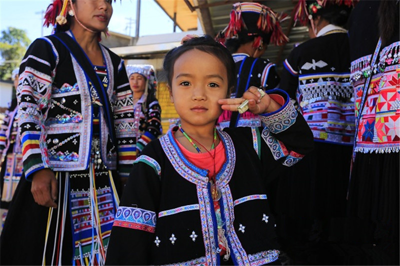
As of 2019, Fazhanhe Hani Ethnic Township had a population of 16,624. The population breakdown is:
-
Hani Ethnic Group (哈尼族): Predominantly the largest group
-
Lahu Ethnic Group (拉祜族): 37.1%
-
Han Chinese (汉族): 22.4%
-
Other minorities include Yi, Dai, Wa, and others, making up 40.5% of the population.
Age Structure
-
Under 14 years: 16.2%
-
15–64 years: 76.9%
-
Over 65 years: 6.9%
Economy
Agriculture
Fazhanhe Hani Ethnic Township's economy is primarily agricultural, with major crops including rice and corn. Other economic crops grown are:
-
Tea: 19,000 acres producing 1,433 tons
-
Coffee: 203 acres producing 1 ton
-
Sugar Cane: 9,309 acres producing 41,891 tons
-
Vegetables: 2,000 acres yielding 1,400 tons
The township also has a strong livestock sector, with:
-
Pigs: 33,000 raised, with 17,000 at year-end
-
Cattle: 5,123 head, with 3,430 at year-end
-
Sheep: 1,855 raised, with 1,215 at year-end
-
Poultry: 65,000 birds with 37,000 sold

Social Infrastructure
Education
There are 4 primary schools and 1 secondary school in the township. The education system boasts:
-
Primary School Enrollment: 100%
-
Secondary School Enrollment: 100%
-
Total Number of Students: 1,064 in primary schools and 460 in secondary school
Healthcare
The new rural cooperative medical scheme covers 98.4% of the population.
Culture and Sports
-
Cultural Facilities: 1 Cultural Center, 4 Village Cultural Centers
-
Sports Facilities: 21 basketball courts
-
Sports Participation: 25% of the population regularly engages in sports activities.

Transportation
The township has a well-established transportation network, with 58 kilometers of asphalt roads connecting it to the rest of the county. It also operates 2 daily bus services with a passenger capacity of 40 people per day.