7 Days GolfingTour
 8 Days Group Tour
 8 Days Yunnan Tour
 7 Days Shangri La Hiking
 11 Days Yunnan Tour
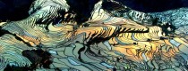
 6 Days Yuanyang Terraces
 11 Days Yunnan Tour
 8 Days South Yunnan
 7 Days Tea Tour
 8 Days Muslim Tour
 12 Days Self-Driving
 4 Days Haba Climbing
 Tiger Leaping Gorge
 Stone Forest
 Yunnan-Tibet
 Hani Rice Terraces
 Kunming
 Lijiang
 Shangri-la
 Dali
Dali
 XishuangBanna
 Honghe
 Kunming
 Lijiang
 Shangri-la
 Yuanyang Rice Terraces
 Nujiang
 XishuangBanna
 Spring City Golf
 Snow Mountain Golf
 Stone Mountain Golf
Top 10 Mountains for Hiking Tour in Kunming
In the cool weather of autumn, there are many choices around Kunming for aficionados of outdoor tours since they can enjoy an impressive experience, and these Ten selected trekking destinations might be the least beat even the locals might not know about.
1.Gudui Mountain(谷堆山) of Jinning County (2,648 meters)

Gudui Mountain is located between the three counties of Jiangchuan, Chengjiang and Jinning. Ascending the top is rewarded with a birds-eye view of the three lakes which are respectively the Fuxian Lake, the Xingyun Lake and the Dianchi Lake. Carpeted with vegetation mainly including grasses and shrubs, the route is highlighted by blooming flowers in the seasons of spring and summer.
Highest altitude: 2,648 metres
Duration: one day
Trekking mileage: 8-12 km
Travel route: Kunming-Jincheng Town(晋城乡, 37 kilometers, drive for about 45 minutes via the Kunming-Yuxi Expressway)-Huale Town(化乐乡)-Guanling Village(关岭村)-Qingshuigou Village(清水沟村,33 kilometers, drive via the Jinning-Jiangchuan County Road for about 45 minutes)-Liangwang Mountain(梁王山)-Gudui Mountain(3 kilometers, 3 hours by foot)
2.Heifeng Mountain(黑风山) of Anning City (2,617 meters)

Heifeng Mountain is so named because there’s a cave on its top called Heifeng Cave. A huge mountain undulating dozens of kilometres, Heifeng Mt is endowed with diversified vegetation and exuberant forests. For most locals, it is a must for camping and excursion.
Highest altitude: 2,617 metres
Duration: one day
Trekking mileage: 16 km
Travel route: Kunming-Anning City-Xianjie Town(县街乡)-Dahongxiang(大红祥)-Yuezizhuang Reservoir(月子庄水库)-Xiayuanliang Village(下元良村)-Zhongyuanliang Village(中元良村)-Xiaoqingkou(小青口)-Litou Mountain(梨头山)-Walise Observatory(瓦里色瞭望台)–the mountain top
3. Laogui Mountain(老圭山) of Shilin County (2,601 meters)

Laogui Mountain is The highest mountain in Shilin County where the Stone Forest is, it is a national forest park located between the counties of Shilin, Mi’le and Luxi.
Highest altitude: 2,601 metres
Duration: one day
Trekking mileage: 6-8 km
Travel route: Kunming-Shilin(90 kilometers, about 1 hour’s drive)-Guishan Town(30 kilometers, about 1 hour’s drive)-Aimeidu Village(3 kilometers, about 30 minutes’ drive)-the mountain top(3 kilometers, 2 hours by foot)
4.Jintongpen Mountain(金铜盆山) of Fumin County (2,817 meters)

Named due to its profile resembling to a reverse copper basin, Jintongpen Mountain is the origin of the drinking water of the locals. Legend goes that the water at the lowest place of the main peak never dried up because there used to be a golden basin which was then taken away by an avaricious man resulting in the dried-up of the water.
Highest altitude: 2,817 metres
Duration: one day
Trekking mileage: 11 km
Travel route: Kunming-Fumin County-Zhebei Village(者北乡)-Nanyin Village(南营村, 40 kilometers, 1 hour’s drive)-Xihua Temple(2 kilometers, 15 minutes’ drive)-Malutang Village(2 kilometers, one and a half hours’ walk)-the mountain top(3 kilometers, 2 hours by foot)
5.Laoye Mountain(老爷山) of Yiliang County (2730 meters)
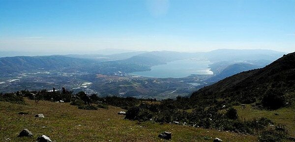
One of the Ten Steepest Mountains in Kunming, Laoye Mountain is situated between Yiliang County and Guandu District of Kunming. Its east part is mainly carpeted by verdant vegetation and the upper part is extremely steeple. Ascending to the top, one can enjoy the overwhelming views of the Yangzong Lake and the Yiliang Basin. Culturally, each lunar 15 June is a local temple fair attended by villagers of the communities around the mountain.
Highest altitude: 2,730 metres
Duration: one day
Trekking mileage: 9 km
Travel route: : Kunming-Muxi Village (Tangchi Town, Yiliang County); Kunming-Adi Village (Dababqiao Town, Guandu District)
6.Liangwang Mountain(梁王山) of Chenggong District (2,820 meters)

Liangwang Mountain is the heart of the cradle of the Ancient Dian Culture. In the Yuan Dynasty (1273-1368), the highest governor of Yunnan Liangwang (a Mongolian Prince) established the Liangwang Palace and trained soldiers on the mountain. Today, several historical sites of the drilling fields can be seen clearly.
Highest altitude: 2,820 metres
Duration: one day
Travel route: Kunming-Majinpu(马金铺, 30 kilometers, 45 minutes’ drive)-Fengkou Village(风口村, 3 kilometers, 45 minutes’ drive)-the mountain top(3 kilometers, 90 minutes by foot)
7.Dajian Mountain(大尖山) of Songming County (2,840 meters)

With a large coverage of pine trees, Dajianshan Mountain is carpeted with assorted wild flowers including azaleas. Living in the mountain are Miao ethnic communities who are typically known for their Christian choir.
Highest altitude: 2,840 metres
Duration: one day
Trekking mileage: 7-10 km
Travel route: Kunming-Songming County(50 kilometers, 45 minutes’ drive)-Taohua’an Village(桃花庵村, 8 kilometers, 30 minutes’ drive)-the mountain top(3 kilometers, 3 hours by foot)
8.Huashitou Mountain(花石头山) of Xundian County (3,294 meters)

The silhouette of Huashitou Mountain looks like a Chinese legendary dragon. The peaks around its summit are all about 3,000 metres high. Views of the fat top of the mountain include meadows, wild flowers and grotesque rocks.
Highest altitude: 3,294 metres
Duration: two days
Trekking mileage: 8 km
Travel route:
Northern Kunming-Songming County-Jinsuo(金所) of Xundian County-Qingshuihai(清水海)-Diansha(甸沙)-Jinyuan Town(金源乡)-Macaokeng(马槽坑)-Gaofeng Village(高峰村)-Tuanbaobao(团包包)-Huajiaoshu(花椒树)-Baishiyan(白石岩)-Luanshizhen(乱石阵)-the mountain top
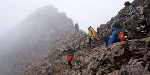
9.Jiaozi Snow Mountain(轿子雪山) of Luquan County (4,344 meters)

Jiaozi Snow Mountain resembles a traditional Chinese Sedan (Jiao Zi) in shape, hence its name. It is located in the Jiaozi Mt Scenic Area within an area of 250 sq km which includes forests, glaciers and glacial lakes and alpine meadows in which rhododendrons and azaleas abound.
Highest altitude: 4,223
Duration: two days
Trekking mileage: 8-10 km
Travel route:
Kunming-aziying(阿子营)-Kedu Town(柯渡镇)-Zhuanlong Town(转龙镇, 156 kilometers, 4 hours’ drive)-entrance of the Jiaozi Snow Mountain scenic area(25 kilometers)-Sifang Water Well(四方井, 10 kilometers, 1 hour’s drive)-Daheijing(大黑箐, 3.2 kilometers)-main scenic spots of the mountain(hiking for about 4 hours via the tour route)
10. Dongchuan Snow Mountain(东川雪岭) of Dongchuan County (4,344 meters)
Xueling Peak is the highest peak in Central Yunnan, Xueling Peak of Gongwangshan Mountain is the most challenging mountain in Kunming. In winter, the snow-capped Xueling Mt appears magnificently orange, thus is called “the Snow Fire Ridge” by the local people. In 2009, the magazine China Geography authenticated it as one of the Ten Unfamous Mountains in China. With two beautiful lakes.
Travel route:
Tangdian(倘甸)-Huashitou Village(花石头村)-Yaoshan Village(窑山村)-Xintanfang Village(新炭房村)-the hiking base of the mountain-Yakou(垭口)-Huo Range of the snow mountain(雪岭火峰)