7 Days GolfingTour
 8 Days Group Tour
 8 Days Yunnan Tour
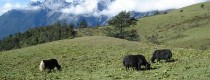
 7 Days Shangri La Hiking
 11 Days Yunnan Tour
 6 Days Yuanyang Terraces
 11 Days Yunnan Tour
 8 Days South Yunnan
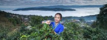
 7 Days Tea Tour
 8 Days Muslim Tour
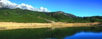
 12 Days Self-Driving
 4 Days Haba Climbing
 Tiger Leaping Gorge
 Stone Forest
 Yunnan-Tibet
 Hani Rice Terraces
 Kunming
 Lijiang
 Shangri-la
 Dali
Dali
 XishuangBanna
 Honghe
 Kunming
 Lijiang
 Shangri-la
 Yuanyang Rice Terraces
 Nujiang
 XishuangBanna
 Spring City Golf
 Snow Mountain Golf
 Stone Mountain Golf
Region Map of Jiangchuan District in Yuxi
Location & Boundaries
Jiangchuan District is located in central-eastern Yunnan Province, spanning longitude 102°35′–102°55′ E and latitude 24°12′–24°32′ N. It borders:
- Southeast: Huaning County and Tonghai County
- Southwest: Hongta District
- Northwest: Jinning District and Chengjiang City
The district covers a maximum east-west width of 31.9 km and a north-south length of 35.7 km, with a total area of 850 km².
Topography & Landforms
Jiangchuan features a diverse landscape of lakes, basins, and low-to-medium mountains, characterized by:
- Higher elevations on the periphery, lower in the center.
- Western Jiuxi area slopes slightly toward Yuxi (Hongta District).
- Mountain ranges predominantly run north-south and east-west, with fewer northeast-oriented ranges.
- Highest point: Cuifeng Gudui Mountain (2,648 m).
- Lowest point: Jiuxi River Mouth Village (1,690 m).
- Urban elevation: 1,730 m.
- Basin elevation: ~1,740 m.
Climate
Jiangchuan has a semi-arid subtropical plateau monsoon climate, with:
- Mild summers (no extreme heat) and cool winters (no severe cold).
- “Spring-like” weather year-round.
- Distinct wet and dry seasons.