-
- Home
- Yunnan Tours
Most Popular Yunnan ToursEssential Yunnan TripsFind Yunnan Tours by MonthFind Yunnan Tours by Duration
- Group Tours
Popular Yunnan Group ToursAll Yunnan Group Tours
- 1 Day Kunming Stone Forest Group Tour
- 1 Day Jade Dragon Snow Mountain Group Tour
- 2 Days Tiger Leaping Gorge Hiking Group Tour
- 4 Days Haba Snow Mountain Climbing Group Tour
- 6 Days Yuanyang Hani Rice Terraces Group Tour
- 8 Days Kunming-Dali-Lijiang-Shangri-la Group Tour
- 8 Days Yunnan Chinese-Speaking Group Tour
- 15 Days Yunnan-Tibet Small Group Tour
- Themes Tours
- City Tours
- Travel Guide
- Attractions
- Customize
 7 Days GolfingTour
 8 Days Group Tour
 8 Days Yunnan Tour
 7 Days Shangri La Hiking
 11 Days Yunnan Tour
 6 Days Yuanyang Terraces
 11 Days Yunnan Tour
 8 Days South Yunnan
 7 Days Tea Tour
 8 Days Muslim Tour
 12 Days Self-Driving
 4 Days Haba Climbing
 Tiger Leaping Gorge
 Stone Forest
 Yunnan-Tibet
 Hani Rice Terraces
 Kunming
 Lijiang
 Shangri-la
 Dali
Dali
 XishuangBanna
 Honghe
 Kunming
 Lijiang
 Shangri-la
 Yuanyang Rice Terraces
 Nujiang
 XishuangBanna
 Spring City Golf
 Snow Mountain Golf
 Stone Mountain Golf
You Might Like
- 4 Days Shangri-La City Tour

- 1 Day Lashihai Lake Boat Cruise and Horse Riding Tour along the Ancient Tea Horse Road
- 25 Days Yunnan-Tibet-Qinghai Overland Tour
- 1 Day Lijiang Cycling Tour from Lijiang Old Town to Lashihai Lake and Zhiyun Monastery
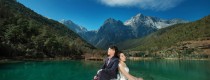
- 13 Days Yunnan Honeymoon Tour to Kunming-Dali-Lijiang-ShangriLa
- 1 Day Kunming City Tour
- 11 Days Yunnan Classic Tour with Jianshui Old Town and Yuanyang Hani Rice Terraces
- 5 Days XishuangBanna and Puer Ethnic Market Discovery Tour


Haba Summit Inn in Haba Village, Shangrila
Chinese Name: 哈巴云端客栈 English Name: Haba Summit Inn of Haba Snow Mountain in Shangri-La, Diqing Haba Summit Inn in Shangrila is located in Haba Village at the foot of Haba...
The Photos of Samaba Hani Rice Terraces in Honghe County, Honghe
The Photos of Samaba Hani Rice Terraces in Honghe County, Honghe...

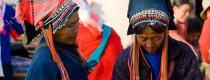
Menghun Saturday Market in Menghai County, Xishuangbanna
The traditional market day in Menghun has a long history, as Menghun Town is one of the ancient Twelve Dai Regions and is situated at the center of Menghai...
Jinping Market in Jinping County, Honghe
Falls every 6 days in downtown streets of Jinping County, mostly Red-top Yao, some Hani and Yi of different branches....
Nafa Market in Jinping County, Honghe
Falls every 6 days on China-Vietnam border, mostly Sha Yao, some Akha, a branch of Hani, some Red-top Yao and Dai....
Mengbalanaxi Culture Show in Jinghong City, XishuangBanna
The Mengbalanaxi Culture Show (勐巴拉纳西文化秀) is performed at the Gaozhuang Xishuangjing Mountain Forest Grand Theater (告庄西双景山林大剧院) in Jinghong City (景洪市), Yunnan Province (云南省). Cultural History “Mengbalanaxi” (勐巴拉纳西) means “a...
Laojizhai Market in Jinping County, Honghe
Falls every 6 days in the main street of Laojizhai Town, mostly Yi people, dressed differently from Yi of other markets....
Yuxi Bus Station
Location Yuxi Bus Station is located in Hongta District (红塔区), Yuxi City (玉溪市), Yunnan Province. As one of the city’s major transportation hubs, it offers convenient access via multiple...

Longwangbian Village in Haba Snow Mountain, Shangrila
Why is Longwangbian Village So Special? The village is close to Haba Snow Mountain, and it is surrounded by mountains and rivers. A lot of tourists choose Longwangbian Village...
Pinghe Market in Luchun County, Honghe
Chinese Name:红河绿春县平河乡赶集 English Name: Pinghe Market in Luchun County, Honghe Falls every 6 days in Pinghe Town of Luchun County, Indigo Yao, and Hani people dressed differently from Hani of...
Jinghong Bus Station
Xishuangbanna (西双版纳) has two long-distance bus stations: Xishuangbanna Bus Station (西双版纳客运站) and Jinghong Bus Station (景洪客运站). Xishuangbanna Bus Station (西双版纳客运站) Xishuangbanna Bus Station is one of the main transportation...

Menghai Sunday Market, Xishuangbanna
In Xishuangbanna, the traditional markets in towns are called “Gan Bai” (赶摆). The main market day is on Sundays, with other days being less formal but still lively as...
Latest Articles


Contact Info

