-
- Home
- Yunnan Tours
Most Popular Yunnan ToursEssential Yunnan TripsFind Yunnan Tours by MonthFind Yunnan Tours by Duration
- Group Tours
Popular Yunnan Group ToursAll Yunnan Group Tours
- 1 Day Kunming Stone Forest Group Tour
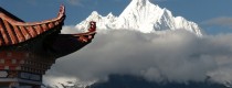
- 1 Day Jade Dragon Snow Mountain Group Tour
- 2 Days Tiger Leaping Gorge Hiking Group Tour
- 4 Days Haba Snow Mountain Climbing Group Tour
- 6 Days Yuanyang Hani Rice Terraces Group Tour
- 8 Days Kunming-Dali-Lijiang-Shangri-la Group Tour
- 8 Days Yunnan Chinese-Speaking Group Tour
- 15 Days Yunnan-Tibet Small Group Tour
- Themes Tours
- City Tours
- Travel Guide
- Attractions
- Customize
 7 Days GolfingTour
 8 Days Group Tour
 8 Days Yunnan Tour
 7 Days Shangri La Hiking
 11 Days Yunnan Tour
 6 Days Yuanyang Terraces
 11 Days Yunnan Tour
 8 Days South Yunnan
 7 Days Tea Tour
 8 Days Muslim Tour
 12 Days Self-Driving
 4 Days Haba Climbing
 Tiger Leaping Gorge
 Stone Forest
 Yunnan-Tibet
 Hani Rice Terraces
 Kunming
 Lijiang
 Shangri-la
 Dali
Dali
 XishuangBanna
 Honghe
 Kunming
 Lijiang
 Shangri-la
 Yuanyang Rice Terraces
 Nujiang
 XishuangBanna
 Spring City Golf
 Snow Mountain Golf
 Stone Mountain Golf
You Might Like
- 10 Days Yunnan-Tibet Highway Overland Tour from Lijiang to Lhasa

- 1 Day Jade Dragon Snow Mountain Hiking Tour (4642 Meters) from Wenhai Lake
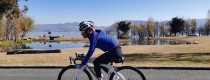
- 7 Days Dali-Shaxi-Lijiang Cycling Tour along The Ancient Tea Horse Caravan
- 12 Days Yunnan Three Parallel Rivers Overland Tour with Biluo and Meili Snow Mountains from Lijiang to Tengchong
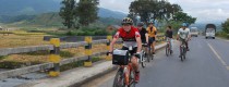
- 9 Days China-Laos-Thailand Tropical Forest Cycling Tour from Jinghong to Chiang Mai
- 11 Days Yunnan Classic Tour: XishuangBanna-Shangrila-Lijiang-Dali-Kunming
- 5 Days Shangri-La Tour with Meili Snow Mountain Pilgrimage
- 1 Day Lashihai Lake Boat Cruise and Horse Riding Tour along the Ancient Tea Horse Road


History of Mongolian Ethnic Minority
Mongol was initially the name of a tribe roaming along the Erguna River. Moving to the grasslands of western Mongolia in the 7th century, the Mongols settled in the...

History of Yi Ethnic Minority
The Yi language belongs to the Tibetan-Myanmese Language Group of the Chinese-Tibetan Language Family, and the Yis speak six dialects. Many Yis in Yunnan, Guizhou and Guangxi know the...

Yubeng Travel Tips of Four Seasons
Yubeng Village, located in the picturesque Meili Snow Mountain range, experiences varied weather conditions throughout the year. Understanding the best time to visit and how to prepare for each...

Photos Gallery of Kunming Stone Forest International Country Golf Club
Stoneforest International Country Club is an exclusive golf club open to member only that integrates natural ecology, golf and features of high-end life into one. While creating a unique...

Travel Tips for Outer Circumambulating Pilgrimage of Meili Snow Mountain
Pilgrimage is the custom of Tibetan people, it’s an act of religious observance and respect for nature, undertake a pilgrimage on foot around some sacred places like a mountain,...

Life Style of Shui Ethnic Minority
The Shui people are one of the ethnic minority groups in China, primarily residing in the Guizhou, Guangxi, and Yunnan provinces. They have a distinct culture, language, and traditions...

History of Shui Ethnic Minority
The Shuis are probably the descendants of the Luoyues, one of the early tribes that lived along China’s southeastern coast before the Han Dynasty (206 B.C.-A.D. 24). They adopted...
Travel Map of Inner Pilgrimage of Meili Snow Mountain
Travel Map of Inner Pilgrimage of Meili Snow Mountain...

Customs of Yi Ethnic Minority
The Yi ethnic minority, with a significant population in the southwestern provinces of China, has a diverse and rich tradition of clothing that varies significantly across regions. Here’s an...

Singapore International School Students Education Tour in Lijiang
Lijiang, Yunnan, is a vibrant destination offering a unique blend of cultural heritage, natural beauty, and ethnic diversity. This educational tour is designed to immerse students in the traditions...

Hiking Tour Photos from Yubeng Village to The Sacred Lake
The Hiking Tour from Yubeng Village to The Sacred Lake offers an unforgettable journey through stunning landscapes, Tibetan culture, and spiritual significance. The Sacred Lake, located near the foot...

Shangrila-Deqin Road
Deqin County is located in the northwest of Shangrila of Diqing Tibetan Autonomous Prefecture. 80% of its 55,000 inhabitants are Tibetan. A small piece of Tibet, accessible without expensive permits. While...
Latest Articles


Contact Info

