7 Days GolfingTour
 8 Days Group Tour
 8 Days Yunnan Tour
 7 Days Shangri La Hiking
 11 Days Yunnan Tour
 6 Days Yuanyang Terraces
 11 Days Yunnan Tour
 8 Days South Yunnan
 7 Days Tea Tour
 8 Days Muslim Tour
 12 Days Self-Driving
 4 Days Haba Climbing
 Tiger Leaping Gorge
 Stone Forest
 Yunnan-Tibet
 Hani Rice Terraces
 Kunming
 Lijiang
 Shangri-la
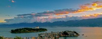
 Dali
Dali
 XishuangBanna
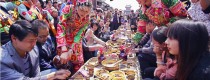
 Honghe
 Kunming
 Lijiang
 Shangri-la
 Yuanyang Rice Terraces
 Nujiang
 XishuangBanna
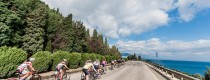
 Spring City Golf
 Snow Mountain Golf
 Stone Mountain Golf
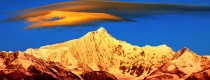
Travel Tips for Outer Circumambulating Pilgrimage of Meili Snow Mountain
Pilgrimage is the custom of Tibetan people, it’s an act of religious observance and respect for nature, undertake a pilgrimage on foot around some sacred places like a mountain, a lake or a temple. An “outer circumambulation” follows a rather more circuitous route as the name would suggest.The outer Circumambulating Pilgrimage, 150 kilometers in length, crosses over seven passes, including the Doker la (4080 meters) and the highest Shola (4800 meters), going from east to west and west to east, respectively, and crosses from the Mekong River on the Yunnan side to the Nujiang (Salween) river in Myanmar. The well-trodden footpath brings pilgrims through primitive forest with gnarled conifers hosting epiphytes and masses of hanging lichens, deep valleys, scree-laden passes, lush meadows, clear streams, big river, and in view of many glaciated peaks. The region’s extreme altitudinal gradients make it an epicenter of biodiversity, home to more than 6000 species of plants, many endemic. It is particularly well known as a source of rhododendrons, and “plant hunters” Joseph Rock, F. Kingdon Ward, and George Forrest all based themselves in the region and traveled the outer kora in their explorations.
This is a tough journey which will cost about 7 to 15 days. Camping gear is necessary during the journey except pilgrims will live in local Tibetan hut guesthouse.
This is the route of outer Circumambulating Pilgrimage of Meili Snow Mountain.
Deqin County Center- Yunling Town- Yangla Village(1950)- Yangza Suspension Bridge- Yongjiu Village(northwards) or Yongzhi Village(southwards) – Yongshitong- Dekangyading- Duokeyaka- Shusutong- Qienatong- Abing- Lakangya(near Nu River, at an altitude of 1700m)- Zhana- Longbu- Damuyaka- Gebu- Daguya(4100m)- Gezaya(4300m)- Meijiubugong- Shuoya(4828m)- Dulongyong- Meilishui(near Lancang River)- Adong River- Deqin
Itinerary
D1 Deqin-> Yangtsa-> Yongzhi (2480m)
Yangza village, the start point of the route, is 60km away form Deqin. Take a Cizhong-bound bus from Deqin and it takes about two hours to get to Yangza, where horses and horsemen are available for rent to ferry your gear and supplies ( to rent horses for, you can also contact the owner of Trekker’s Home in Deqin) . Walk for 3 hours to Yongzhi(永支) village. Basic lodging available at villagers’ home, Y10/night or free.
D2 Yongzhi to Yongxitong(3290m)
Yongxitong is a pasture located at foot of Dokarla Snow Mt. with beautiful scenery. Nearby Tibetans make their way to shepherd cattles here throughout the summer. Smoke of cooking can be seen along the road. It becomes humid and muddy when get into the valley. In rainy days, your feet can even get stuck thoroughly in the mud.
Overlooking towards east through the Lancang River Valley, where the stupendous mountains towering and rivers running, a deep breath will make you feel relaxed in pure peace. Crossing the 3200m high ridge, you descend the slope and will soon step into the no man’s land.
It takes about 8 hours from Yongzhi village to Yongxitong. Camping at Yongxitong meadow in grove.
D3 Yongxitong-> Dokarla Pass(4487m)-> Zasutong (3600m)
8 hours walk. Along the road, you need to cross the Dokarla Yakou, a narrow mountain pass, which is about 4480m above sea level, decorated with colorul pray flags. it sees rows of snow-capped peaks on both sides of the Meili Snow range. This is the first difficulty on the road to Tibet. . Camping in Zasutong.
D4 Zasutong to Qunatong(2560m)
Descend to the Tsawarong District in Tibet and trek along the Salween River (Nu Jiang in Chinese). Qunatong is a highland pasture in Chayu. Stay in a log cabin or camping. Tigers are often sighted by local Tibetans here.
D5 Qunatong to Arbing village(2230m)
The road ascends precipitously from Qunaton. Some shacks were built ablong the 3400m high mountainside for pilgrims to stay at night. The downhill path is quite easier.
It’s about 8 hours walk from Qunatong to Arbing village, en route you will see many Mani stones and a special spot with a lot of bowls and old clothes because every passerby will leave one bowl and one old clothes to this place. the Tibetan legend said by doing so one can enjoy a never-hungry and never-cold next life.
Arbing is a village few western traveler has been and the villagers are very unpretending and hospitable. There is a yard which has rooms open to pilgrims. You may also accommodate yourself in local Tibetan families. However, as, most of the local residents don’t even speak Mandarin, communication is rather a problem. Small shops and buffets are also available there. Comparing to the conditions of the previous days, these are 5-star hotels. You can replenish some food which is very expensive for the transportation difficulty.
D6 Arbing to Quzhu(1780m)
It’s about 3-4 hours from Arbing village to Quzhu, en route you will see the clear Arbing river flowing into the torrential Nu River near the Lakanglalama Temple of 1730m. Rocks engraved Tripitake and six-words proverb. One of the stones is a must-touch for all the pilgrims.
The road from Arbing to Quzhu Hot Spring is quite good, but it has little vegetation and seldom shadow. The area around the hot spring is flat and suitable for camping. You can buy food in small shop of the temple, or you can cook your own meal with the shop owner’s kitchens. But the real pilgrims never pitch a tent, they sleep in the open beside the river.
It’s a fairly easy day. To save time, you can also continue to Chanan and overnight there, it’s 28km away from Arbing.
D7 Quzhu to Chanan(2000m)
It is 13km from hot spring to Chanan, the county seat of Chawalong, with flat road along the river, but landslide often happens. Around 3km north, there are huge limestone suspended high on east bank of the river. The highest point of the stone is 1000m high over the surface of the river. Trekkers are at the risk of being hitted by a dropping stone at any time, while you also need to watch out the road under your feet. It’s the most dangerous part of the route, teamwork is extremely important.
The nearer, the wilder the Chawalong river valley is, the more terrace dams formed by the riverbed movement for millions of years, which are 10-300m higher than the surface of the river. On the terrace grows huge cactuses of 4-5m high, which gives the place an appearance of desert.
7 hours’ walk leads you to Chanan Village, where you can stay in the villagers’ home or pitch tents beside the village.
D8 Chanan to Long-na (2500m)
It’s only 2 hours walk from Chanan to Long-an and you can have a one-day rest here after a dew days hard journey. Wandering in the village and take some photos. Stay in the local Tibetan house.
D9 Long-na to Gebu(2330m)
The distance is 22km for the day. After crossing over the Tangduila Pass of 3300m, it comes a terrible downhill path of swamps and sandy stone, so easy to get yourself in! There is a beautiful small Tibetan village Zhagu at the foot of the mountain, after which the path winds along the Yuqu river. You will reach Gebu via Lada village and Gebu Bridge.
Stay at the village’s small temple or camp besides Weiqu-the tributary of Nujiang river. There are also some hotels for pilgrims. Local home staying is available.
D10 Gebu to Ladiza(2800m)
Today you have the longest distance of 29km to conquer. The walk is about 9 hours from Gebu to Ladiza. On the way, you will pass through Jingwei Tower, Zanqing Bridge, Gebula Holy Mountain.On the west of Gabula Yakou,the picturesque scenery stretches far away. The winding Yuqu and Salween dispear at the deep bottom of the valley. Snow-capped mountains lying across the sky in the distance. On the east is the northern part of Meili Snow Range, with other rolling snow mountains behind it. It is difficult to climb over Gebula Pass of 4100m, the uphill road is steep and seems endless. Even the experienced Tibetans who have accomplished the pilgrimage for several times will take it seriouly.
D11 Ladiza to Shulaka (3090m)
Not long but steep walk. The view on route is amazing with the back of Karwa Karpo in sight. About 3 hours from Ladiza to Shulaka(also called “Laide”). The village head’s home is open for lodging, and it’s also an idea location to take photos. Or, you can camp.
D12 Shulaka -> Suola Pass (4815m)-> Duotong (4100m)
Be well prepared of the hard day and set out as early as possible, though the beauty of Shula Mt. is hard to describe. After about 5 hours climbing of the first steep slope, it will take another 2.5 hours to cross over the Suola Pass. Then trek down for one hour and stay overnight in Duotong High Mountain Pasture, where you are close to the border of Yunnan.
D13 Duotong -> Meilishui(2150m)-> Deqin
It is 5 hours hiking from Duotong to Meilishui. Downhill along the river valley, pass the stony road, steep slope and meadows. You may cross more than 20 bridges on the way. When it sees the big rock of Meilishui, you are at the end of the trek, it’s near the Yunnan-Tibet Highway. Hitch a passing by Deqin-bound bus back to Deqin. Stay in the town or take a connection ride to Feilaisi for the night if you haven’t been there. Or else, take a bus to Zhongdian next morning.