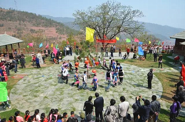
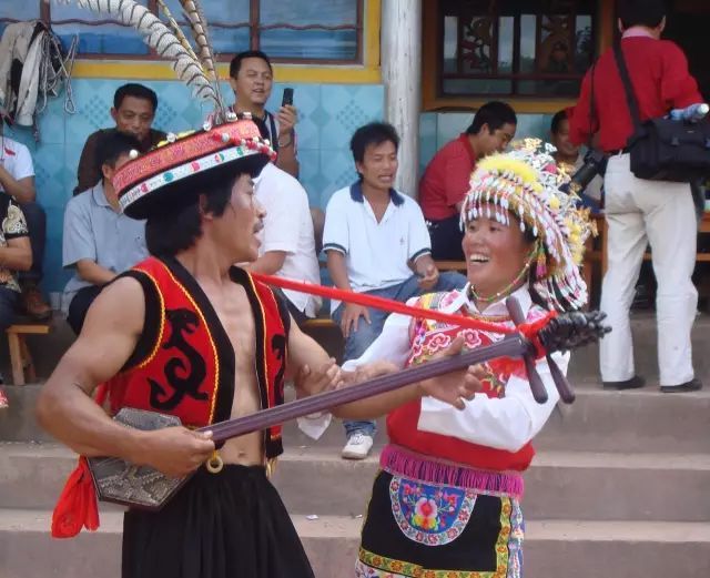
Changjie Yi Ethnic Township (厂街彝族乡) is under the jurisdiction of Yongping County (永平县), Dali Bai Autonomous Prefecture (大理白族自治州), Yunnan Province (云南省). It is located in the southern part of Yongping County, bordered by Longjie Town (龙街镇) to the east, Shuixie Yi Ethnic Township (水泄彝族乡) to the south, Shanyang Town (杉阳镇) to the west, and Bonan Town (博南镇) to the north. It is 28 kilometers away from the Yongping County People’s Government. The total area is 357 square kilometers. As of the end of 2019, the registered population was 19,753.
Before the founding of the People’s Republic of China, it was known as Longma Township (龙马乡). In 1984, Changjie Commune (厂街公社) was renamed Changjie Yi Ethnic Township (厂街彝族乡). As of June 2020, it has jurisdiction over 11 administrative villages, with the township government located in Changjie (厂街). By the end of 2019, the township had 12 industrial enterprises and 28 general stores or supermarkets with a business area exceeding 50 square meters.
Chinese Name: 厂街彝族乡
Administrative Category: Ethnic Township
Location: Southern Yongping County (永平县)
Area: 357 km²
Subdivisions: 11 administrative villages
Government Seat: Changjie (厂街)
Area Code: 0872
Postal Code: 672606
Climate: North subtropical monsoon climate
License Plate Code: 云L
Population: 19,753 (as of the end of 2019)
Historical Evolution
Before the founding of the People’s Republic of China, the area was called Longma Township (龙马乡).
In 1950, the present-day areas of Changjie (厂街), Shuixie (水泄), and part of Longjie (龙街) were combined to form District Three, named Changjie District (厂街区).
In early 1958, after the abolition of districts and the merging of townships, it was placed under the direct jurisdiction of the county.
At the end of 1958, Changjie District (厂街区) was divided into five communes: Changjie (厂街), Wajin (瓦金), Weilong (伟龙), etc., under the Longjie Cooperative Association (龙街联社).
In 1962, Changjie District was reestablished, mainly consisting of Changjie, Wajin, and Weilong communes.
In 1966, Changjie District was reorganized as Changjie Commune (厂街公社).
In 1984, Changjie Commune was renamed Changjie Yi Ethnic Township (厂街彝族乡).
Administrative Divisions
Evolution
In 1997, Changjie Yi Ethnic Township governed 11 administrative villages: Yangliushu (杨柳树), Yanbei (岩北), Qichang (七昌), Chalu (岔路), Lutang (炉塘), Yilu (义路), Laoyingpo (老鹰坡), Sancun (三村), Jiemian (界面), Wajin (瓦金), and Wapan (瓦畔).
In 2005, the Songpo Village (松坡村) and Mianliangku Village Group (免粮库村民小组) of Yonghe Yi Ethnic Township (永和彝族乡) were placed under Changjie Yi Ethnic Township’s jurisdiction. Meanwhile, three village groups of Chalu Village (岔路村) in Changjie Yi Ethnic Township—Lihaichong Shangcun (里海冲上村), Xiacun First Sub-village (下村一社), and Xiacun Second Sub-village (下村二社)—were incorporated into Bonan Town (博南镇).
As of the end of 2011, Changjie Yi Ethnic Township administered 11 villages: Yanbei (岩北), Qichang (七昌), Chalu (岔路), Lutang (炉塘), Yangliushu (杨柳树), Laoyingpo (老鹰坡), Sancun (三村), Jiemian (界面), Wajin (瓦金), Wapan (瓦畔), and Yilu (义路), comprising 172 village groups and 216 natural villages.
Current Divisions
As of June 2020, Changjie Yi Ethnic Township has jurisdiction over 11 administrative villages: Yangliushu (杨柳树村), Yanbei (岩北村), Qichang (七昌村), Chalu (岔路村), Lutang (炉塘村), Laoyingpo (老鹰坡村), Sancun (三村), Jiemian (界面村), Wajin (瓦金村), Wapan (瓦畔村), and Yilu (义路村). The township government is located in Changjie (厂街).
Geographic Environment
Location
Changjie Yi Ethnic Township is situated in the southern part of Yongping County (永平县), bordered by Longjie Town (龙街镇) to the east, Shuixie Yi Ethnic Township (水泄彝族乡) to the south, Shanyang Town (杉阳镇) to the west, and Bonan Town (博南镇) to the north. It is 28 kilometers from the Yongping County People’s Government, covering a total area of 357 square kilometers.