7 Days GolfingTour
 8 Days Group Tour
 8 Days Yunnan Tour
 7 Days Shangri La Hiking
 11 Days Yunnan Tour
 6 Days Yuanyang Terraces
 11 Days Yunnan Tour
 8 Days South Yunnan
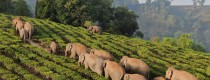
 7 Days Tea Tour
 8 Days Muslim Tour
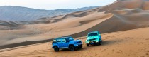
 12 Days Self-Driving
 4 Days Haba Climbing
 Tiger Leaping Gorge
 Stone Forest
 Yunnan-Tibet
 Hani Rice Terraces
 Kunming
 Lijiang
 Shangri-la
 Dali
Dali
 XishuangBanna
 Honghe
 Kunming
 Lijiang
 Shangri-la
 Yuanyang Rice Terraces
 Nujiang
 XishuangBanna
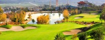
 Spring City Golf
 Snow Mountain Golf
 Stone Mountain Golf
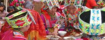
Junsai Wa, Lahu, Lisu and Deang Ethnic Town in Zhenkang County, Lincang City
Chinese Name:镇康县军赛佤族拉祜族傈僳族德昂族乡
English Name: Junsai Wa, Lahu, Lisu and Deang Ethnic Town in Zhenkang County, Lincang City
Chinese Name:镇康县军赛佤族拉祜族傈僳族德昂族乡
English Name: Junsai Wa, Lahu, Lisu and Deang Ethnic Town in Zhenkang County, Lincang City