 7 Days GolfingTour
 8 Days Group Tour
 8 Days Yunnan Tour
 7 Days Shangri La Hiking
 11 Days Yunnan Tour
 6 Days Yuanyang Terraces
 11 Days Yunnan Tour
 8 Days South Yunnan
 7 Days Tea Tour
 8 Days Muslim Tour
 12 Days Self-Driving
 4 Days Haba Climbing
 Tiger Leaping Gorge
 Stone Forest
 Yunnan-Tibet
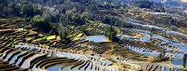
 Hani Rice Terraces
 Kunming
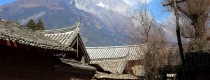
 Lijiang
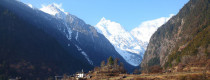
 Shangri-la
 Dali
Dali
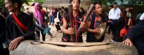
 XishuangBanna
 Honghe
 Kunming
 Lijiang
 Shangri-la
 Yuanyang Rice Terraces
 Nujiang
 XishuangBanna
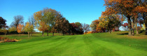
 Spring City Golf
 Snow Mountain Golf
 Stone Mountain Golf


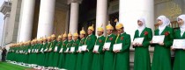
 What Our Customers Say?
 alt="XishuangBanna Surrounding Counties and Towns: Weekly & Special Local Markets Travel Guide"
/>
alt="XishuangBanna Surrounding Counties and Towns: Weekly & Special Local Markets Travel Guide"
/>
Ruili City History
Ruili City History
Ruili is the cradle of the ancient culture of Dai nationality. Ruili River Valley is one of the places inhabited by ancient human beings. The cultural relics include Pattra Leaves Scripture and ruins of ancient city. The ancient city wall of Mengmao is the oldest wall of Dai nationality discovered up to now. Ruili is called the hometown of songs and dances and has been entitled the “hometown of farmers’ painting in China” by the State Cultural Ministry.
Dehong was called “Ancient Mengmao Kingdom” in the recording of The Pattra Sutra; it was named as the “Dianyue Elephant Riding Kingdom” under the pen of Simaqian; it was the Jinchi Kingdom in the book of “Marcopolo and His Travels”. Dehong is not only the outlet of the ancient “The Southwest Silk Road of China”, but also the outlet of the Yunnan-Myanmar Road. At present,it is still the golden port leading to South Asia and Southeast Asia.
Ruili, with a long history, is the birthplace of Ancient Mengmao. The plain open terrain, convenient transportation, flourishing business activities and completed city faculties have made Ruili a gate opened for Southeast Asia and South Asia. Ruili owns two national coasts (Ruili and Wanding) and two economic cooperation zones (Ruili border economic cooperation zone and Wanding border economic cooperation zone) approved by the State Council.

