7 Days GolfingTour
 8 Days Group Tour
 8 Days Yunnan Tour
 7 Days Shangri La Hiking
 11 Days Yunnan Tour
 6 Days Yuanyang Terraces
 11 Days Yunnan Tour
 8 Days South Yunnan
 7 Days Tea Tour
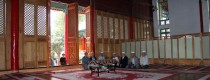
 8 Days Muslim Tour
 12 Days Self-Driving
 4 Days Haba Climbing
 Tiger Leaping Gorge
 Stone Forest
 Yunnan-Tibet
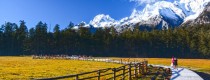
 Hani Rice Terraces
 Kunming
 Lijiang
 Shangri-la
 Dali
Dali
 XishuangBanna
 Honghe
 Kunming
 Lijiang
 Shangri-la
 Yuanyang Rice Terraces
 Nujiang
 XishuangBanna
 Spring City Golf
 Snow Mountain Golf
 Stone Mountain Golf
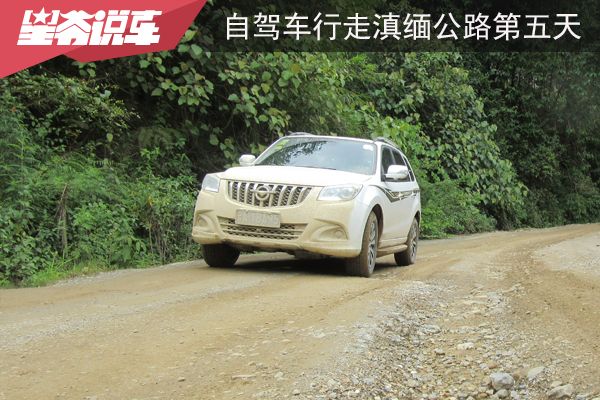
China Self-Driving Tour Along the Sino-Myanmar Road (The Burma Road) –Day 5: From Longling to Wanding
Longling (龙陵) on the Sino-Myanmar Road (滇缅公路) is rich in War of Resistance against Japanese Aggression relics, making it well worth a careful visit. After that, I passed through Mangshi (芒市) and arrived at the border crossing point of the Sino-Myanmar Road: Wanding (畹町). According to the records, the domestic section of the Sino-Myanmar Road spans 959 kilometers, while my driving distance in 2015 was 942 kilometers.
In 1941, Professor Zeng (曾教授) recorded the following observations when he visited Longling (龙陵):
-
There were no city walls.
-
The main street was 1,600 meters long, paved with stone slabs.
-
The alleys on both sides of the main street were very short.
-
There were restaurants and cafés on the street.
-
Due to its proximity to Myanmar, the cost of living was twice as high as in Baoshan (保山), but slightly lower than in Mangshi (芒市) and Wanding (畹町). A plate of fried rice cost 0.25 yuan.
-
This area marked the boundary between the Han Chinese and the Dai people. Beyond this point, one would enter the world of the Dai people.
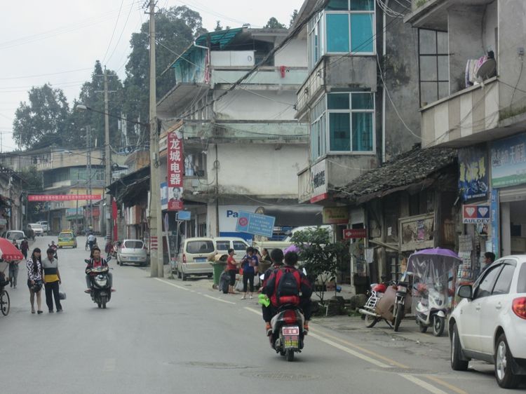
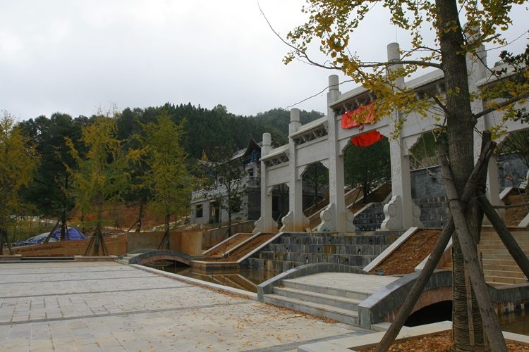
Today, the main street in Longling (龙陵) is still called Longshan Road (龙山路). I measured it, and it’s about 3,100 meters long. The middle section of the road corresponds to the historical county town of Longling, and there are still quite a few old buildings lining both sides. As I walked along, this was the first time I encountered a county town that felt relatively authentic and original.
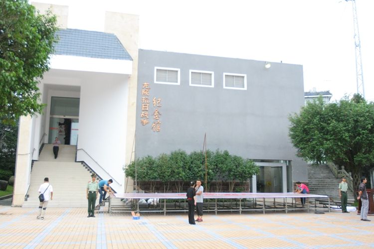
If it’s your first time in Longling (龙陵), I recommend setting aside at least half a day to visit the War of Resistance relics. Despite the small size of the county town, there are quite a few historical sites related to the war, including the War Memorial Museum (抗战纪念馆), Japanese bunkers (日军碉堡), the former site of a comfort station (慰安所旧址), the former Japanese command headquarters (日军司令部旧址), and the old site of the military and political training class (军政班旧址), among others.
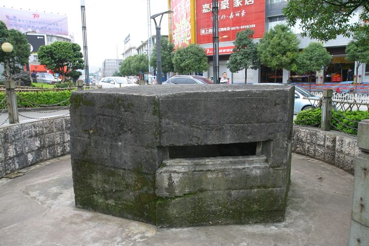
The northern section of Longshan Road (龙山路) is home to the War of Resistance Square (抗战广场), where you can find a well-preserved bunker. It is said to be the most intact Japanese bunker in all of western Yunnan (滇西). The location of the bunker was once known as Dongka (东卡), meaning the eastern gate of Longling (龙陵) city. In 1944, when the Chinese Expeditionary Force (中国远征军) eliminated the Japanese forces stationed in Longling, a flag-raising ceremony was held with the assistance of the American forces at Dongka.
Today, there is a memorial hall (纪念馆) at the War of Resistance Square, which features a replica of the Japanese fortifications from Songshan (松山). The hall also houses a collection of weapons from that time, offering visitors a glimpse into the military history of the region.
In the middle section of Longshan Road (龙山路), there is a small alley called Dongjiagou (董家沟). A few dozen meters down the alley, you will find a small courtyard that was once the site of a Japanese comfort station (慰安所). Today, it has been turned into an exhibition hall, providing a detailed and informative display of the history of the site, which is worth visiting.
There are only two preserved comfort station sites in China as evidence of Japanese war crimes during their invasion. The other one is in Nanjing (南京). These sites stand as a solemn reminder of the atrocities committed during that period.
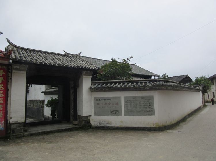
In the western part of Longling County (龙陵县), there is a White Pagoda Community (白塔社区) situated at a relatively high point. Here, you will find the Zhao Family Ancestral Hall (赵家祠堂). During the counteroffensive in western Yunnan (滇西反攻), the Japanese 56th Division (56师团) set up a temporary command headquarters in this area. This location played a key role during the battle and remains an important historical site related to the War of Resistance against Japanese Aggression.
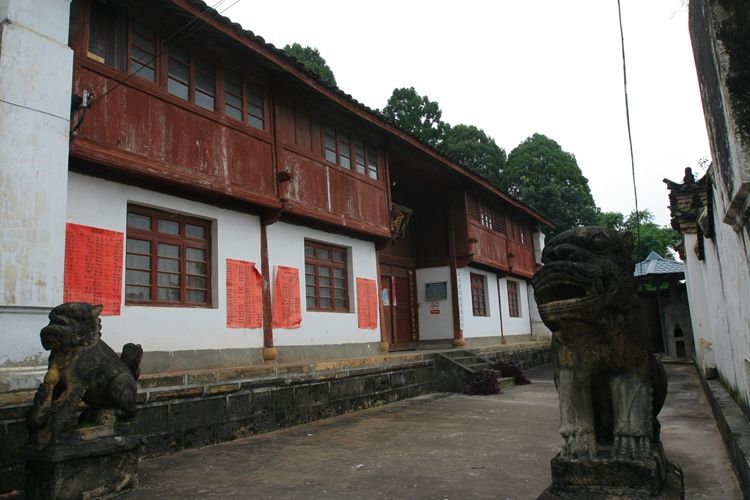
To the west of the White Pagoda Community (白塔社区), in the outskirts, there is a temple called Yunlong Temple (云龙寺), which was also occupied by the Japanese forces. Originally, the temple was named Fulong Temple (伏龙寺). The Japanese 56th Division (56师团), which invaded western Yunnan, had the code name “Long” (龙), and they believed it to be an inauspicious omen. So, they renamed the temple Yunlong Temple, meaning “Cloud Dragon Temple.”
Interestingly, this name turned out to be quite prophetic, as the 56th Division suffered heavy losses in Longling (龙陵) — a true “dragon’s tomb” (龙的陵墓). This eerie coincidence adds a layer of historical irony to the region’s wartime legacy.
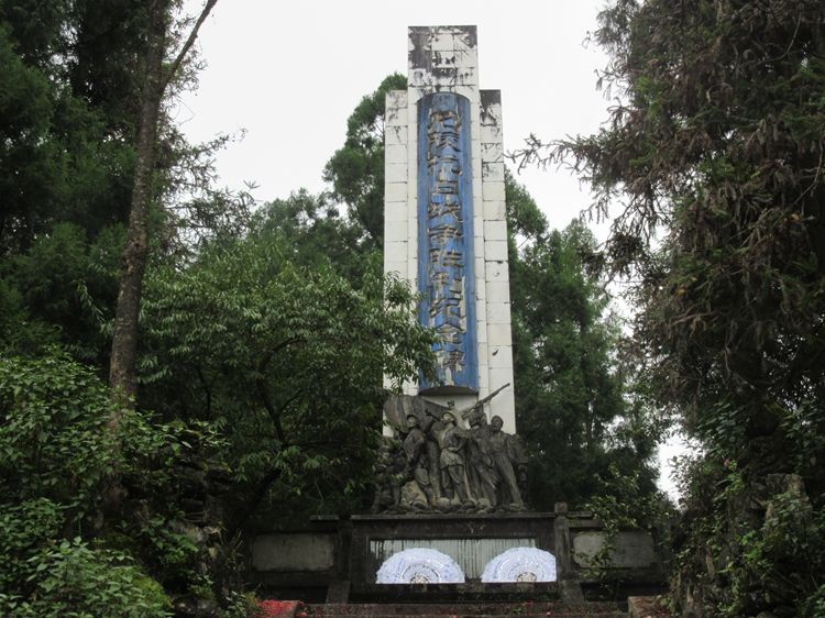
To the east of Longling (龙陵), right next to the city, there is a mountain called Lao Dongpo (老东坡). This was the site of fierce battles between the Chinese Expeditionary Force (中国远征军) and the Japanese forces during the war. The difficulty of capturing Longling was comparable to that of Songshan (松山).
Historically, this battle is known as the “Three Battles of Longling” (三战龙陵). From June to November 1944, the battle lasted for five months. During this time, the Chinese forces suffered 29,000 casualties, while the Japanese forces lost 13,000 soldiers. The intense and protracted nature of the battle made it one of the key engagements in the campaign to reclaim western Yunnan (滇西).
To the east of Lao Dongpo (老东坡), there is an even higher mountain, where you’ll find Jian Mountain Temple (尖山寺). During the battle for Longling (龙陵), the command headquarters for the attack was located here. The road leading to Jian Mountain Temple is quite difficult to navigate, and for those who are not confident in their driving skills, it is best to avoid driving there. The steep and winding path can be challenging, making it a more suitable journey for experienced drivers.
About 75 kilometers northwest of Longling (龙陵) is Tengchong (腾冲). After the Japanese forces invaded western Yunnan (滇西), the 148th Regiment (148联队) was stationed in Tengchong, while the 113th Regiment (113联队) was stationed in Songshan (松山). During the Chinese counteroffensive in western Yunnan, the Japanese forces in Songshan and Longling were reinforced with troops from Tengchong.
The Chinese forces quickly realized this change and launched an attack on Songshan and Longling. Initially, the troops attacking Longling made significant progress. However, the Japanese forces counterattacked, catching the Chinese forces off guard. Just after capturing Longling, the Chinese troops lost it again.
The reason for this setback was the presence of Tenglong Bridge (腾龙桥) between Longling and Tengchong, only about 10 kilometers from Longling. A company had been dispatched to defend the bridge and was prepared to blow it up if necessary. Unfortunately, the company did not have enough explosives to destroy the bridge. When the Japanese forces arrived, the defending troops had already retreated, allowing the Japanese to easily cross the bridge and regain the upper hand.
The war relics I saw in Longling (龙陵) evoke mixed emotions—some make me angry, while others leave me feeling anxious. However, they are all part of real history, in stark contrast to the heroic dramas often shown on television. Although such TV shows can be satisfying to watch, they are not real.
I believe that a nation must face its history honestly, learn from its mistakes, and avoid repeating them to make genuine progress. If we adopt an attitude of avoidance, or worse, modify, beautify, or fantasize about the past, the lessons learned may end up being for nothing. What happened in history might one day repeat itself, and it is only by confronting the past with integrity that we can prevent such a recurrence.
irst Section: From Longling to Mangshi
Leaving Longling (龙陵), continue heading along National Route 320 (320国道). Not far from there, near Shuangbo (双波), you’ll encounter a border checkpoint. Shortly after, on your right, there is a road that used to be part of the historic Yunnan-Burma Road (滇缅公路), now called the Shuangxin Line (双新线). Nearby is a place called Nantianmen (南天门), which was also the site of battles, as depicted in the TV series My Regiment Commander, My Regiment (我的团长我的团).
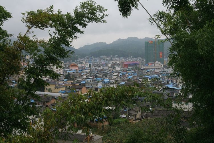
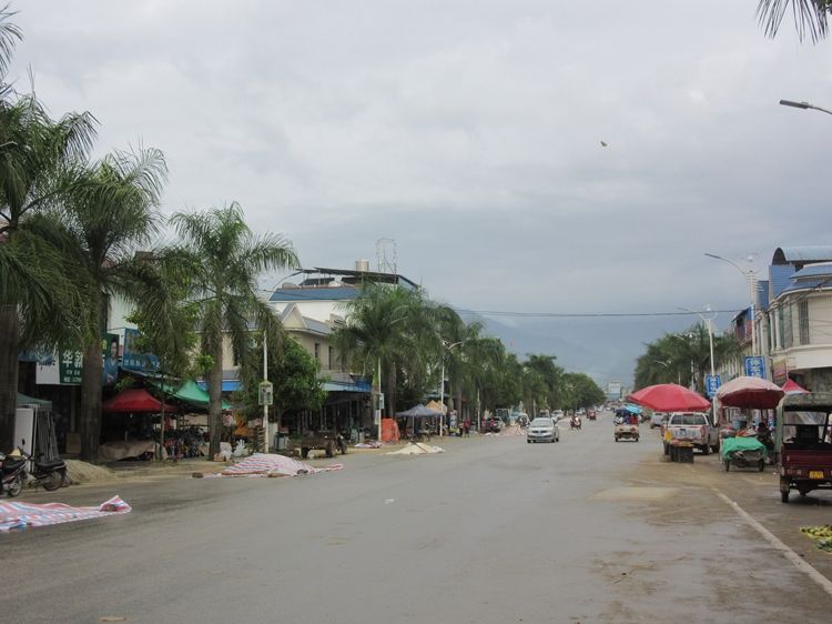
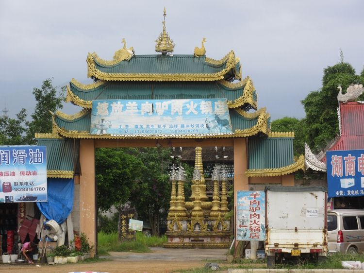
Between Longling (龙陵) and Mangshi (芒市), there is a mountain. Once you cross it, you’ll enter the Mangshi Basin (芒市坝子). Mangshi is located in Dehong Prefecture (德宏州), officially known as Dehong Dai and Jingpo Autonomous Prefecture (德宏傣族景颇族自治州). This means the main ethnic groups here are the Dai (傣族) and Jingpo (景颇族).
As soon as you enter the city, you’ll immediately feel the strong Dai cultural influence. When people think of the Dai people, many imagine Xishuangbanna (西双版纳), but in reality, Mangshi is also very much a Dai world.
Large-leaved plants like banana plants, golden-roofed buildings with high eaves, and the numerous pagodas and temples scattered throughout, all create the distinct characteristics of a Dai (傣族) homeland. It is said that there are over 60 million Dai people, mainly across South Asia, with only about 1.2 million residing in China.
What makes the Dai people especially unique is their widespread practice of Theravada Buddhism (上座部佛教), which differs from the Mahayana Buddhism (大众部佛教) commonly practiced in Han Chinese regions.
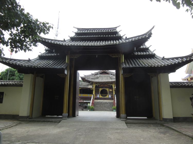
In Mangshi (芒市), I tried to recreate the city as described in Professor Zeng’s records—West Gate, East Gate, the Tusi (local chieftain) residence, Yufeng Garden, temples, and so on. However, aside from the Bodhi Temple (菩提寺) and the Lama Temple (喇嘛庙), I found little else. The city gates and walls are long gone, and I couldn’t locate the Tusi residence either.
Currently, the main thoroughfare running through the city is Tuanjie Street (团结大街), which runs north to south. At its southernmost point is “Three Trees” (三棵树). To the east of this area, you’ll find a more lively spot called Fengqing Street (风情街), and further east is a place known as the Exotic Garden (奇珍园). To the south, Xianchi Road (仙池路) features many distinctive restaurants. Overall, this area is well worth exploring in detail.
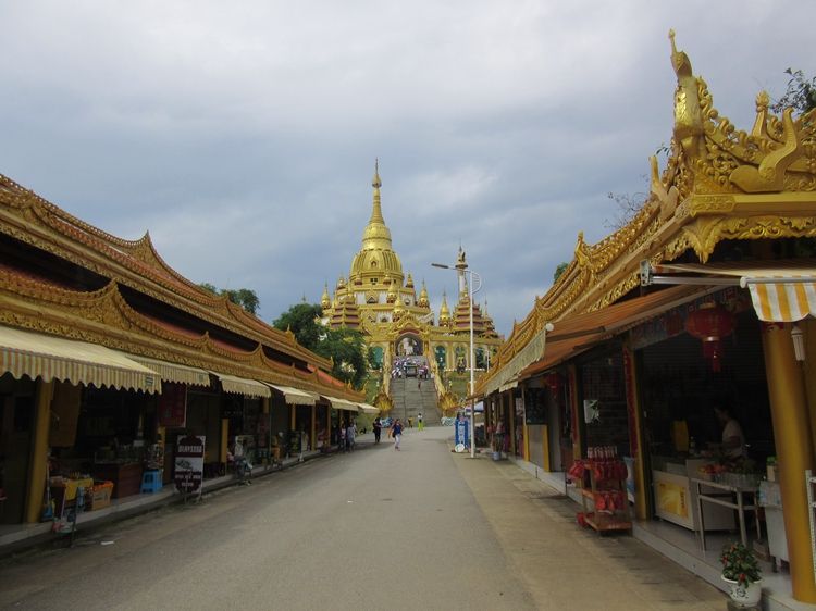
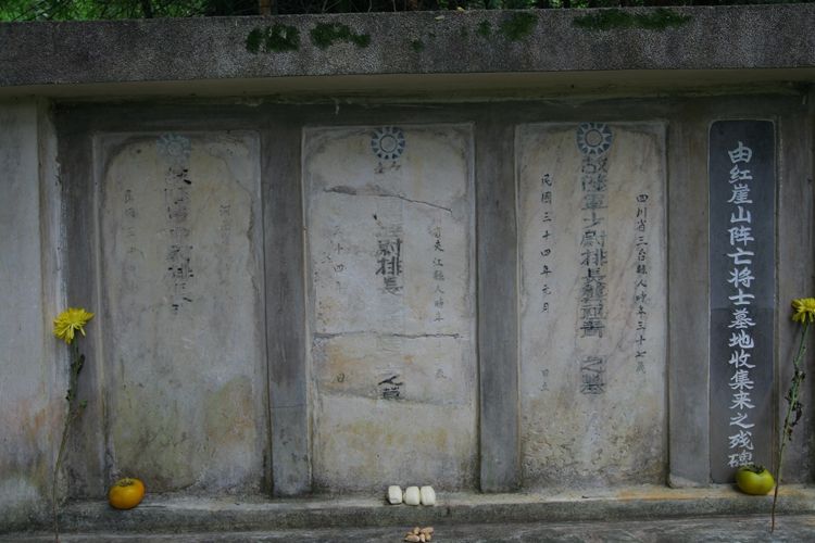
To the east of “Three Trees” (三棵树), there is a mountain with a large golden Buddha pagoda shining at the summit. At the foot of the mountain, along Xianchi Road (仙池路), stands a War Memorial (抗战纪念碑). In fact, after the Western Yunnan Campaign (滇西战役) ended, Mangshi established three memorials, but all of them were eventually destroyed. The one standing here today was rebuilt in recent years. Next to the memorial, there are several gravestones relocated from the Hongya Mountain battlefield site (红崖山战场遗址) and a small commemorative marker.
Second Section: From Mangshi to Wanding
Leaving Mangshi, continue along National Highway 320. After about 20 kilometers, you will have crossed Mangshi Basin and begin to enter the mountains, an area known as Santai Mountain (三台山). The first sight here is a wartime battlefield site. After the Chinese Expeditionary Force (中国远征军) captured Longling, a series of battles followed. This is because the areas between Longling and Mangshi, and between Mangshi and Wanding (畹町), are all mountainous. The Japanese forces used these mountains to put up persistent resistance at each stage.
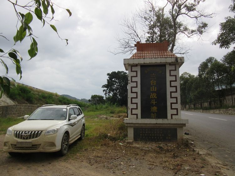
![]() After entering the mountains for 5 kilometers, passing through Santai Mountain Town (三台山镇) at an altitude of 1,140 meters – lower than Longling’s (龙陵) 1,529 meters but higher than Mangshi’s (芒市) 947 meters. This section of the Burma Road (滇缅公路) completely overlaps with National Highway 320 (320国道), with excellent road conditions. In Professor Zeng’s travel notes, it’s mentioned that Santai Mountain (三台山) has three mountain peaks which the highway passes sequentially, but I only felt there was one peak.
After entering the mountains for 5 kilometers, passing through Santai Mountain Town (三台山镇) at an altitude of 1,140 meters – lower than Longling’s (龙陵) 1,529 meters but higher than Mangshi’s (芒市) 947 meters. This section of the Burma Road (滇缅公路) completely overlaps with National Highway 320 (320国道), with excellent road conditions. In Professor Zeng’s travel notes, it’s mentioned that Santai Mountain (三台山) has three mountain peaks which the highway passes sequentially, but I only felt there was one peak.
![]() Driving for 12 kilometers after passing through Santai Mountain (三台山), we enter another basin where Zhaifang (遮放) lies at its center, with the altitude dropping to 850 meters.
Driving for 12 kilometers after passing through Santai Mountain (三台山), we enter another basin where Zhaifang (遮放) lies at its center, with the altitude dropping to 850 meters.
According to Professor Zeng’s records, strategic supplies transported from the United States were first unloaded in Burma, then shipped by train to Lashio, and later transported by truck along the Burma Road (滇缅公路) to Zhaifang (遮放). Chinese convoys would then take the supplies further to Kunming. Today, Zhaifang remains relatively quiet, with only a few shops along its streets.3
The Burma Road played a crucial role during the war as a vital supply route, connecting Burma (now Myanmar) to China. The section from Lashio to Zhaifang was particularly important for the transfer of wartime materials.
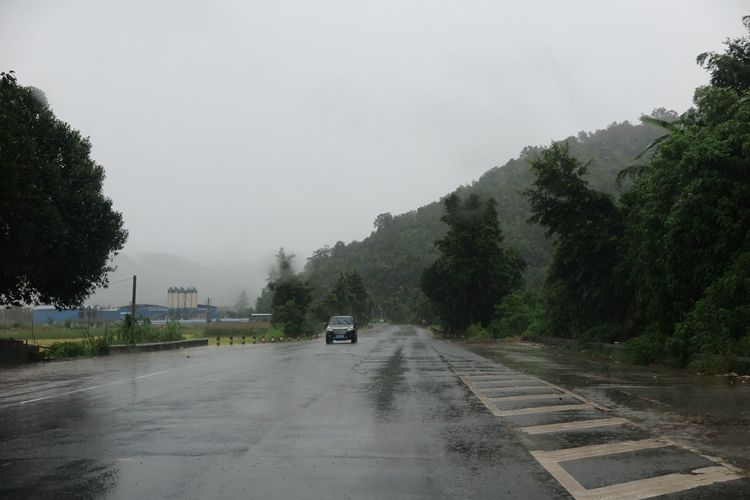
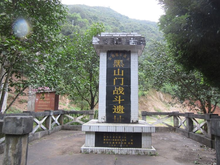
After leaving Zhaifang (遮放), 21 kilometers later, the road begins to ascend into the mountains. Another 11 kilometers into the mountains brings you to Heishanmen (黑山门). Here, the Chinese Expeditionary Force fought its final battle against the Japanese forces. After this battle, the Japanese retreated into Burma, marking the end of the Western Yunnan Counteroffensive.34
Notes:
- Zhaifang (遮放): A town in Yunnan, historically significant as a transit point for wartime supplies.
- Heishanmen (黑山门): A strategic mountain pass where the decisive battle of the Western Yunnan Counteroffensive took place.
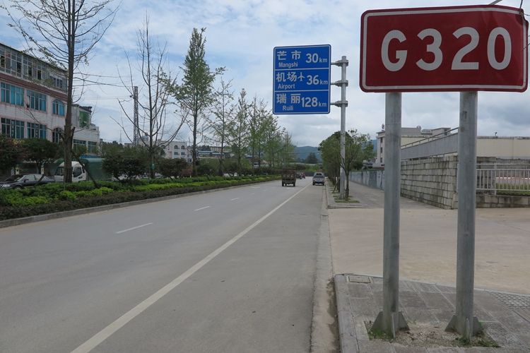
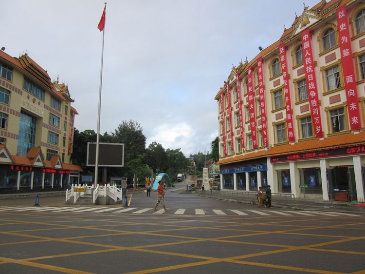
After crossing the mountain pass, the road begins to descend. Two kilometers later, you reach a fork where National Highway 320 (320国道) continues straight toward Ruili (瑞丽), while the Burma Road (滇缅公路) turns south and winds downhill. Another four kilometers brings you to Wanding (畹町). Following the road, you soon arrive at a place fluttering with the Five-Star Red Flag (五星红旗)—the Wanding Port (畹町口岸). Here, the Burma Road crosses the border into Burma (Myanmar).
Notes:
- Wanding Port (畹町口岸): A key Sino-Myanmar border checkpoint, historically vital for wartime supply routes and now a major trade hub.
- Burma Road (滇缅公路): The legendary supply route during WWII, connecting Kunming to Burma.
- Ruili (瑞丽): A bustling border city in Yunnan, known for its trade with Myanmar.
The journey from the mountain pass to the border encapsulates both the rugged terrain of Yunnan and the enduring legacy of the Burma Road in connecting China and Southeast Asia.
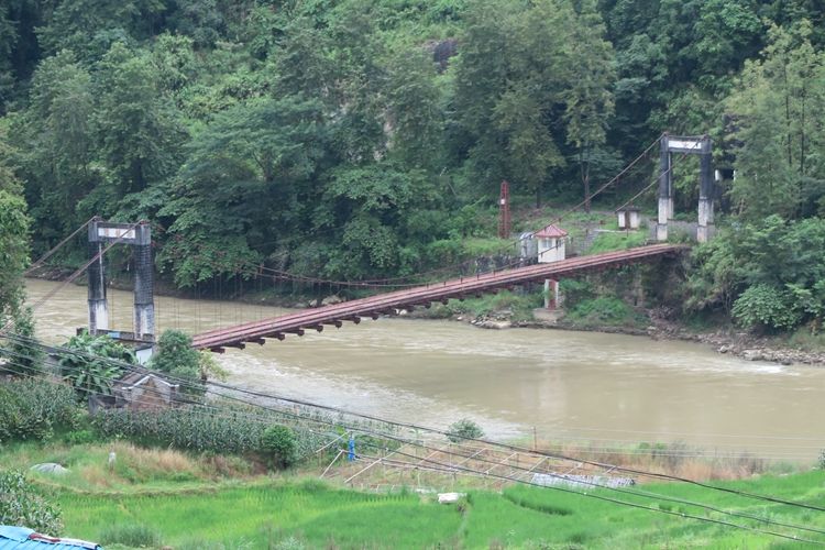
Across from Wanding (畹町) lies Kyaukse (九谷) in Myanmar, with the two countries separated by the Wanding River (畹町河). Spanning the river are two bridges:
-
American G.I. Bridge (美国工兵桥)
Built during WWII by U.S. engineers, this bridge was a critical lifeline for transporting Allied aid to China. It is now decommissioned, with a sign at its midpoint marking the boundary for visitors. -
Modern Border Bridge
The current functional bridge serves as a major trade and transit route between the two nations.
Key Terms:
- Wanding (畹町): A historic border town in Yunnan, China, known for its role in WWII supply routes.
- Kyaukse (九谷): A town in Myanmar’s Shan State, directly opposite Wandang.
- Wanding River (畹町河): The natural border between China and Myanmar.
- American G.I. Bridge (美国工兵桥): A WWII-era steel truss bridge symbolizing Sino-U.S. wartime cooperation.
The two bridges reflect both the region’s wartime legacy and its contemporary cross-border ties.
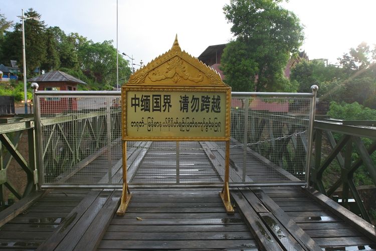
The steel-concrete bridge currently in use near the American G.I. Bridge (美国工兵桥) serves as the primary border crossing between Wanding (畹町), China, and Kyaukse (九谷), Myanmar. Spanning the narrow Wanding River (畹町河)—described as “stream-like” in width—this modern structure contrasts with its historic neighbor, facilitating daily trade and transit.
Wanding (畹町) was originally a city and served as the exit point of the Burma Road (滇缅公路). During the 1950s and 1960s, Zhou Enlai (周恩来) visited Myanmar multiple times, and on one occasion, he walked across the bridge here to return to China78. Later, Ruili (瑞丽) was upgraded from a county to a city, and the Ruili Port (瑞丽口岸) became bustling, while Wanding was downgraded to a district under Ruili1.
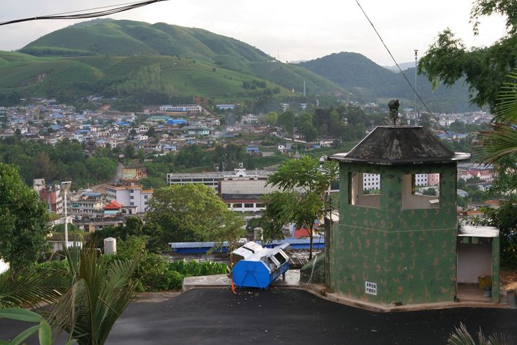
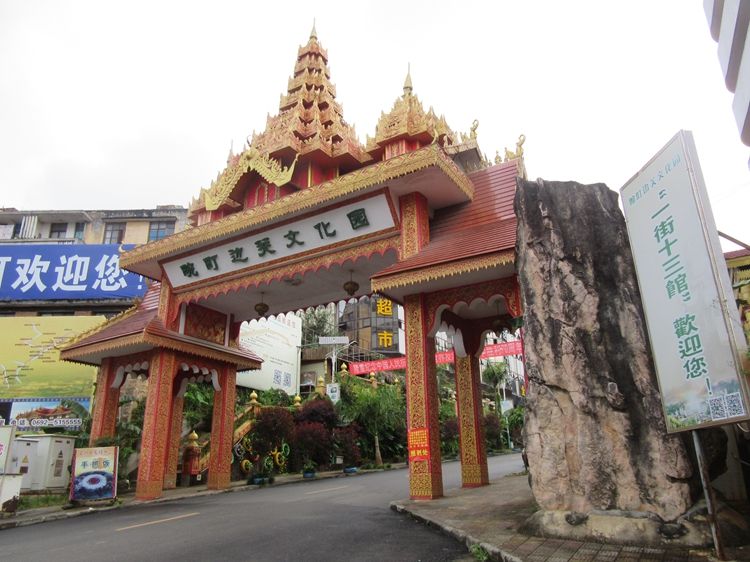
Most tourists focus on Ruili (瑞丽) and only briefly pass through Wanding (畹町). In fact, Wanding is worth staying in for a day, as there are many sights worth seeing. Just 200 meters from the Wanding Port (畹町口岸), there is a Cultural Street (风情街) with beautiful architecture at its entrance. Further inside stands the “Republican-Era Inn” (民国客栈), which was once the Bank of China (中央银行) during the Anti-Japanese War (抗战). Nearby, there is also a Expeditionary Force Memorial Hall (远征军纪念馆).
Key Terms:
- Wanding Port (畹町口岸): The border checkpoint between China and Myanmar.
- Cultural Street (风情街): A historic street showcasing Sino-Myanmar cultural fusion.
- Republican-Era Inn (民国客栈): A preserved building from the early 20th century, once a financial institution.
- Expeditionary Force Memorial Hall (远征军纪念馆): A museum honoring the Chinese Expeditionary Force in WWII.
Wanding’s quiet charm lies in its well-preserved wartime history and cultural heritage, making it a rewarding stop for those seeking depth beyond Ruili’s bustling tourism.
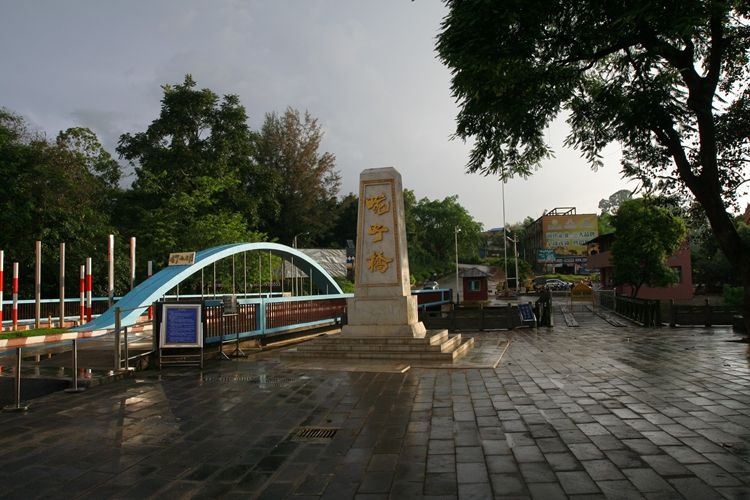
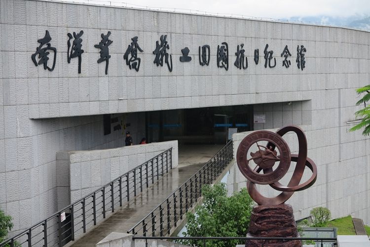
Heading uphill, there is a courtyard built to commemorate Zhou Enlai’s (周恩来) passage through Wanding (畹町) when returning from Myanmar. Further up stands the Nanyang Mechanics Memorial Monument (南洋机工纪念碑) and its accompanying museum.
After the Burma Road (滇缅公路) opened in 1938, there was an urgent need for drivers and mechanics. Learning of this, Mr. Tan Kah Kee (陈嘉庚) in Singapore called upon overseas Chinese to return and serve their homeland48.
In response, over 3,000 patriotic华侨 returned to China, driving trucks back and forth along the Burma Road to transport military supplies to the front lines. By the end of the war in 1945, more than 1,000 of them had sacrificed their lives on this vital transport route.
Key Terms:
- Nanyang Mechanics (南洋机工): Overseas Chinese mechanics and drivers who returned to support China’s WWII efforts.
- Burma Road (滇缅公路): The lifeline highway linking China and Myanmar during WWII.
- Tan Kah Kee (陈嘉庚): Prominent Southeast Asian Chinese community leader who organized the recruitment.
This historical site complex preserves the legacy of both Zhou Enlai’s diplomatic journey and the heroic contributions of the Nanyang Mechanics during China’s resistance war.
![]()
Translation with Special Place Names and Scenic Spots (Chinese Notes Included):
According to historical records, the Burma Road (滇缅公路) spans a total length of 1,153 kilometers, with 959 kilometers within China. I traveled 942 kilometers from Kunming (昆明) to this point, completing the journey along the domestic section (国内段) of the Burma Road.
Key Terms:
- Burma Road (滇缅公路): A critical wartime supply route connecting Kunming, China, with Lashio, Burma (Myanmar).
- Domestic Section (国内段): The portion of the Burma Road located entirely within China, stretching from Kunming to the border.
This marked the end of the domestic leg of the historic Burma Road—a testament to both the engineering feat of its construction and the sacrifices made along its perilous wartime route.
(Note: The Burma Road’s full international route extended another 194 km into Burma before reaching Lashio.)
Chinese Version:自驾车行走滇缅公路第五天:从龙陵到畹町
https://www.chexun.com/2024-05-06/114013099.html