7 Days GolfingTour
 8 Days Group Tour
 8 Days Yunnan Tour
 7 Days Shangri La Hiking
 11 Days Yunnan Tour
 6 Days Yuanyang Terraces
 11 Days Yunnan Tour
 8 Days South Yunnan
 7 Days Tea Tour
 8 Days Muslim Tour
 12 Days Self-Driving
 4 Days Haba Climbing
 Tiger Leaping Gorge
 Stone Forest
 Yunnan-Tibet
 Hani Rice Terraces
 Kunming
 Lijiang
 Shangri-la
 Dali
Dali
 XishuangBanna
 Honghe
 Kunming
 Lijiang
 Shangri-la
 Yuanyang Rice Terraces
 Nujiang
 XishuangBanna
 Spring City Golf
 Snow Mountain Golf
 Stone Mountain Golf
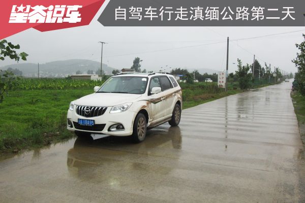
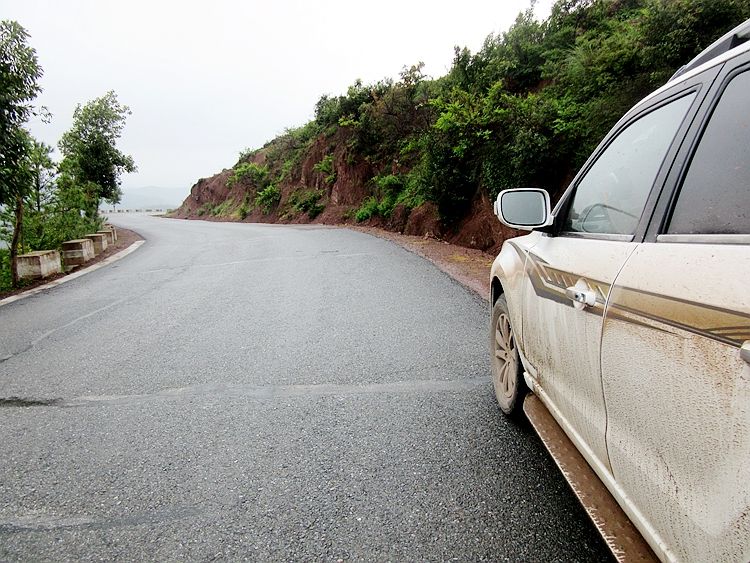
China Self-Driving Tour Along the Sino-Myanmar Road (The Burma Road) –Day 2: From Chuxiong to Xiaguan
Chuxiong (楚雄) is an Yi Autonomous Prefecture (彝族自治州), while Dali (大理) belongs to the Dali Bai Autonomous Prefecture (大理白族自治州). The distance between the capitals of these two prefectures is over 200 kilometers. Driving along the Yunnan-Myanmar Road (滇缅公路), it took me 6 hours and 15 minutes. Along the way, I passed by the place that was the first to be named “Yunnan” (云南) and also saw the airport used for the Hump Airlift (驼峰航线).
Section 1: From Chuxiong to Nanhua
Leaving Chuxiong (楚雄), continue along National Highway 320 (320国道), passing through Zixi Town (紫溪镇), which looks very quiet with few buildings. Further ahead is Nanhua County (南华县). This stretch of road is 37 kilometers long and took 1 hour. Nanhua was formerly known as Zhi’nan (镇南). To ease tensions, many similar place names in China have been modified, such as An Dong being changed to Dan Dong (丹东), Sha Hu Kou becoming Sha Hu Kou (杀虎口), and Di Hua being renamed Urumqi (乌鲁木齐), among others.
Section 2: From Nanhua to Yunnan Yi
About 1 kilometer out of Nanhua County (南华县), there is a park called Parrot Mountain Park (鹦鹉山公园), which is the site of one of the Eight Scenic Spots of Zhinan Prefecture (镇南州), known as “Parrots Coming to Qing” (鹦鹉来青).
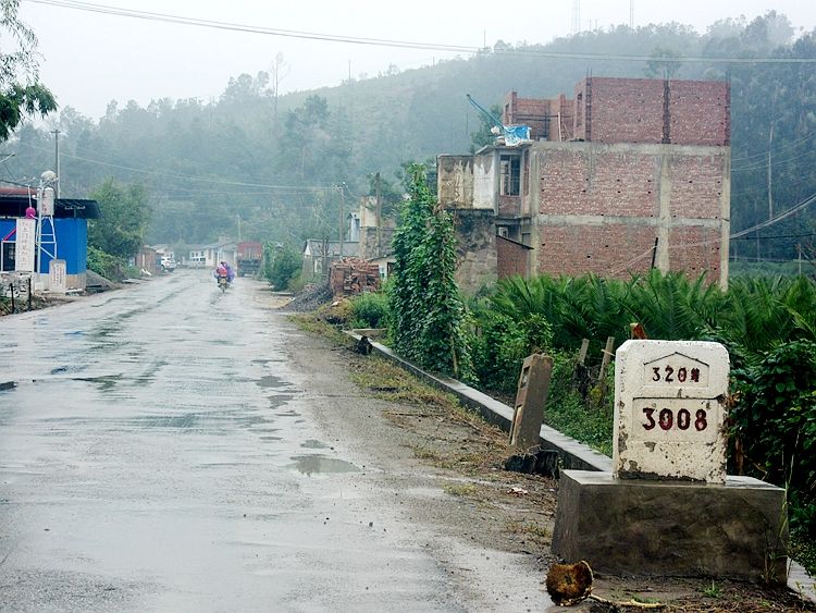
Diagonally opposite the park is the milestone marking the 3008th kilometer of National Highway 320 (320国道), which starts in Shanghai. The total length of National Highway 320 is 3695 kilometers, meaning there are just 687 kilometers left until I reach the China-Myanmar border, from where I will enter Myanmar and head to the endpoint of the Yunnan-Myanmar Road (滇缅公路): Lashio (腊戍).
After traveling 20 kilometers, I passed Shaqiao (沙桥). Another 8 kilometers past Shaqiao, the road begins to ascend the mountain.
According to Professor Zeng’s (曾教授) records, this mountain is called Tianzimiao Slope (天子庙坡), with an elevation of 2,600 meters. It is the second highest point along the Yunnan-Myanmar Road (滇缅公路), and both the uphill and downhill sections are very steep. However, the road has since been upgraded, so it no longer feels as steep. Along the way, you first pass through Yingwu Pass (英武关), followed by Tianshengtang Township (天申堂乡), which sits at an elevation of 2,292 meters.
Next, I reached the mountaintop, and my GPS showed an elevation of 2,392 meters, which is 208 meters lower than Professor Zeng’s (曾教授) recorded elevation.
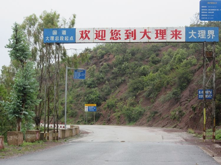
Not far after the mountaintop, a sign appears indicating the entrance to Dali Prefecture (大理州). The milestone for National Highway 320 (320国道) here shows 3049 kilometers.
After that, the road descends, passing through Libi Dian Village (力必甸村), which is a place where you can stop and have a meal. The village is small but has a few restaurants that look relatively clean. Shortly after, I saw several villages with “Shao” (哨) in their names, such as Old Shao (旧哨) and New Shao (新哨), and so on. In fact, along the entire route from Kunming (昆明), there are quite a few villages with “Shao” in their names. I wonder if this is related to the era of Wu Sangui (吴三桂).
In Professor Zeng’s (曾教授) travel journal, he mentioned that before descending to the flat land, there was a detour on the foothills leading to Xiazhuang (下庄), as his friends were hosting him for lunch there. If not, the road would continue directly to Yunnan Yi (云南驿). Nowadays, National Highway 320 (320国道) must pass through Xiazhuang, which shows that the route has changed from the old Yunnan-Myanmar Road (滇缅路).
Yunnan Yi: The place that was the first to be named “Yunnan.”
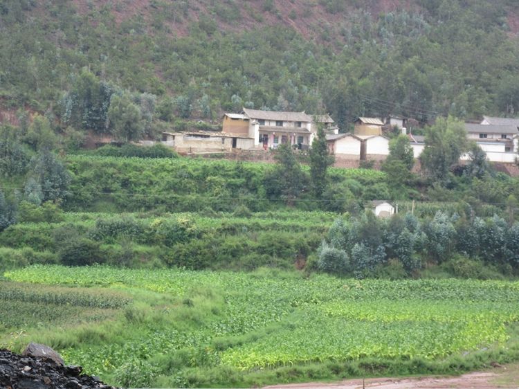
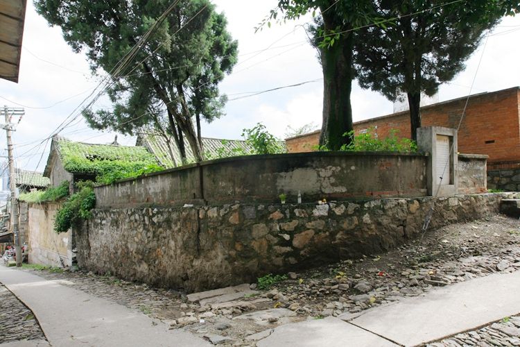
Xiazhuang (下庄) is the first town you reach when entering the Yunnan Yi Basin (云南驿坝子), and it’s fairly large, with a highway exit nearby. The Yunnan Yi Basin covers a vast area. During the War of Resistance (抗战时期), two airports were built here. One was located on the eastern side of Yunnan Yi (云南驿), called Yunnan Yi Airport (云南驿机场), with its runway situated between Yunnan Yi and Jiuzhan Village (旧站村). The other was located to the northeast of Yunnan Yi, called Beitun Airport (北屯机场), with its runway situated between Beitun Village (北屯村) and Songmei Village (松梅村). Beitun Airport is still in use today, while Yunnan Yi Airport was abandoned after the war and has since been converted back into farmland.
Both Yunnan Yi Airport (云南驿机场) and Beitun Airport (北屯机场) were part of the Hump Airlift (驼峰航线). As early as 1940, a pilot from China National Aviation Corporation, Chen Wenkuan (陈文宽), made the first flight to India, pioneering the Hump Airlift. At that time, the Japanese had already entered Vietnam, and to prevent the Yunnan-Myanmar Road (滇缅公路) from being interrupted by bombings, China National Aviation Corporation (中航公司) attempted to establish air transport.
By 1941, Song Ziwen (宋子文) proposed the China-India Hump Airlift plan to the United States, requesting transport aircraft. Thanks to the early groundwork, in May 1942, when the Japanese occupied western Yunnan and cut off the Yunnan-Myanmar Road, the Hump Airlift began, ensuring a near-seamless continuation of the strategic material supply.
The Hump Airlift, stretching from Tingjiang in India to Yunnan, was managed by two units: the Chinese side was China National Aviation Corporation (中国航空公司), and the American side was the 10th Air Force (第10航空队). Since the entire route passed through high mountains, it not only neared the maximum altitude limit of the aircraft but also had highly variable weather. Because of this, the number of crashes on this route exceeded half. The American Time Magazine once described it this way: “In the deep mountain valleys and snowy peaks along the 800-plus kilometers, aircraft debris is scattered everywhere. On clear days, the aluminum pieces gleam in the sunlight, which gave rise to the famous ‘Aluminum Valley’—the Hump Airlift.” By the way, it is a common misconception that the Flying Tigers (飞虎队) were responsible for flying the Hump Airlift.
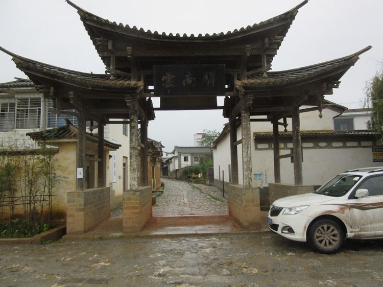
Yunnan Yi (云南驿) is the earliest place to be named “Yunnan.” From the village to the county, it was always called Yunnan, and later, the province itself adopted the name Yunnan. To avoid repetition, the county was renamed Xiangyun (祥云), and the county seat was moved more than 20 kilometers to the west. However, the village still retains the name Yunnan.
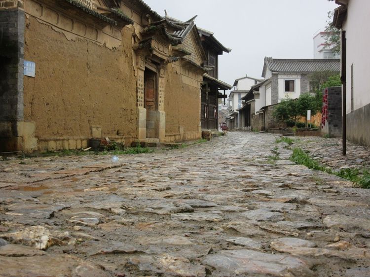
Yunnan Yi Village (云南驿村) still maintains its ancient charm. Not far to the east of the village is the site of the old airport, which has now been converted into farmland. If you use satellite imagery, you can still clearly see the remnants of the runway from back in the day.
Section 3: From Yunnan Yi to Xiangyun
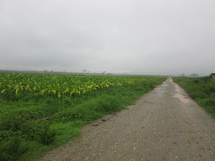
Leaving Yunnan Yi (云南驿), head towards the county seat of Xiangyun (祥云). On the north side of the road is Qinghai Lake (青海湖), which stretches for about 3 kilometers. The view on a clear day is beautiful.
Continuing forward, you will reach the Qinghua Cave (清华洞) intersection. The county seat of Xiangyun is 3 kilometers to the north, while National Highway 320 (320国道) continues west. Near the intersection is Qinghua Cave, an archaeological site dating back to the Neolithic period. On the hillside above the cave is a commemorative monument honoring U.S. pilot Moni (莫尼). Moni was stationed at the Yunnan Yi Airport during the war. While engaged in combat against the Japanese, his plane was shot down. To prevent the aircraft from crashing into the county seat of Xiangyun, Moni delayed his parachute jump and was severely injured. The people of the county made great efforts to save this hero, but were unable to revive him. Subsequently, they collected donations for a proper burial and erected a monument in his memory.
Section 4: From Xiangyun to Dali (Xiaguan)
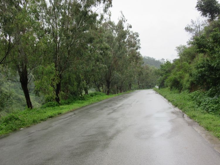
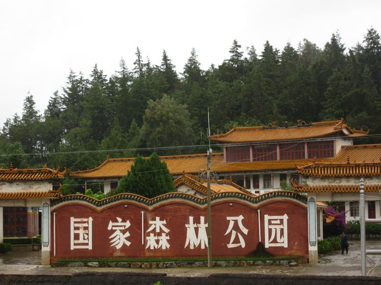
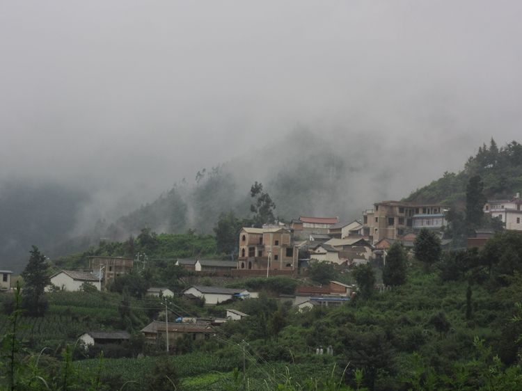
After passing the Qinghua Cave intersection, the road begins to descend, entering the Midu Basin (弥渡坝子). During my journey on this stretch, I didn’t encounter a single vehicle. The trees on both sides of the road were exceptionally dense, and the environment was serene, giving a very pleasant feeling. Along the way, there is Dongshan National Forest Park (东山国家森林公园), but I didn’t see a soul there.
Entering the Midu Basin (弥渡坝子), I started to see buildings in the Bai ethnic style (白族). Soon after, there was a T-junction. Heading south for less than 10 kilometers brings you to the county seat of Midu (弥渡县); heading northwest leads to Dali’s Xiaguan (大理下关). The distance from Xiangyun (祥云) to this point is about 15 kilometers.
Soon, the road begins to climb as it crosses Dingxi Ridge (定西岭). At the top of the mountain, there is a flat area with a village called Houshan Village (后山村). The GPS shows an elevation of 2,266 meters, while Professor Zeng’s (曾教授) record from back then is 2,340 meters.
After that, there is a long descent. Once you pass an exit for the highway, the road widens. Although it’s still National Highway 320 (320国道), this section is called Xiangyun Road (祥云路). After traveling about 4 kilometers, as you approach Fengyi Town (凤仪镇), the wide Xiangyun Road continues north, while National Highway 320 veers slightly west to enter Fengyi Town.
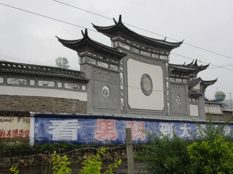
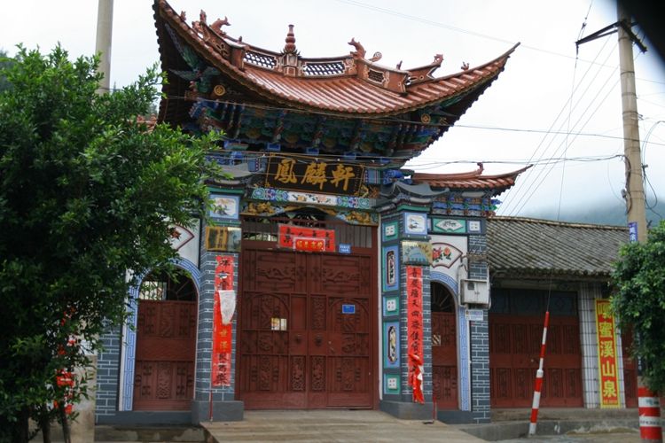
Inside the town, at Dali No. 3 Middle School (大理三中), there is an ancient gate near the school entrance. This gate once belonged to the Fengming Academy (凤鸣书院) in history. Near the academy, there is another beautiful gate called Fenglin Xuan (凤麟轩).
After passing through Fengyi Town (凤仪镇), continue along the road until it reaches the end, then return to Xiangyun Road (祥云路) and head west into Xiaguan (下关). Finally, at 7:30 PM, I arrived at Xiaguan Town. The total distance for the day was 216.5 kilometers, and it took 6 hours and 15 minutes. Professor Zeng (曾教授) took about 8 hours to drive from Chuxiong (楚雄) to Xiaguan.
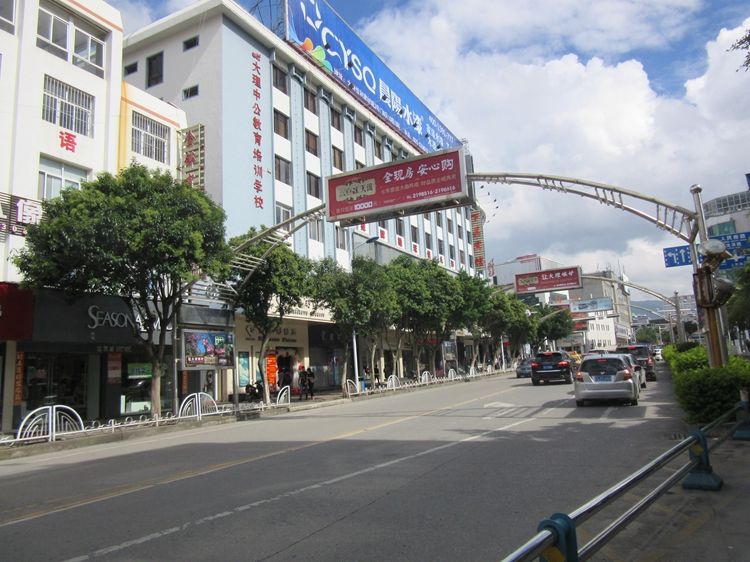
Dali City Center: Xiaguan’s Attractions
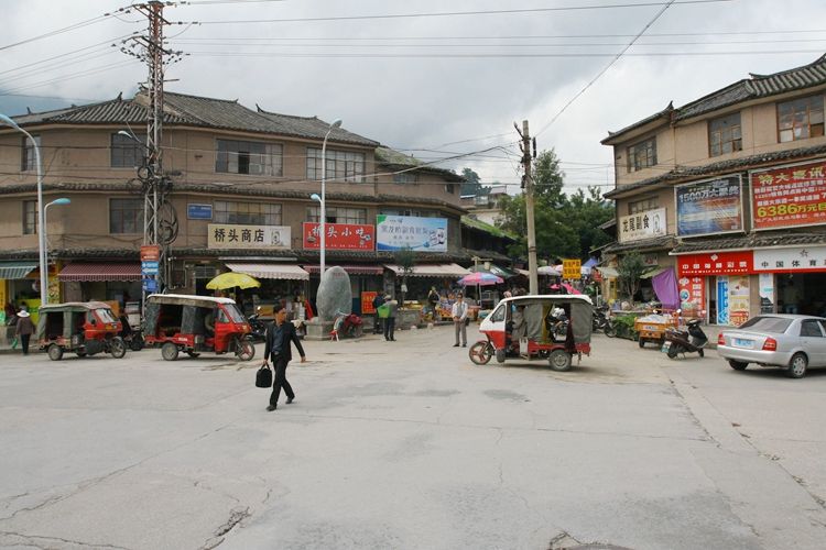
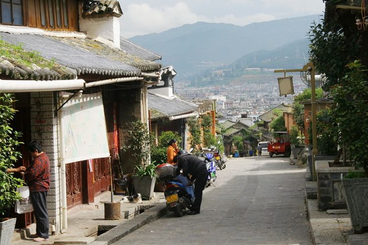
Dali’s full name is Dali Bai Autonomous Prefecture (大理白族自治州). Both the Dali Prefecture government and Dali city government are located in Xiaguan (下关). Historically, Dali referred to the ancient town that exists today. Many tourists come to Dali, almost all heading straight for the ancient town.
When Professor Zeng (曾教授) visited here in 1941, his records were as follows: “Shangguan (上关) is to the north of Dali, and Xiaguan (下关) is to the south. The main streets form a T-shape, composed of East Street (东街), West Street (西街), and North Street (北街). East Street is about 500 meters long, while West Street is less than 100 meters. To the north of North Street, there is a simple gate and a bridge. Below the bridge is Erhai Lake (洱河). After crossing the bridge, there is another gate called ‘Yulong Pass’ (玉龙关), which is the ‘Pass’ (关) of Xiaguan. Continuing forward and turning left, you cross another bridge, still over Erhai Lake, and then pass through another gate with the inscription ‘Longwei City’ (龙尾城).”
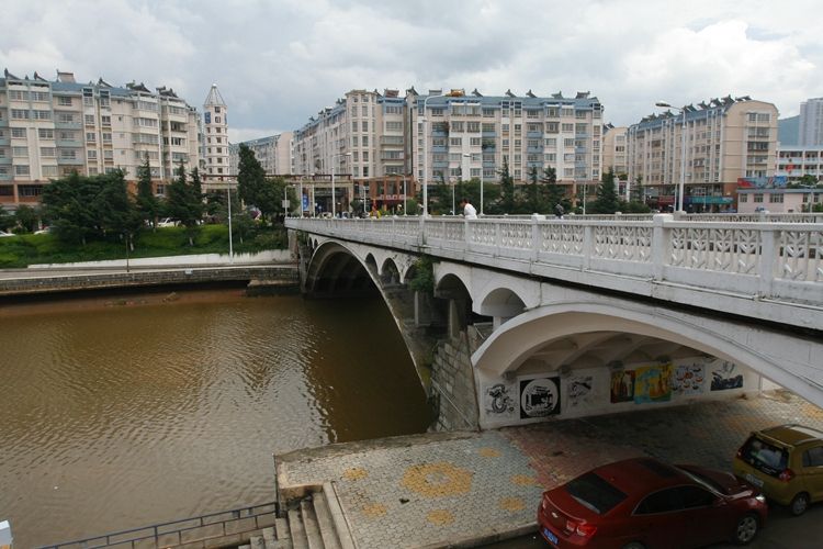
According to Professor Zeng’s (曾教授) records, I inquired around the Black Dragon Bridge (黑龙桥) area. An elderly person mentioned that there used to be a gate at the bridgehead, which might have been the southern city gate of Longwei City (龙尾城). As for whether it was called “Yulong Pass” (玉龙关), the elderly person was somewhat unsure.
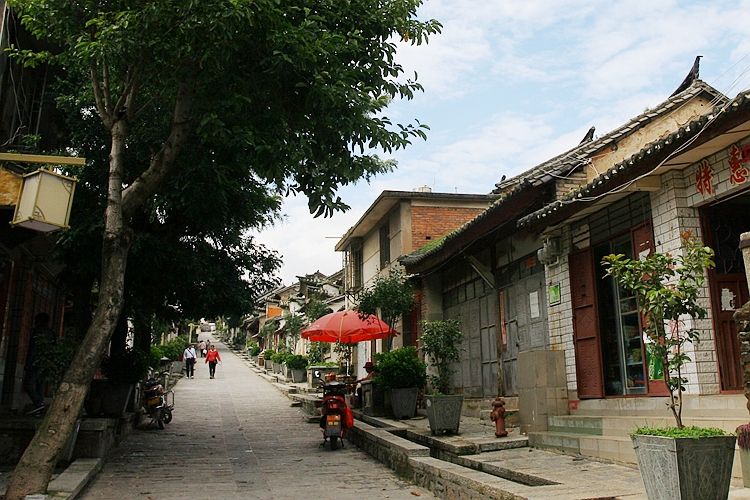
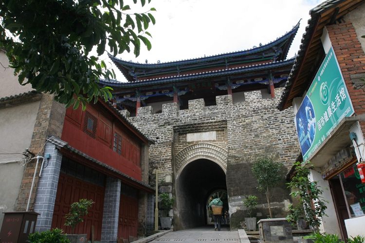
After crossing the bridge, follow an ancient street and continue upwards.
After walking about 200 meters, I saw a city gate. According to the stone tablet by the roadside, it is the northern city gate of Longwei City (龙尾城), which was restored by the Dali City Landscaping Bureau (大理市园林局) in 1986.
After passing through the city gate, about 60 meters to the right, there is an earth platform, which is the site of the Yuan Dynasty’s military review platform. Dali is historically famous for the Nanzhao Kingdom (南诏国) and the Dali Kingdom (大理国). During the reign of Emperor Xuanzong of the Tang Dynasty (唐玄宗), there were six large tribes around Erhai Lake (洱海), collectively known as the “Zhao” (诏). The southernmost of these tribes was called Nanzhao. With the support of the Tang Dynasty, Nanzhao conquered the other tribes and established the Nanzhao Kingdom, which lasted for 200 years. After its fall, following a period of conflict, the Dali Kingdom emerged. The Dali Kingdom lasted for over 300 years before being destroyed by the Mongols. The Mongol forces that occupied the Dali Kingdom built a General’s Mansion here, and this military review platform was used for the general’s military reviews.
The most beautiful place in Xiaguan (下关) is the park by Erhai Lake (洱海). Additionally, in many parts of the city, you can see the stunning Cangshan Mountain (苍山). Against the backdrop of Cangshan and Erhai, Dali is truly beautiful. As a person from Beijing, when I first visited here several years ago, I was in awe of its beauty. In contrast, while my hometown is admired by many, its climate, environment, and water resources have inherent shortcomings. Some believe Beijing, as the capital of several dynasties, is a land of good fortune. However, in reality, its status as the capital was due to geopolitical reasons, not because it is an ideal place to live.
Chinese Version: 自驾车行走滇缅公路第二天:从楚雄到下关
https://www.chexun.com/2024-05-03/114013083.html