 7 Days GolfingTour
 8 Days Group Tour
 8 Days Yunnan Tour
 7 Days Shangri La Hiking
 11 Days Yunnan Tour
 6 Days Yuanyang Terraces
 11 Days Yunnan Tour
 8 Days South Yunnan
 7 Days Tea Tour
 8 Days Muslim Tour
 12 Days Self-Driving
 4 Days Haba Climbing
 Tiger Leaping Gorge
 Stone Forest
 Yunnan-Tibet
 Hani Rice Terraces
 Kunming
 Lijiang
 Shangri-la
 Dali
Dali
 XishuangBanna
 Honghe
 Kunming
 Lijiang
 Shangri-la
 Yuanyang Rice Terraces
 Nujiang
 XishuangBanna
 Spring City Golf
 Snow Mountain Golf
 Stone Mountain Golf
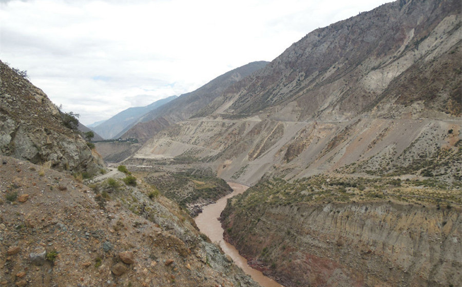
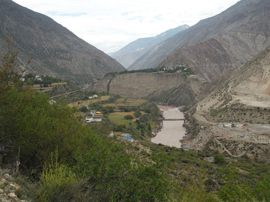
Ninong Grand Valley in Deqin County, Diqing
Attraction Overview
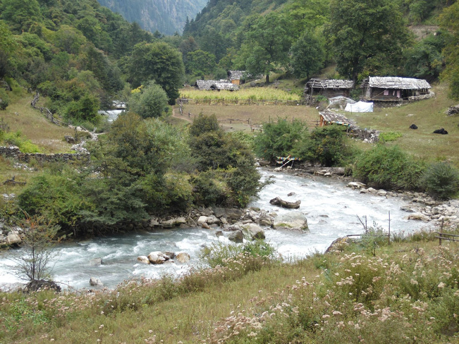
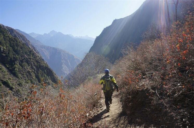
Ninong Grand Valley is located in the lower reaches of the Yubeng valley. The stream of Ninong valley is formed by the snow water from several snow mountains in Yubeng village, which stretches for more than 10 kilometers, and finally flows into the Lancang river.
Attraction Type: Grand Valley
Chinese Name: 尼龙大峡谷(Chinese Pinyin: Ninong Daxiagu)
Best Time to Visit: Autumn and Winter
Open Hours: All Day Long
Location: the lower reaches of the Yubeng valley, Deqin County, Yunnan
🏞️ Niru Grand Canyon Hiking Guide
Route Overview
-
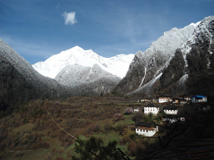
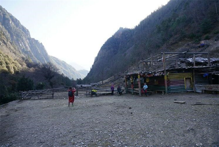
Starting Point: Lower Yubeng Village (Altitude: 3,090m)
-
Ending Point: Niru Village (Altitude: 2,136m)
-
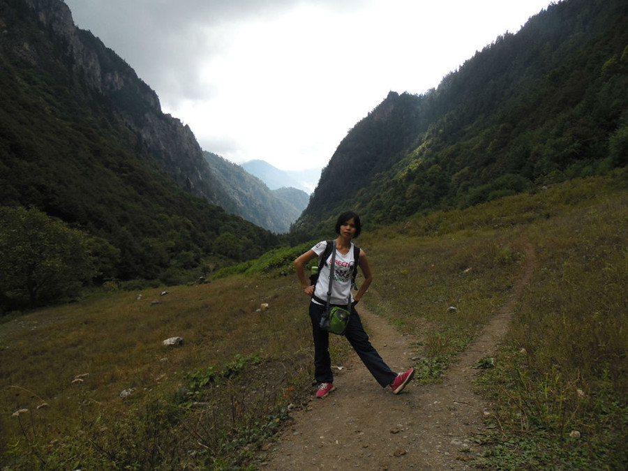
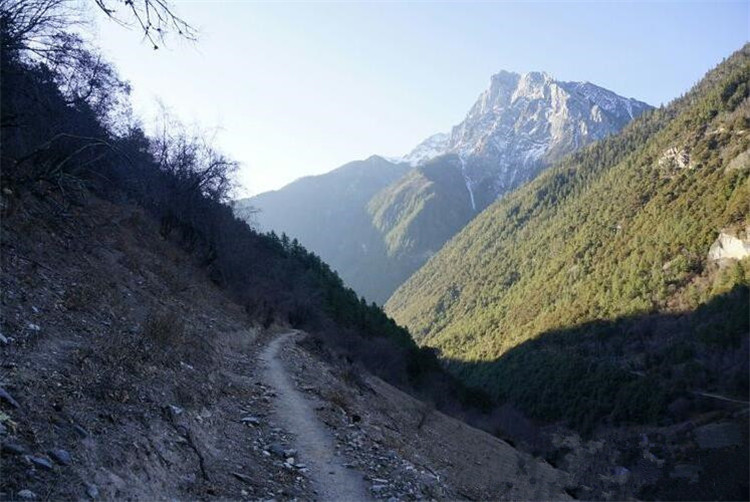
Distance: Approximately 13–15 km
-
Duration: 3–5 hours on average
-
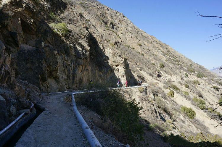
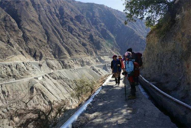
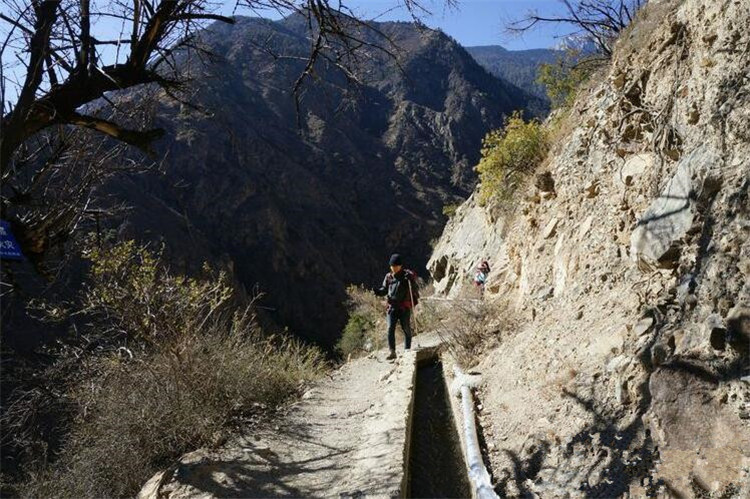
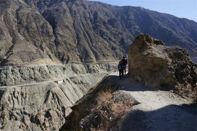
Trail Type: Entire route is paved cement downhill path with an average slope of around 60%. Cliffside sections are widened to about 1.5 meters, though the narrowest parts remain under 1 meter.

What You’ll See
-
Beginning: Pristine alpine forest with rhododendrons and orchids; mountain streams and open pastures.
-
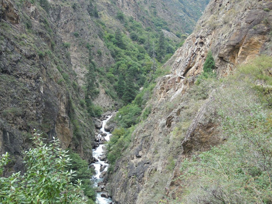
Middle Section: Cliff-hugging plank trail along the roaring Yubeng River, with cascading waterfalls beside you.
-
Final Stretch: Open rocky terrain with panoramic views of the dramatic Lancang River bend.

🔥 Four Highlights of the Hike
1. Thrilling Canyon Traverse
-
Hug the cliffs while giving way to passing mule trains (used to transport goods).
-
Be especially cautious during windy weather.
-
Rockfalls are frequent during the rainy season (May–September), especially near the river junction.
2. Stunning Biodiversity
-
Rhododendrons bloom spectacularly in May and June 🌸
-
Vibrant fall colors light up the trail in October 🍂
-
Yaks grazing on the meadows create a soundtrack of tinkling bells echoing through the valley.
3. Improved but Still Adventurous
-
Water ditches have been rebuilt to reduce flooding risks.
-
However, wooden bridges over rapids remain aged and slippery—caution required.
-
At the endpoint (Niru Village), shared car rides back to Shangri-La are available once enough hikers gather.
4. A More Rewarding Choice
-
Easier than the Ice Lake hike, more rugged and wild than Tiger Leaping Gorge.
-
This is the best route to exit Yubeng, sparing you the steep climb back to Xidang Village.
🛡️ Safety Guidelines
Risk Management
| Hazard | What to Do | Risk Zones |
|---|---|---|
| Rockfalls | Avoid hiking during rain; watch for loose cliff rocks. | Rocky turns along open canyon walls |
| Strong Winds | Use two trekking poles; stay close to inner cliff walls. | Final section above the Lancang River |
| Slippery Trails | Wear anti-slip hiking shoes; avoid moss-covered areas. | Waterfall splash zones, frozen bridges in winter |
Essential Gear
-
Basics: Anti-slip hiking shoes, knee support (for downhill impact), 2 trekking poles
-
Protection: High-SPF sunscreen, wide-brim hat or cap (no shade at the end), waterproof jacket (for sudden rain)
-
Supplies: 1.5L of water, high-energy snacks (only one guesthouse en route, often closed in off-season)
⏱️ Best Time & Travel Tips
When to Go
-
Best Months: June (rhododendron season) and October (fall foliage)
-
Start Early: Leave before 6:30 AM to avoid strong UV rays and mule traffic later in the day.
Travel Strategy
-
After the Hike: Shared minivans from Niru Village can take you straight to Shangri-La.
-
Reverse Hike: You can start from Niru and ascend into Yubeng (elevation gain of 1,100m) — a more challenging route.
💎 Hiker’s Impression
Wander through misty waterfall trails → pause at the Lancang River viewing platform with snow-capped peaks above → finish your trek to the sound of yak bells echoing through one of the most colorful canyons in northwest Yunnan.
📌 Practical Info
Entry Fees
-
No extra ticket required. This hike is included in the ¥55 admission for the Yubeng Scenic Area.
Phone Signal
-
No signal in forested areas. Signal resumes near the canyon exit (best with China Telecom network).
Leave No Trace
-
There are no trash bins along the trail. Please pack out all your garbage to help protect the environment.
