 7 Days GolfingTour
 8 Days Group Tour
 8 Days Yunnan Tour
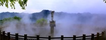
 7 Days Shangri La Hiking
 11 Days Yunnan Tour
 6 Days Yuanyang Terraces
 11 Days Yunnan Tour
 8 Days South Yunnan
 7 Days Tea Tour
 8 Days Muslim Tour
 12 Days Self-Driving
 4 Days Haba Climbing
 Tiger Leaping Gorge
 Stone Forest
 Yunnan-Tibet
 Hani Rice Terraces
 Kunming
 Lijiang
 Shangri-la
 Dali
Dali
 XishuangBanna
 Honghe
 Kunming
 Lijiang
 Shangri-la
 Yuanyang Rice Terraces
 Nujiang
 XishuangBanna
 Spring City Golf
 Snow Mountain Golf
 Stone Mountain Golf
Mengga River in Yingjiang County, Dehong

🌍 Location & Basin
Mengjia River is one of the four major river systems in Yingjiang County, Dehong Dai and Jingpo Autonomous Prefecture, Yunnan Province.
-
Location: Northwest mountainous region of Yingjiang County; the main river originates from the eastern hills of Sudian Township.
-
Basin Area: The Mengjia River drainage system covers a catchment area of 1,073.43 km².
💧 Hydrological Features
-
River Length & Elevation Drop: Total length of 49.85 km, with an average slope of 43.48‰ and an elevation drop of 1,560 m.
-
Flow Rate: Between 0.80–26.5 m³/s.
-
Hydropower Potential: The river alone has a hydropower potential of 250,600 kW.
🌊 Tributaries
-
Mulong River (木笼河)
-
Originates from Mulong Head Mountain near the border, flows southwest, receiving multiple tributaries.
-
Drains 84.8 km², elevation drop 1,680 m, average slope 80‰.
-
Minimum flow: 1.1 m³/s, hydropower potential: 61,000 kW.
-
-
Mengdian River (勐典河)
-
Originates from Furongdi Mountain, Mengnong Township, flows south, passes Mengdianba, then west through Kachang Township.
-
Drains 351.2 km², river length 34.6 km, elevation drop 1,600 m, average slope 46‰.
-
Hydropower potential: 196,000 kW.
-
-
Mengnong River (勐弄河)
-
Originates from Saishuipo and Luanmao Mountain tops, flows northwest, joins Mengdian River.
-
Drains 112.0 km², river length 20.6 km, elevation drop 1,040 m.
-
⚡ Water Resource Utilization
-
Hydropower Development:
-
Multiple hydropower stations have been built along the Mengjia River, including Six-level Hydropower Station (operated by Mengjia River Six-Level Hydropower Development Co., Ltd.) and Four-level Hydropower Station.
-
The Four-level Hydropower Station is classified as a Type IV Small(1) Project, a run-of-river scheme designed solely for power generation.
-
Infrastructure includes diversion dams, water tunnels, pressure shafts, pipelines, surface power plants, and step-up substations.
-
Mengjia River is not only a vital water resource for Yingjiang County but also a key hydropower development zone supporting regional energy needs. Its tributaries, steep gradients, and ample flow make it ideal for small-to-medium scale hydropower projects.


