 7 Days GolfingTour
 8 Days Group Tour
 8 Days Yunnan Tour
 7 Days Shangri La Hiking
 11 Days Yunnan Tour
 6 Days Yuanyang Terraces
 11 Days Yunnan Tour
 8 Days South Yunnan
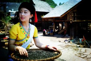
 7 Days Tea Tour
 8 Days Muslim Tour
 12 Days Self-Driving
 4 Days Haba Climbing
 Tiger Leaping Gorge
 Stone Forest
 Yunnan-Tibet
 Hani Rice Terraces
 Kunming
 Lijiang
 Shangri-la
 Dali
Dali
 XishuangBanna
 Honghe
 Kunming
 Lijiang
 Shangri-la
 Yuanyang Rice Terraces
 Nujiang
 XishuangBanna
 Spring City Golf
 Snow Mountain Golf
 Stone Mountain Golf


Mojiang County
Mojiang County Overview
Chinese Name: 墨江县 English IPA: Mo Jiang Xian Location: Southwest Yunnan Population (city): 360,000 Language: Southwest Mandarin, Hani Language Zip code: 654800 Tel code: (+86) 0879 Time zone: UTC+8
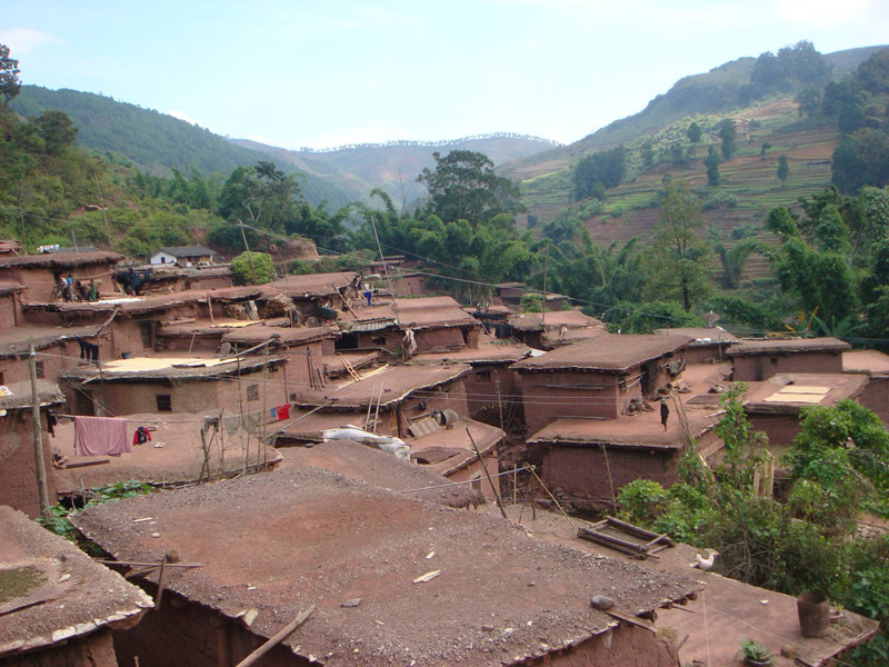
Mojiang Hani Autonomous County(墨江哈尼族自治县) is located in the southern part of Yunnan Province, east of Pu’er City. It is located at 101°08′~102°04′ east longitude and 22°51′~23°59′ north latitude. It borders on Yuanjiang County, Yuxi and Honghe in the east, and faces Ninger County across Babianjiang River in the west, borders on Jiangcheng County in the south, Xinping County in the north, Lvchun County in the southeast, and Zhenyuan County in the northwest. It has a horizontal distance of 64 kilometers from east to west, a vertical distance of 135 kilometers from north to south, and a total area of 5,312 square kilometers.
Highlights
- Long History: Before 109 BC, the present Mojiang County was the southern boundary of the ancient Dai Country “Mengdaguang(勐达光)”(Ailao Country in Chinese).
- Multi-ethnic Settlement:In Mojiang County, there are many ethnic groups, including Yao, Hani, Bulang, Dai, Bai, Zhuang, Pumi.
- Abundant Resources: It is abundant in plants resources, animals resources, water resources, mineral resources.
Other Destinations in Mojiang County
Mojiang County Attractions
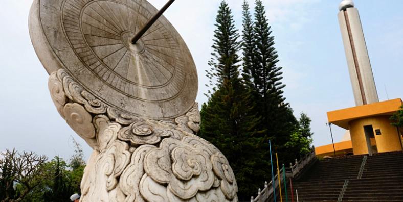
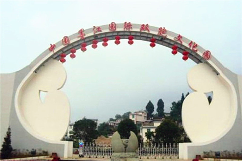
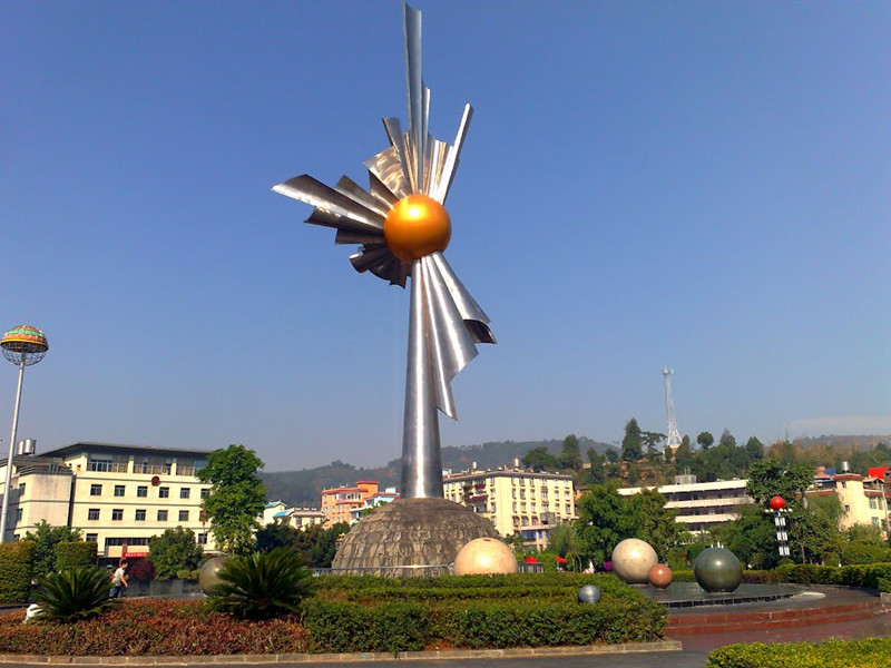
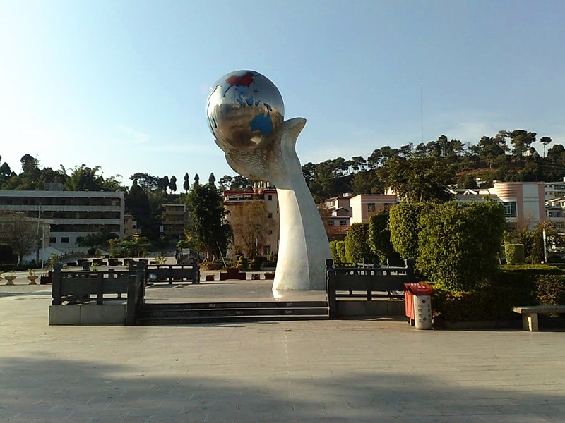
What to Visit in Mojiang County Mojiang Hani Autonomous County (墨江哈尼族自治县) is an autonomous county under the jurisdiction of Pu'er Prefecture, Yunnan Province, China. It is in the south of Yunnan province, the east of Pu’er City. There is 350 kilometers from the north of it to Kunming city. Within the territory, there are over 10 scenic plots such as the Twins Well(双胞胎井), Bixi Old Town(碧溪古镇), Mojiang Temple(墨江文庙), Mojiang Tropic of Cancer Sign Park(墨江北回归线标志园), Puyi Park(普益公园) and so on. [...]
More Mojiang County Attractions >>
Mojiang County Tours
When you traveling Pu’er, Mojiang County is a good place to be put on your list. It can be joined in whatever your Pu’er Tour or Yunnan Tour. Come to Mojiang Pu’er, take Kunming, XishuangBanna and Puer Family Tour with Tropical Forest and Ethnic Culture Discovery, South Yunnan Ethnic Minority Discovery and Tropical Forest Photograph Tour. If you prefer, contact our consultant and we can adjust the itinerary of our prearranged routes or we can just tailor-make your own kind of Mojiang County Pu'er Tour. [...]
Climate & When to Go
Climate in Mojiang County Mojiang County is located at low latitude and high altitude area. The 2/3 area of Mojiang Hani Autonomous County is located in the southern part of the Tropic of Cancer. One third of the area is northern part of the Tropic of Cancer. It belongs to the south subtropical semi-humid mountain monsoon climate. The seasons are not very clear. The seasons are like spring, and the dry and rainy seasons are obvious. Best Time to Visit Mojiang County It is suitable to [...]
More Mojiang County Climate & When to Go >>
Transportation
How to Get to Mojiang County 1. By Air There are no airports in Mojiang County. Visitors can take a plane to Simao District, Puer, then take a long-distance bus to Mojiang County. 2. By Train Pu'er Railway Station is the middle station of the Yumo Railway under construction and an important station for the Laos section of the Trans-Asian Railway. It is expected to be put into use by 2020. 3. By Long-distance Bus In the following, there is the Passenger Station Time-table in Mojiang County for reference only. Terminal(终点) Departure Time(发车时间) Departure Station(起点) Longtan(龙潭) 06:30 Mojiang(墨江) Xinping(新平) 06:40 Mojiang(墨江) Jiangcheng(江城) 06:50 Mojiang(墨江) Simao(思茅) 07:00 Mojiang(墨江) Chuxiong(楚雄) 07:00 Mojiang(墨江) Tuantian(团田) 07:10 Mojiang(墨江) Lvchun(绿春) 07:20 Mojiang(墨江) Wenwutangchang(文武糖厂) 07:30 Mojiang(墨江) Simao(思茅) 07:40 Mojiang(墨江) Longtan(龙潭) 07:50 Mojiang(墨江) Jiangcheng(江城) 07:50 Mojiang(墨江) Baliu(坝溜) 08:00 Mojiang(墨江) Kunming(昆明) 08:00 Mojiang(墨江) Xinfu(新抚) 08:00 Mojiang(墨江) Yinyuan(因远) 08:00 Mojiang(墨江) Wenwu(文武) 08:10 Mojiang(墨江) Simao(思茅) 08:20 Mojiang(墨江) Wenwu(文武) 08:30 Mojiang(墨江) Yuanjiang(元江) 08:30 Mojiang(墨江) Jingxing(景星) 08:40 Mojiang(墨江) Yuanjiang(元江) 09:00 Mojiang(墨江) Simao(思茅) 09:00 Mojiang(墨江) Yuxi(玉溪) 09:10 Mojiang(墨江) Zhenyuan(镇沅) 09:20 Mojiang(墨江) Jiangcheng(江城) 09:30 Mojiang(墨江) Gasa(嘎洒) 09:40 Mojiang(墨江) Simao(思茅) 09:40 Mojiang(墨江) Kunming(昆明) 10:00 Mojiang(墨江) Yuanjiang(元江) 10:00 Mojiang(墨江) Baliu(坝溜) 10:00 Mojiang(墨江) Simao(思茅) 10:20 Mojiang(墨江) Jiangcheng(江城) 10:30 Mojiang(墨江) Yuanjiang(元江) 10:50 Mojiang(墨江) Tuantian(团田) 11:00 Mojiang(墨江) Simao(思茅) 11:00 Mojiang(墨江) Kunming(昆明) 11:00 Mojiang(墨江) Yinyua(因远) 11:10 Mojiang(墨江) Yuxi(玉溪) 11:30 Mojiang(墨江) Yuanjiang(元江) 11:40 Mojiang(墨江) Simao(思茅) 11:40 Mojiang(墨江) Balong(龙坝) 11:50 Mojiang(墨江) Jinghong(景洪) 11:50 Mojiang(墨江) Yayi(丫乙) 12:00 Mojiang(墨江) Jiangcheng(江城) 12:00 Mojiang(墨江) Simao(思茅) 12:20 Mojiang(墨江) Kunming(昆明) 12:30 Mojiang(墨江) Longnijiang(龙泥江) 12:30 Mojiang(墨江) Yuanjiang(元江) 12:40 Mojiang(墨江) Jianxin(建新) 13:00 Mojiang(墨江) Sanxingjie(三星街) 13:00 Mojiang(墨江) How [...]
More Mojiang County Transportation >>
Festivals and Activities
In Mojiang County, there are many ethnic groups, including, Hani, Dai, Yao and Pumi. Of course, the festivals and activities are diverse. 1. Spring Festival of Yao Ethnic Minority Yao New Year, on the first day of the Lunar, the girls wear beautiful bright-colored clothes and bright-colored dresses, and put on beautiful silver ornaments. The young men also dress in festive costumes and come to the party. At the beginning of the rally, the three young performers play "Gengzuo Play", one plays as a cow, one plays as [...]
More Mojiang County Festivals and Activities >>
Travel Tips
1. Useful Numbers of Mojiang County Fire: 119 Police: 110 Ambulance: 120 Weather Forecast: 121 Consumer Complaint: 12315 Telephone Number Inquiry: 114 2. Post Offices in Mojiang County China Post Office(中国邮政) Add: Mojiang Hani Autonomous County(墨江哈尼族自治县) Tel: 0879-4231322 3. Banks in Mojiang County You can use your credit card, traveler's check or cash to exchange for Chinese Yuan in some branches of Bank of China in Mojiang County. China Postal Savings Bank(中国邮政储蓄银行) Add: No.36 of Xinjian Road, Zhulian Town, Mojiang Hani Autonomous County(墨江哈尼族自治县联珠镇新建路36号) China Construction Bank(中国建设银行) Add: Jiayuan Supermarket, Mojiang Hani Autonomous County(墨江哈尼族自治县墨江哈尼族自治县佳园超市) Tel: 0879-4232042 4. [...]
More Mojiang County Travel Tips >>
Useful Maps
If we go to somewhere new, maps are good facilitators for us. In order to show you clear direction and location, Maps of Mojiang in Pu’er provide you some useful maps like Region Map of Mojiang County in Pu'er, Tourist Attractions Map of Mojiang County in Pu'er, Location Map of Mojiang County in Pu'er Yunnan, etc. [...]
More Mojiang County Useful Maps >>
Mojiang County Accommodation
Where to Stay in Mojiang County Mojiang County is a county under the jurisdiction of Pu'er City, Yunnan Province, China. There are many hotels around Mojiang County. Yunnan Exploration will provide the best hotels for you. The recommended hotels are as follows: 1. Chengwaicheng Inn(城外诚客栈) Add: Shuangbao Avenue, Mojiang Hani Autonomous County(墨江哈尼族自治县双胞大道) Tel: 0879-4234228 2. Huigui Grand Hotel(回归大酒店) Add: No.69 Xinjian Road, Mojiang Hani Autonomous County(墨江哈尼族自治县新建路69号) Tel: 0879-4238988 3. Mojiang Suixi Ethnic Inn(墨江随喜民族客栈) Add: Taiyangcheng, Mojiang Hani Autonomous County(墨江哈尼族自治县太阳城) Tel: 0879-4337177 4. Beihuiguixian Hotel(北回归线酒店) Add: North Side of Moon Square, Shuangbao Avenu 5. [...]
More Mojiang County Accommodation >>
Other Hot Destinations in China
- Babao Town
- Baisha Ancient Town
- Baishuitai
- Baoshan Stone Town
- Bingzhongluo
- Dali Ancient Town
- Dashanbao
- Dongchuan Red Land
- Dulongjiang
- Feilaisi
- Haba Snow Mountain
- Heshun Ancient Town
- Honghe Hani Rice Terraces
- Jade Dragon Snow Mountain
- Jingmai
- Lashihai Lake
- Lijiang Ancient Town
- Lugu Lake
- Meili Snow Mountain
- Puzhehei
- Shuanglang Town
- Shuhe Ancient Town
- Stone Forest
- Three Parallel Rivers
- Tiger Leaping Gorge
- Yuanyang Hani Rice Terraces


